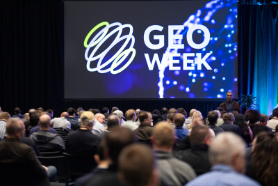
As is the case every year at Geo Week, the first morning of the 2025 edition of the event featured our product previews, giving companies from around the industry a way to showcase their latest offerings. This year’s previews included 22 presentations, which took place across two rooms Monday morning. At Geo Week News, we will be briefly covering what each company had to say through three different articles over the next three days, finishing today with a look at the rest of our products, relating to point clouds and more.
Be sure to check out parts one and two of the series.
Global eTraining
One of the biggest challenges for the AEC industry today is keeping up with all of the changing technologies, with things like BIM and AI changing constantly. The industry is dealing with labor issues right now, so maintaining upskilling for current employees is vital for these firms. That’s the challenge that Global eTraining is addressing, with its massive course library of upskilling trainings for AEC and other industries. You can read more about the work the company is doing here.
Flai
While the general public today tends to think of AI in terms of large language models and other generative AI tools, the geospatial industry benefits from machine learning and other algorithms to streamline point cloud classification. Flai’s platform is for just that, with an algorithm that classifies large point cloud files for a variety of industries, including transportation, utilities, and more. Nejc Dougan, who gave the presentation, noted that the algorithm has been trained for locations on every continent excluding Antarctica, which should provide the basis for this platform to be valuable to nearly any location on the globe.
TopoDOT
As Paul DiGiocobbe, who gave TopoDOT’s presentation, noted to the audience, there is a massive problem in the geospatial industry. We have these massive amounts of data that should provide so much value, but actually deriving that value is a challenge. TopDOT’s platform is designed to help these agencies get the most out of their data, with feature extraction and analysis. He specifically noted their TopoShare offering, which comes free to all users and allows for data governance and a sharing portal. Additionally, he told the audience about a new offering, which will provide consulting for firms that are looking for help in working with their data.
Stitch3D
Clark Yuan, the founder and CEO of Stitch3D, presented on another point cloud classification platform, with this one being a cloud-native platform to make it easier to share and collaborate with this data. In his presentation, he talked about his time in the Army and how difficult sharing data was at that time, which ultimately sparked this idea. As he points out, the interface is similar to that of Dropbox to make things as easy as possible, particularly for those non-technical stakeholders. He showed demonstrations on a variety of workflows that can take place within the platform, including creating fly-throughs and “multi-player” mode which allows for real-time collaboration.
LP360
During the Product Preview session, GeoCue took the opportunity to describe the many recent enhancements to its sensor agnostic LP360 point cloud and imaging software. Updates made over the past year include job management tools for creating and customizing data collection flights, batch processing, integration with DJI, and support for photogrammetry images. Other improvements include the ability to colorize point cloud and ortho images, support for handheld mapping solutions and mobile mapping, GUI improvements, including an immersive view, and the introduction of new online tools, such as a portal, LP360 Cloud, and desktop support.
Trimble
Skyler Neumeyer from Trimble Geospatial described the products in his company’s new mobile mapping portfolio. He explained how Trimble is phasing out its image-only MX7 system and introducing the new MX60 “mid-spec” system along with the high-resolution MX90. Available in “core,” “pro,” and “premium” options, the MX60 offers improvements in range noise and density over previous products. What’s more, the MX60, as well as the MX90, benefit from Applanix software updates, including access to field and office software and the Trimble Reality Cloud Platform service, which lets users easily host and share data.
Blue Marble Geographics
According to Senior Applications Specialist Gus Cooke, Blue Marble Geographics’ Global Mapper Pro is “an insight and learning engine” that helps mappers safe time and effort. Deep learning tools, he said, are central to the effectiveness of Global Mapper Pro. These tools enable semantic segmentation, which improves land cover classification and building extraction operations. Similarly, object detection tools help Global Mapper perform tasks like vehicle detection. Looking ahead, Cooke explained that Blue Marble is looking to add more advanced settings to Global Mapper Pro, including data fusion and the ability to download, save, and share models.