

It’s not hard to be inspired by Geo Week. The show floor is filled with innovative technologies that are being put to use to perform tasks that make business processes – and everyday life – easier and more efficient. What’s more, the keynote presentations and educational sessions present use cases and perspectives on the countless ways geospatial technologies and related systems can be adapted and adopted to make our world a better place.
So, it’s not surprising that Geo Week hosted a session exclusively dedicated to unusual, creative, and one-of-a-kind projects. The “Unique Case Studies” presentation showed how lidar, photogrammetry, and other emerging technologies are being used to repair culturally significant buildings, expand our use of sustainable energy sources, improve utilities inspections, and much more.
Here is a look at the unique and inspiring case studies presented during the session:
Drones for Orphan Wells: Applying Modern Solutions to a Century Old Problem
Ron Krawczyk from Parsons Corporation explained how his company found a way to use modern sensor and mapping technology to uncover “orphan” wells. These wells, he explained, were constructed before World War II and contain oil, brine, or methane that could leak and cause extensive environmental damage and pose a health threat to our communities. To find these wells, Krawczyk said, Parsons deployed UAV-mounted magnetometers and lidar. These technologies, he reported, proved “extremely useful in locating abandoned wells” and were faster and more efficient than traditional techniques. This “groundbreaking” project, he said, could be easily adapted to other applications, including other types of utilities inspections.
DrSOLAR – Drone-based Solar Panel Inspection with AI
According to Alex Fraess-Ehrfeld of AIR6 SYSTEMS, solar power is positioned to become the world’s largest source of energy in the coming years. To aid that growth, the solar industry needs efficient and accurate systems to inspect solar panels, and AIR6 SYSTEMS has created “DrSOLAR” to meet this need. An automated drone-based solution for solar panel inspection, specifically for fault detection, DrSOLAR uses semi-autonomous drones equipped with high-resolution cameras that are used to perform orthophoto mapping of solar farms. The system also employs AI to produce comprehensive data analysis leading to more accurate and automatic identification of faults.
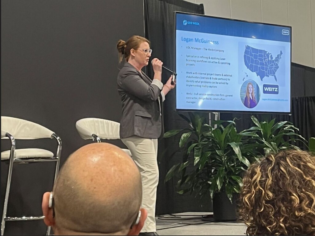
Navigating Digital Twins: Reality Capture in Student Housing Projects
Many construction industry clients are interested in the concept of “Digital Twins,” but clients often don’t fully understand the term and how it can be used in their projects. In this presentation, The Weitz Company’s Logan McGuinness described her company’s experience on a student housing building project. She used this example to explain how Weitz deployed different reality capture solutions to deliver a complex “digital twin” for their client and how they overcame the many challenges around data collection and facilities management.
Asset Data Collection & Processing in Nevada: A Case Study Using AI and Collaboration
Mandli Communication’s Ray Mandli explored the possibilities of using AI, specifically the use of natural language interfaces for interaction with data, on large scale projects. To show the promise of this approach, he described a recent collaboration between GIS Surveyors, Mandli Communications, and the Nevada Department of Transportation that involved the collection and processing of asset data along 9,500 miles of road. Using these new technologies, Manli reported, professionals were able to “talk to the data” and extract meaningful information in ways that were faster and more accurate than previous methods. Building on the success of the Nevada project, Manli said his firm is engaged in even larger efforts deploying naturalized language interfaces.
The Mystery of Windmills: Preserving World’s Cultural Heritage through Photogrammetry
Three years ago, Dronepartner’s Saulius Zaura embarked on a journey to use photogrammetry techniques to further the preservation of historic windmills that had fallen into disrepair. Zaura traveled through Lithuania, Latvia, Estonia, and other nearby nations to digitally preserve more than 500 windmills. Using aerial photography and ground-level data collection, as well as photogrammetry techniques, Zaura created immersive 3D models of the windmills, helping to preserve cultural heritage and breathe new life into endangered structures.
USAFA Chapel Scan & Fab
Comprised of 100 75-foot long tetrahedrons, enclosed with aluminum panels that are spaced to house colored Dalle de verre glass, the iconic Air Force Academy Chapel in Colorado Springs faced issues with water resistance and needed repair. To help, they turned to Zahner, a world-renowned architectural metal company. In this presentation, Zahner representatives explained how they used a variety of robot-assisted methods to repair the building. They explained how they digitized as-built conditions of structural steel, modeled critical interface points, and used other modern techniques to aid workers on the job site and in the office.


