

The vast majority of the experience at a Geo Week event is, as all events are, centered around companies exhibiting their products on the show floor and industry thought leaders and insiders discussing trends, case studies, and more in sessions. These are all extremely valuable, and led to a record-breaking show this year with compelling takeaways, but they also don’t exactly reflect the day-to-day of so many attendees, which revolves around collecting and presenting data.
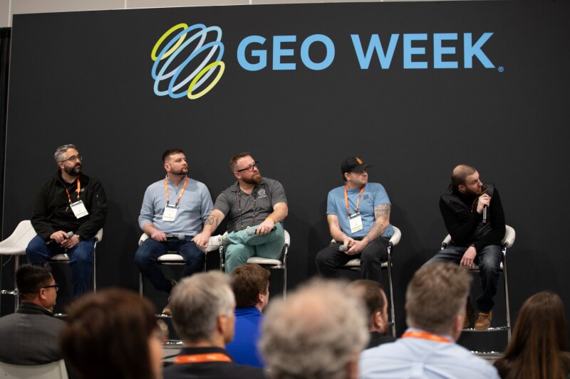
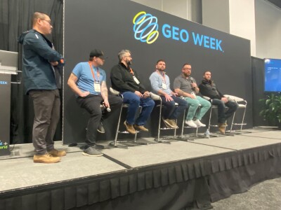
For the second straight year, the United States Institute of Building Documentation (USIBD) led a session where they did collect and present data right there in the Colorado Convention Center. As we detailed in a pre-show preview of the session, this year the session was more focused on mobile scanning systems, though there were a few terrestrial scanners involved as well.
The session highlighted some of the preliminary results from the scans, which took place in the days prior to the event and during the first couple of days, and included the following speakers:
Chris Kercheval, TopKerv Consulting LLC
Shawn Asher, Allen & Company
Alex Hill-Stosky, Eagle Engineering and Consulting
Mack Kowalski, LiDaholics Consulting
Drew Seward, Precision Point, Inc.
Leo Zhang, The Conco Companies
In terms of the results from the various scanners, the word “preliminary” is key in the above paragraph. There is still a lot of work to do to get the full results from the tests – as Kercheval told the crowd, “You don’t bring data out from the field and the next day you’re giving it to your customer. Please don’t expect that from us.” – and those will be released later this year in a report from the USIBD.
That said, here are the companies for which the panel was able to provide some very early data on, along with the scanners. Note that scanners with an asterisk are terrestrial scanners, while the rest are mobile scanners.
NavVis VLX 3
Gexcel Heron Twin Color
Z+F FlexScan 22
Z+F IMAGER 5016*
Emesent Hovermap STX
Exyn Nexys
Green Valley LiGrip H300
FARO Orbis
FARO Focus*
RIEGL VZ600i*
While there were some quick results shared during the session, including the time it took to scan the area and how long it took the data to process to .e57 format. That said, in terms of this specific panel session at Geo Week 2024, the focus was more on the process and the philosophy behind these tests, which made for a really interesting discussion.
On the process side, the USIBD team created a course to derive the most possible information from these systems. Though the panel didn’t have exact measurements for the area scanned with each system, they estimated that it was 7,000 to 10,000 square feet. That’s not just a straight line, either. The course included multiple curves and doglegs, areas that would potentially cause drift in the result and force systems to go off control.
The convention center also provided a great venue to truly test the abilities of these systems, with Kowalski saying, “One of the things I was really excited about when I got here was that there’s about every material that you can think of inside this building.” Those materials include things like black and white squares, which mean that systems using auto target will have to manually delete “about 20,000 targets,” along with black areas and glass railings, both of which can be a challenge for most laser scanning systems.
Sitting in the crowd for the session, what became most clear was the group’s philosophy behind these kinds of discussions and presentations. It’s certainly not to declare one scanning system better than any other in a generalized sense, but rather provide all of the relevant information a prospective customer would need to make their own decision. That’s why for this year’s test, they added in the entire process for the test rather than just scanning. So, they don’t just look at how long the scanning took, but also how long the processing took, the quality of the data, and even things like how it is to deal with a company’s customer service department.
Seward said, “If you look at most of the scanners that are available here right now, many of them use the same kind of guts. It’s going to be interesting to see what the differences are, because if the hardware is all the same but the products are different, obviously the approaches are not uniform. That means that one might be more beneficial for your work than another, and their post processes make more sense to you than another.”
These kinds of sessions are one of the reasons why attending these types of in-person events are so valuable, as it gives an opportunity to get a truly neutral view from a nonprofit whose goal is to test as much as possible to give end users the maximum amount of information. They also take audience feedback to heart, as evidenced by this year’s session coming from a suggestion last year about testing mobile systems, and taking into account the entire process rather than just scanning.
To that end, attendees for this session had a chance to interact directly with the panel, leading to plenty of interesting discussions. Included among these were discussions about the need to standardize spec sheets – which was a main topic of discussion at last year’s session – as well as the idea to include other costs, such as costs for renting equipment while your main units are out for maintenance.
We’ll be sure to keep an eye out for the USIBD’s full report of their tests from this year’s Geo Week coming later 2024.


