

With sea levels predicted to rise 12 inches by 2050, sufficient flood defenses and a better understanding of water flow help to mitigate risk to coastal towns and cities. Globally, lidar solutions help to create the foundations for flood modeling of large areas, however, they seldom consider mapping underground spaces. UrbanArk, a joint research project under the US-Ireland research and development program, seeks to change this by using modern lidar technologies (SLAM-based systems).
Presenting the risks of incomplete data
This particular project aims to improve resilience and emergency preparedness against coastal flooding in urban centers. Accurately predicting flood behavior is complicated, especially when not accounting for underground spaces. By presenting the research, UrbanArk demonstrates why incomplete data in high-risk areas poses risks to the population.
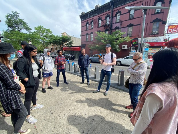
Research by Dr. Aaron Miller, a Research Assistant at Queens University Belfast, focuses on the acquisition and analysis of static and mobile lidar data. Working as part of the UrbanArk project, Dr. Miller captured both above and below-ground data in areas of Belfast using a handheld SLAM scanner from UK tech firm GeoSLAM. He further used a terrestrial laser scanner, the FARO Focus, to complement the data. Static scanning was used to compare against the GeoSLAM data, in terms of accuracy, resolution and efficiency. The survey of the study area was completed using the GeoSLAM as the only form of lidar data collection. Due to its considerable amount of subsurface space and proximity to the coast, Belfast proved to be an ideal candidate for the research.
Underground lidar data and flood behavior
 Dr. Miller explains that there is little information available regarding underground spaces within the urban environment and that these spaces are priority risk areas in a flood scenario, so knowing their location and ideally their use, would inform emergency services of which spaces may need evacuating first. Furthermore, in a flood scenario, underground spaces act as sinks for floodwater, which could divert the flow of water throughout the streetscape and change the rate of inundation at the street scale.
He continues: “In Belfast for example, Victoria Square shopping center has a two-story underground carpark: this would have major implications on flood dynamics in the surrounding areas. By surveying these spaces and gathering volumetric data, it is possible to include some information regarding these spaces in flood models, therefore providing a more realistic depiction of future flood scenarios.”
In addition to this, lidar data is used as the basis for digital surface models: “The higher the resolution of the lidar dataset, the less estimation is involved in the production of a DSM. The GeoSLAM allows for the collection of lidar data that is dense enough to include street-level features, such as roadside curbs, which are proven to impact flood simulations at the street scale. A more accurate DSM lends itself to the production of more accurate flood models.”
Data capture
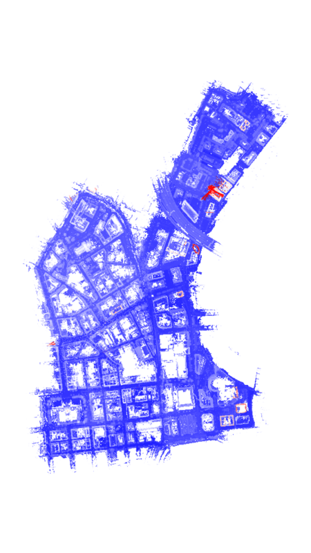
Dr. Miller set to work capturing a 1km2 area split across several blocks, covering most of the city center. Underground spaces identified and captured in this area include parking lots and basements. Dr. Miller states that gaining access to the underground areas proved to be very difficult and that in the end, the only spaces that were internally surveyed were government buildings, as the project was working closely with partners in the Belfast City Council. Accessibility was the major limitation of data collection.
Dr. Miller scanned each block individually, using GeoSLAMs ZEB Horizon scanner, georeferencing and merging the final point clouds into one complete dataset. The flood modeling is 2D and was completed in Mike+, an integrated water modeling platform. Inundation rates and flood water depth gathered from these 2D models were used to inform 3D visualizations, but 3D flood models themselves have not been utilized.
Prioritizing efficiency and maneuverability
Belfast is an old and bustling port city with tight passageways and streets full of people, which are a concern for data collection. However, the handheld nature of the SLAM scanner meant that Dr. Miller seamlessly transitioned through the tough environments. With each capture lasting around 7-15 minutes and over 50 scans carried out in total, Dr. Miller now had the data necessary for the next stage of the project. Using the information gathered, UrbanArk refined flood prediction models and developed immersive virtual reality applications as a communication tool to support communities and emergency planners.
The ease of use of the SLAM scanners, alongside control reference points, means that repeating scans frequently to review changes over time and adjust models accordingly, is made simple. “In this investigation, efficiency and maneuverability were prioritized, so using a handheld system such as the GeoSLAM ZEB Horizon scanner fit our needs.” Dr. Miller has since presented the research at conferences in the USA and Europe, including Geo Week in Denver and the Geospatial World Forum in Amsterdam. The project was also the winner of the Outstanding University Achievement in Lidar award presented at Geo Week 2022.


