The three demands of mobile railway surveying
THE HAGUE, The Netherlands – More and more train operators, rail network companies and railway contractors are starting to take an interest in the possibilities afforded them by mobile 3D laser scanning. However, as pointed out by Paul DiGiacobbe, associate VP and director of strategic technology for incubation at HNTB (USA), “[Mobile lidar] is still at the early stages of acceptance in the USA.” What is starting to drive uptake is the move from design-bid-build to design-build construction contracts. “The client is no longer the owner,” he told the audience here at SPAR Europe 2001. “The client is the builder. We are delivering models to the contractors now. Everything has to be delivered faster,” he said. “Now we do 30-50% design models and we need mobile lidar during the tender phase.”
HNTB has partnered with the software provider Virtual Geomatics to deliver the scan data in a form the client can use. “It’s given us a three to four times speed improvement; that’s very important with the fast turnaround – sometimes just 24 hours – required by contractors,” explained DiGiacobbe.
The two companies have worked together on a project for the Honolulu Light Rail in Hawaii and on a complete survey of a railroad for an undisclosed client (as well as scanning Interstate-405 in Los Angeles). “Railroad scanning is harder than it looks,” pointed out Virtual Geomatics’ chief technologist Ramesh Sridharan, who co-presented with DiGiacobbe. Precise data are needed for things like road crossings and elevations and, as Sridharan observed, unlike with a road scanning job, “you don’t have the flexibility to collect the data again and again.”
In Honolulu, HNTB scanned the 35 km long elevated light rail for a design-build contractor, and then used Virtual Geomatics’ VG Calibrator and VG Analyzer to construct a model of the existing surface and overhead structures and utilities. As DiGiacobbe noted, “accuracy and precision” of scan data are essential. “The last thing we want to find out is that the data is not accurate: QA/QC is very important.” HNTB is using Virtual Geomatics’ VG Product Suite to analyze the accuracy of the mobile lidar and to provide a complete workflow, enabling the delivery of properly merged information about the track and all critical assets in the CAD and GIS formats the client requires.
The need for precise scanning was also highlighted by Nickolaus Studnicka of Riegl in his presentation on the use of his company’s VMX-250 pulsed time-of-flight mobile laser scanning system on the Deutsche Bahn network in Germany. “The speed and precision of measurements have improved a lot in the last three years,” he explained. This has enabled a railway scanning proof-of-concept in which the VMX-250 was mounted on a standard duty railway trailer traveling at 30 km/hr and successfully scanned several kilometres of track near Frankfurt-am-Main this past September, capturing such important elements as neighboring tracks, power rails and signage. The use of the normal issue trailer was also important as a proof-of-concept, said Studnicka: “Some companies are building special railway carriages for scanning. We showed it could be done quickly, with standard equipment.”
Co-presenting with Studnicka was Dr Ivo Milev, the MD of German company technet-rail 2010, who reminded everyone of the fact that “a point cloud is a measurement not a product.” Milev’s firm has developed a product – called SiRail – that is designed to analyze and manage kinematic scan data for the rail industry. “We started to convince railway companies in 2005, because we were accurate within 2 mm,” recalled Milev. Now employed in Germany, Finland and Luxembourg, SiRail enables detection of potential collisions with infrastructure for any shape of wagon in use. And in future it will enable collision detection with real (scanned) vehicles. The software also lets users combine point clouds with web-based map services and will enable Android-based mass market applications, “but still for engineers,” said Milev.
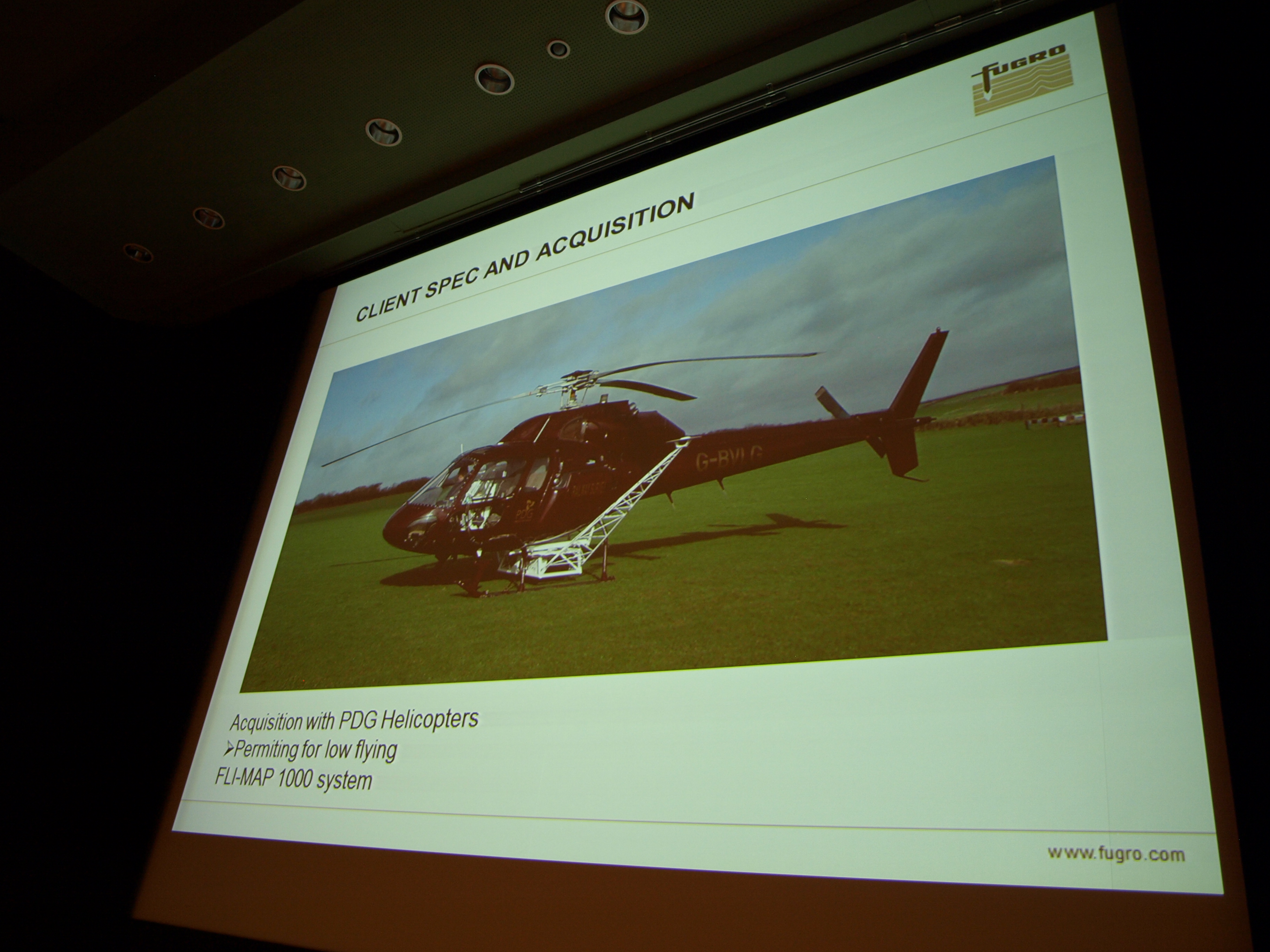
Closing out the session was Robert Hoddenbach, operations manager at the Dutch company Fugro Aerial Mapping, who highlighted a case study from the UK illustrating accurate high-density lidar for the railway industry. “The client specification was that the quality, point density and accuracy of the data should be sufficient for design purposes,” said Hoddenbach. To achieve this, Fugro employed an aerial mapping method that was approved by the Dutch Road Authorities in 2007 and which involved flying helicopters as low as 175 m. Hoddenbach pointed out that an enormous number of validation checks are carried out to ensure the accuracy of the data, but that the result is a dataset with an average deviation of just 1.8 cm. This high-density accuracy dataset also makes 3D modeling easier and although additional local terrestrial imagery had to be taken, in future, Fugro’s Railmap or Drivemap mobile mapping solutions could be employed to such an end. Alignment calculation is a third potential spin-off of the dataset, alongside producing 3D models and mobile rail mapping, suggested Hoddenbach.
Another important facet of this case study was the fact that “without accurate lidar data to complete the 2D mapping, 3D modeling would not have the desired impact when shared with project stakeholders,” said Hoddenbach. The importance of visualization of 3D data for communication purposes was a theme that recurred frequently at SPAR Europe, and SPAR 3D will be exploring this theme further in coming weeks.