

In response to a growing demand for digitized road data from road authorities, road engineers, road inspectors, and surveyors, Belgium-based XenomatiX launched the 6D Road Scanning Services business unit earlier this year. XenomatiX uses their ‘6D’ road lidar to measure and collect high-precision and up-to-date data of road networks or sections requested by its customers.
Traditional methods for road management and inspection, include the use of Multi-Functional Vehicles (MFV) equipped with multiple sensors and highly specific equipment, or on-site detailed visual inspections. However, both of these options can trend towards being expensive, labor-intensive, and require a high level of training. For example, a typically outfitted MFV can cost between $1M and $1.5M, which may be out of reach for regional network owners to add to their fleet. According to the Urban Institute, state and local governments spent $181 billion on highways and roads in 2017, and reducing the cost of road management is a priority in many areas.
“To keep track of the quality of every road or street, road network owners need to choose between highly expensive equipment or high labor and time-intensive methods,” said Kris De Meester, Vice President of Sales and Business Development. “Both, of course, come at a significant cost.”
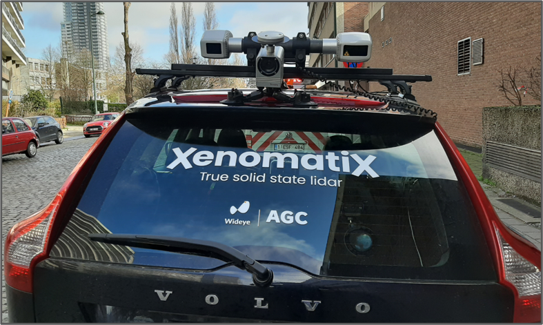
The XenoTrack solid-state lidar sensor can be mounted on any vehicle.
In a partnership with the Belgian Road Research Center (BRRC), an independent research center focused on strengthening road construction, XenomatiX wants to develop innovative and affordable solutions for performant and cost-effective road management, taking advantage of upcoming technologies such as solid state lidar. Their system of “6D lidar” is comprised of a pair of 3D solid state lidar and optical sensors that can be mounted on normal vehicles.
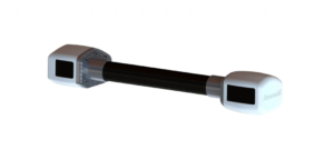
XenoTrack is XenomatiX’s car-mountable, high precision, high-resolution, short-range solid-state 6D lidar sensor with accuracy to within a millimeter for highly granular surface measurements. Capable of identifying road waviness, road damage, small and nearly invisible objects in real-time or post-analysis, the XenoTrack can cover the needs of other inspections.
Additionally equipped with a fast CMOS camera, a large field of view, and a well-conditioned image processing, XenoTrack is suitable for high driving speeds. 3D point clouds, surface reflectivity data, and camera images, can all be collected at highway speed, and all of the resulting data is annotated with detailed GPS data.
Currently, the sensor is available in two versions:
- XenoTrack RearView – Offers detailed surface measurements accurate to within 1mm, making it ideal for applications such as pothole detection, surface monitoring during road construction works, seasonal surface degradation analysis, road waviness, etc.
- XenoTrack FrontView – Designed for real-time application relying on preview measurements such as active suspension for ultimate driving comfort, lane keeping, small but dangerous road obstacle avoidance, and more.
Additionally, XenoTrack’s software, XenoWare, offers an intuitive framework to integrate XenoTrack into any real-time or offline road profile applications. With built-in stitching and mapping algorithms, XenoWare easily reconstructs the surface for an in-depth examination. XenomatiX provides different road data sets, including cobblestone, concrete plates, gravel, tunnel, and bridge. Moreover, the data sets are available in different formats, such as 3D geometrical data in CSV, CRG, and 2D images, or reflectivity data in PGM.
During the Road Scanning Innovation webinar, XenomatiX presented a few XenoTrack’s uses cases. For example, a road construction company used the sensor before, during, and after road works to check the quality of the roads they have to or are repairing. This also works to analyze road transversal evenness for airport runaways.
In the near future, XenomatiX expects to see these sensors mounted on dedicated and utility vehicles, providing weekly measurements. In the next 10 years, the company believes that with higher levels of autonomous vehicles, this technology will be implemented in all future cars and data will be collected by all road users.
“In the future, a lot of data can be collected without specific vehicles and resources,” De Meester added. “[For example,] a community garbage truck gets a road lidar. In the next week, another truck driving through a different part of the community gets one, and so on. After a month or two, the whole community is digitized. If you can do that regularly, you can really see what the degradation is. That’s how we see it is going to help the pavement management system.”
XenomatiX will deploy its new 6D Road Scanning in Europe and the United States, with other locations to follow. The Belgium-based company recently opened an office in Detroit to support customers in the North American market.


