
Follows investment in new airborne Leica system
KANSAS CITY, Kansas – Officials here with the Kansas Geographic Information System Partnership have awarded a contract to AeroMetric to provide lidar data covering 9,720 square miles in the easter part of the state. It includes 11 counties, parts of the Missouri River, and Kansas City.
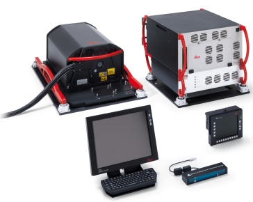
This directly follows an announcement by AeroMetric that it has invested in the new Leica ALS70 ultra high point density corridor and wide-area lidar system, which the company says it will use on this project.
“There are two key advantages to this system: First, the ALS70 has a collection rate that allows us to fly higher, capturing a wider swath of data—which results in increased efficiency for large area projects. Second, the ALS70 utilizes full waveform pulses, which allows us to better analyze ground cover and extract more meaningful information from the lidar data,” said Rob Merry AeroMetric’s geomatics manager, in a statement.
Ivan Weichert, director of the Kansas GIS, Office of Information Technology Services, said the selection of AeroMetric in this case was about more than selecting the lowest bid. “What we liked about AeroMetric was the fact that they are very experienced, giving us confidence that they have the resources, capability and expertise to meet all of our needs in performing this project,” he said in a statement.


