Sponsored by 3Dsurvey
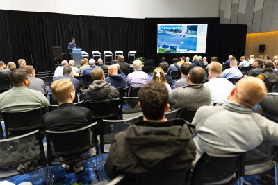
We see first-hand at Geo Week News the rapid pace of innovation for technology in the surveying industry, with new types of technologies, along with improvements to traditional tools, revolutionizing the way work is done. Today, there are all kinds of tools that allow for assisted, or even completely automated, workflows, opening up more time for the crucial work in a project and less time spent on tedious tasks.
The Problem: Fragmentation in Surveying Tools
All of this innovation, however, has brought new problems to the industry, bringing too many disparate tools that can be crucial for different projects, and a wider variety of data that all needs to come together for a cohesive deliverable.
This leads to a number of issues, particularly for smaller and mid-sized firms who can’t necessarily afford all of these different tools, and don’t necessarily have the solutions that can bring everything together. As a result, while these new innovations are still making a positive impact on the industry, that impact isn’t being maximized with most of the options currently available on the market.
3Dsurvey’s Solution: An All-in-One Approach
This is a problem that 3Dsurvey is solving with their all-in-one approach to spatial data processing. The software company was founded by experienced surveyors who know first-hand the challenges that those in the industry are facing today, and they are able to put that experience into the product that they deliver.
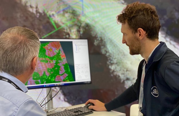
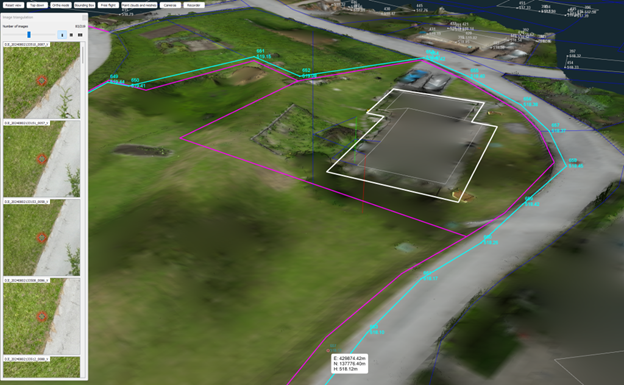
Today, 3Dsurvey is able to take inputs from a variety of sources, including drones, cameras, smartphones, lidar scanners, total stations, CAD data, and GNSS measurements, and unify them into a single platform. This makes 3Dsurvey a true integrator for geospatial technology.
The Scan Module
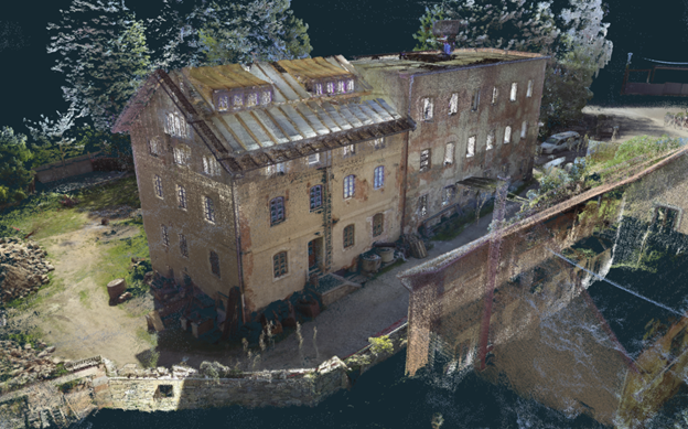
The latest version of 3Dsurvey’s software includes key add-on modules and integrated tools that come together to create this all-in-one integrator tool for surveyors. That includes, for example, the Scan module that is now available with 3Dsurvey, which allows users to merge point clouds or meshes from different data sources or locations into a single model. 3Dsurvey describes this add-on as being ideal for those who are struggling to produce accurate floor plans from scan or SLAM data.
This module comes with a couple of key features, including the registration capabilities. There are options for this to be done either manually or automatically, with the former being for instances when a user needs to align two models that share at least some features. This manual option comes with a wizard to help quickly get acquainted with the feature. For bringing together two point clouds, users can also use the automatic registration method, utilizing an algorithm that works on the principle of minimizing the distance between corresponding points of two point clouds.
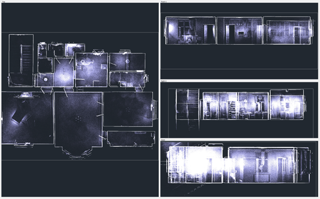
X-Ray Capabilities
On top of the registration capabilities within the Scan module, users can also take advantage of 3Dsurvey’s X-Ray views function. This is a unique offering for this software, simplifying the process of creating floor plans from point cloud data. This feature turns point cloud data into CAD-friendly drawing planes, resembling an X-ray, allowing users to rotate in all directions and easily draw outlines based on the point cloud data.
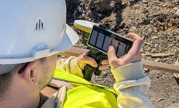
RTK Videogrammetry
One of the other unique add-on features for 3Dsurvey is their RTK videogrammetry module, which takes the ease of taking video with your phone and uses that to create a 3D representation of physical space. This approach takes videos of some complex areas of a project site and uses the individual frames of the video to create an accurate 3D model, similar to how photogrammetry uses images to do the same thing. With this module, users can then extract exact measurements, calculate volumes, and extract profile lines. The module also includes the 3Dsurvey SiteScan app for Android, which increases the precision and reliability of these models using corrections from a reference station.
Streamlining Workflows with Integrated Services
3Dsurvey Cloud
Along with these add-on modules, 3Dsurvey includes integrated services to continue streamlining work for surveyors and fight the issues that can come with disparate tools and data sources. For example, users can take advantage of 3Dsurvey Cloud, allowing for simple sharing of results with clients using various devices without sacrificing quality. With just a web link, clients and other stakeholders can easily view models without concern about owning the right software or using equipment with the right requirements.
Integrated CAD Engine
Finally, users can take advantage of the software’s integrated CAD engine, which allows for the creation of 3D models to directly draw CAD elements with easy transition from existing tools and workflows. Whereas this kind of work traditionally requires the use of multiple programs to bridge the photogrammetry and CAD, 3Dsurvey provides this within a singular software.
Conclusion: A Unified Solution for Modern Surveying
All of the new tools and data sources available to surveyors today bring a combination of positives and negatives, providing paths to more accurate and versatile data, but often requiring multiple programs and strong systems to process all of this data. With the surveying experience present on the 3Dsurvey team, they recognized these challenges and have sought to bring a simple-to-use solution. With the aforementioned modules and integrations, like RTK videogrammetry and cloud, offered in their latest version of the software, they are bringing crucial tools together for a singular, truly unified solution.
If you want to learn more about 3Dsurvey, come see us at Geo Week, Booth #732 or try the software free for 14 days.