
“The application of new technologies can transform how archaeologists and the wider public understand one of the best-studied landscapes on Earth.”
Note: All virtual representations of Stonehenge originally appear in the article “What Lies Beneath Stonehenge” from the September issue of Smithsonian Magazine. Other shots courtesy of Ludwig Boltzmann Institute, University of Birmingham.
Because 3D technology often feels like the future (with the “wow” factor of lasers, structured light, augmented reality, and virtual reality headsets) it can be easy to forget how often it gives us valuable insight into the past.
You’ve already seen Time Scanners, (reported on here) which paired Leica scanners with a renowned structural engineer to solve the engineering mysteries of Egypt’s pyramids, St. Paul’s Cathedral in London, and other ancient landmarks. Now, 3D scanning has been used to solve another of the world’s most enduring mysteries: what, exactly, is Stonehenge? What 3D found was big enough for the project to earn the cover story of this month’s Smithsonian magazine. (Read to the bolded section at the bottom for some details on the 3DLS technology used in the project).
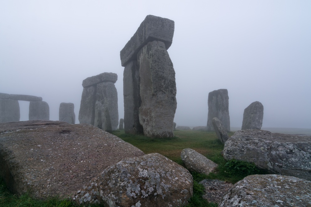
The story follows Vince Gaffney, “a short, sprightly archaeologist of 56, from Newcastle upon Tyne in northeast England” as he walks the reporter through the landscape surrounding Stonehenge, which he has been measuring and scanning for four years. This work has been undertaken as part of the Stonehenge Hidden Landscapes project, a collaboration between Gaffney’s team and the Ludwig Boltzmann Institute for Archaeological Prospection and Virtual Archaeology in Austria. Over numerous sessions, they used tools including a magnetometer (which measures the strength of Earth’s magnetic field in a specific place), a ground penetrating radar, and a 3D laser scanner to scan the area surrounding Stonehenge, (roughly 4 square miles) to a depth of almost 10 feet. The data gathered was used to create an unprecedented 3D model of the site.
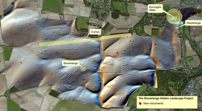
3D map indicating existing and new monuments in the area scanned. Source: Ludwig Boltzmann Institute, University of Birmingham
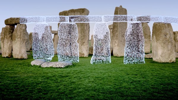
Frames from Smithsonian Channel’s “Stonehenge Empire” show stones whose locations were determined only in 2013. (© October Films for Smithsonian Channel). Source: Smithsonian Magazine.
Using the model and the cold, hard data that it supplies, the teams discovered hundreds of new features that had remained unseen for hundreds of years. The features included “more than 15 possible new or poorly understood Neolithic monuments” (or little henges), the location of missing stones at Stonehenge itself, and evidence of around 60 giant pillars that are thought to have formed a mile-wide super henge at the nearby Durrington Walls.
The biggest discovery was a huge hole on the West end of the nearby Cursus that, if connected by a line to Stonehenge’s heelstone, marks the the path of the sunrise on the summer solstice. This discovery has changed the way that Stonehenge is viewed, and it is now seen as a monument meant to operate in relation to the movement of the sun.
“The point I think we’re coming to,” Gaffney said to the Smithsonian, “is that increasingly we can see the area around Stonehenge as providing extensive evidence for complex liturgical movement–which we can now understand, largely because we know where things are.”
In the project’s official press release, Gaffney enthusiastically touts the use of these advanced sensors and the 3D digital map as a game-changer for archaeology: “The application of new technologies can transform how archaeologists and the wider public understand one of the best-studied landscapes on Earth.”
As part of that press release, the project included pictures of the official map of their discoveries. The Smithsonian article, for its part, includes some great shots from a documentary they are airing about the project (the documentary is available on the BBC iPlayer for those of you in the UK).
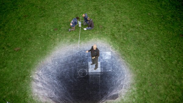
Vince Gaffney (in a special effects scene in the film “Stonehenge Empire”) stands avove the mysterious pit at the Western end of the Stonehenge Cursus. (© October Films for Smithsonian Channel). Source: Smithsonian Magazine.
That’s Great, But How’d They Perform The Scan?
For those of us who are interested in the 3DLS portion of the project, Smithsonian magazine is frustratingly lacking in detail.
Lucky for us, RIEGL (whose scanners were used on site) covered some of these specifics in February of this year with a miniature case study. They tell us the hardware used (an LMS-Z420i, a VZ-400), tell us the software used (RiSOLVE), and explain in a good amount of detail how the technicians approached the project. Click through to their site for more.


