
Introduction
Geospatial technology has advanced significantly in recent years, improving in many fields. Advancements have made geospatial data more accessible, which has allowed for real-time data processing and analysis. Networks have increased speed and data transfer, allowing for more efficient processing of geospatial data.
Geospatial technology can be used to optimize the behavior of physical spaces and assets in a variety of applications. The industry has enhanced the optimization of physical spaces and assets, leading to a more efficient and sustainable use of resources in a safer way in several applications.
Combine
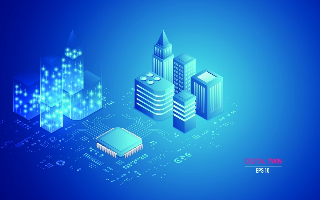
Spatial Digital Twins (SDT) and Information and Communications Technology (ICT) are two technologies that can be combined to create more advanced and intelligent systems that simulate and optimize the behaviour of physical spaces and assets in real time. SDT is the replica of virtual representations of spaces and physical assets, while ICT includes communication network technologies that allow the exchange and analysis of data in real time.
Combining SDT and ICT has the potential to improve communication and collaboration between the different stakeholders involved in the management and maintenance of physical spaces. Providing real-time data and insights from facilities enables better maintenance to make more informed and proactive decisions to optimize performance and avoid problems.
Possibilities
Possibilities to combine SDT and ICT can create a detailed virtual representation of a physical space, which you can use to monitor and manage many aspects of the physical environment including temperature, humidity, lighting, occupancy and more. These virtual representations can also be used to optimize the performance of various assets within the physical space, such as buildings, machines, and vehicles, simulating their behaviour under different conditions and identifying areas for improvement.
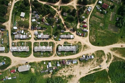
This advancement has repeatedly helped cities to deal with the growing complexity of producing, exchanging, and disseminating information from different infrastructures. Driven by the rise of Internet of Things (IoT) as part of the smart city scenario, which make up the space and urban telecommunications flows to be measured. Allowing the transformation of the built environment into something more possible to understand and build something more viable than ever before.
Communication
With the infrastructure utilized by citizens, tourists, and other users it provides unprecedented insights into the city to help them with their daily lives and planning how to use the city in the future. Providing analytical tools to make them accessible in a spatial context that democratizes the understanding and use of the city.
Wireless communication technology combined with the IoT allow them to interact with each other to reveal the “city in real time”.
The immersive analysis of space, especially urban space, allows emancipating contents from the spatial context that surrounds them in 3D visualization in virtual environments for research in simulation and interaction with Spatial Digital Twins.
An SDT is a highly complex system that combines infrastructure, simulation, data processing, human-computer interaction that related to ICT are expressive tools to digitally represent the world and offer new means of analysis and understanding. Real-time data set with different properties enable real-time interaction with IoT networks: interoperability of communication with the infrastructure.
Conclusion
The combination of SDT and ICT has the potential to create advanced and intelligent systems that simulate and optimize the behaviour of physical and active spaces in real time. The integration of geospatial data and analysis techniques with communication flow systems can lead to the optimization of resource use, reduction of energy consumption, improvement of safety and comfort in several applications, including in the context of smart cities.
This integration can also create new opportunities for optimization and innovation in different sectors. Overall, SDT and ICT integration has the potential to improve the efficiency, sustainability and resilience of physical spaces and assets, leading to a smarter, more connected world.
References:
Lin, S.-K. Introduction to Remote Sensing. Fifth Edition.By James B. Campbell and Randolph H. Wynne, The GuilfordPress, 2011; 662 pages. Price: £80.75, ISBN 978-1-60918-176-5. Remote Sens. 2013, 5, 282-283.
Grübel, Jascha & Thrash, Tyler & Aguilar, Leonel & Morad, Michal & Chatain, Julia & Sumner, Robert & Hölscher, Christoph & Schinazi, Victor. (2022). The Hitchhiker's Guide to Fused Twins: A Review of Access to Digital Twins in situ in Smart Cities.