Geography, GIS and cartography are fundamental ways of understanding the world by bringing together maps and relevant information. With as much advancement as we’ve seen in the abilities of geospatial data to be transformative and helpful - from disaster recovery to planning for the smart cities of the future - there is a challenge that continues to persist for some in the community who could benefit from their information. As sighted people within the geospatial profession - we see these maps as entirely visual pieces of media. This can leave behind individuals with visual impairment (from minor vision loss to full blindness) from benefitting from the help that geospatial information can provide - especially when it comes to navigation.
Last year, I attended the Geospatial World Forum, where among the many presentations about the intersection of humanity and technology was a short presentation featuring Vincent van Altena of Kadaster, and a woman named Ellen Zielman. In the presentation, which you can watch the recording of here, Ellen describes her experiences and challenges navigating the world while blind, and the impossibility of using conventional maps. Together with Kadaster, they developed a pilot set of what they called “tactile maps” to help the visually impaired navigate the world through touch. The maps featured ridges, indentations, and braille to help orient through touch.
While this idea in and of itself was revelatory to many of the geospatial professionals and enthusiasts in the room that day, the process for making the maps did not seem like something that could be easily scaled - and I didn’t hear much more about these efforts after that meeting, though I still kept that presentation in my mind.
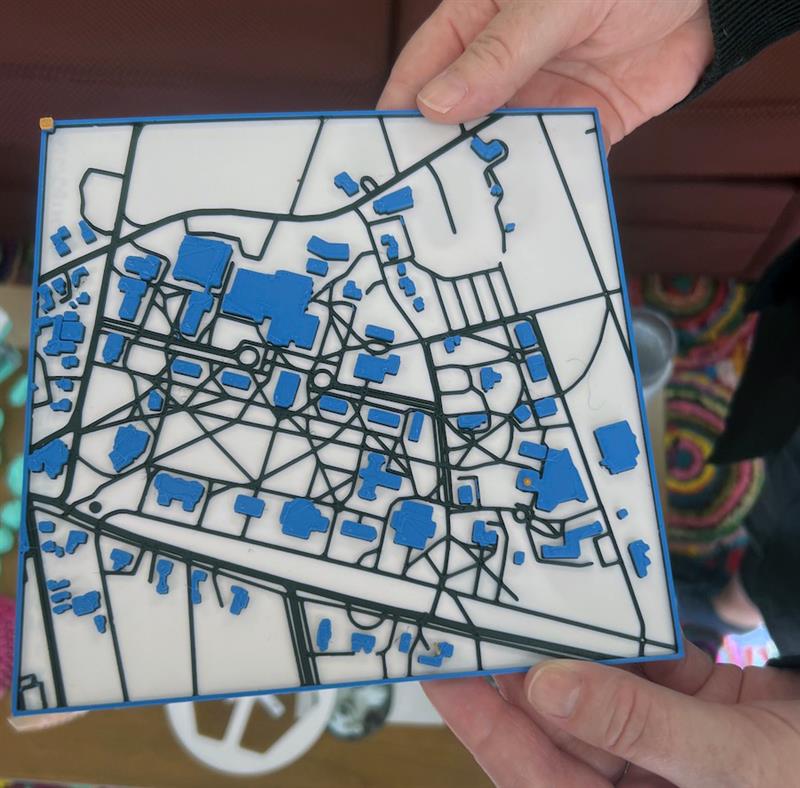
Last week, however, I ran into a story in my own regional newspaper in Maine that reminded me of the experience. Bowdoin College, located in Brunswick, Maine about a 10-minute drive from my house, popped up in the news for creating a tactile map of campus, using 3D printing.
While the Bowdoin College story isn’t the only project to investigate the usefulness of 3D printed, tactile maps, (with similar projects happening in Leeds, University of North Georgia, and UC Davis, to name a few), it’s a great way to see how ideas can spread - from a visit to a botanical garden to a student project, to something implemented on campus.
This combination of designing maps combined with the increasing accessibility of 3D printing opens up a new world of possibilities for tactile maps. Rather than being made by hand, they could be made repeatedly, potentially even on-demand. Perhaps data collected from 3D scans can be used to make even more accurate representations that can be felt - like the facades of historical buildings or the texture of winding stone paths.
While there are certain to be more geospatial/3D solutions developed for bringing geospatial information to the visually impaired, whether it is through virtual reality, real-time navigation, computer vision, or other means, I’m encouraged to see the next generation of geospatial students think about those with abilities different than their own. Maps are powerful tools - and those tools should be able to be wielded by anyone who needs them.