Every week, we highlight stories from friends around the internet that put a spotlight on the latest from within the geospatial, advanced visualization, and AEC industries. These stories can take many different forms, whether they be about a new innovation or workflow, an interesting and/or unique use case for technology, or a higher-level look at the state of the sector. Today, we look at how reality capture is being used to revitalize the city of Detroit, the usage of GPS on the moon, and geospatial digital tools being used in a historic downtown area.
Find links to the full articles below.
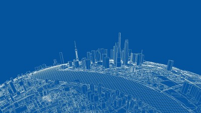
Urban Renewal: How Reality Capture Data Is Supporting Detroit’s Revitalization
Linda Duffy | American City & Country
Detroit was once one of the major economic centers in the United States thanks to its place in the automotive industry. As manufacturing started to move overseas, however, the city has undergone economic struggles and a declining population. Today, some revitalization is happening across the region, and Detroit is back on the way up. This article highlights some of that rejuvenation and specifically looks at how mobile mapping, GIS, and other geospatial tools are being used to support this revitalization.
NASA uses GPS on the moon for the first time
Andrew Paul | Popular Science
GPS for civilian use in the United States has been around for over 30 years, and today it is such a common part of life that we rarely think about it. We always are connected to our location and can easily retrieve directions to anywhere else on the planet. Now, those capabilities are being brought beyond the planet and into space. Earlier this month, Firefly Aerospace’s Blue Ghost became the first commercial lunar lander to touch down successfully on the moon’s surface. As this article dives into, after it landed, it’s also successfully demonstrated the ability to use Earth-based GPS signals on the moon, which could have major ramifications looking forward to future missions from NASA.
A Historic Downtown, Favored on Film, Gets a Digital Twin to Promote Revitalization
Keith Cooke | Esri
There’s a good chance you’ve never heard of Magna, Utah, a former copper boomtown that was buzzing in the early 20th century. Eventually, people started moving out of the town, and the downtown area was left vacant. Even though you’ve never heard of it, however, you may have seen it as the vacant downtown has become a classic setting for film and television projects. This article looks at how technology is being used to preserve the historic downtown.