

As we covered coming back from this year’s Esri User Conference, held in San Diego earlier this month, there were some buzzwords that stood out as major themes of the event. While there is negative connotation around a buzzword, in this case presentations and conversations from the week-long event showed how tools like GeoAI and virtual and augmented reality are starting to present real value for professionals in the industry. One other buzzword that didn’t come up in that piece – though it did a bit on the topic of GIS for infrastructure projects that we covered last week – but did come up often throughout the week was digital twins.
During the week, Geo Week News was able to interview a couple of groups who gave presentations earlier in the conference around how they are using digital twins, based around GIS along with 3D modeling, for public-facing projects. In one, Geo Week News spoke with Kyle Edmonds, GIS Manager at City of Altamonte Springs, and Shane Melde, Geospatial Solutions Engineer at England-Thims & Miller, about a pilot project in Altamonte Springs in which they created a digital twin of a local city park. In another, Alaina Ellis, GIS Manager at InterDev, and Savanna Arnold, Geospatial Solutions Analyst at InterDev, spoke with Geo Week News about their work creating a digital twin to help prepare for sea level rise in Longboat Key, Florida.
These two projects share some similarity in location, with both taking place in Florida, what’s most interesting is that these two conversations covered the same kind of tool, but differed in use case and even how they got started. For the Altamonte Springs project, the idea stemmed from the government themselves, who knew what they were looking for immediately. For InterDev’s work, however, the customer wasn’t initially asking for what the final deliverable ultimately was.
“[The idea for a digital twin] came to us from city management,” Edmonds explained when asked about the impetus for the project. “Our city manager attended some conferences and heard about digital twins, about how they can solve some data issues that I think almost all local governments experience, and said, ‘This is the way we’re going. Figure out how to make it happen.”
Meanwhile, Longboat Key was looking for a way to better simulate and prepare for future sea level rise, but initially they weren’t looking for such a complex solution. “Originally they just bought the maps and data,” Ellis explained. “They just wanted to see it on a map, and that was the conversation.” As they continued talking, though, they explained that a simple map wasn’t going to tell the full story as it wouldn’t take into account topography as well, and so they eventually decided to incorporate lidar data to create a 3D map, all built within ArcGIS.
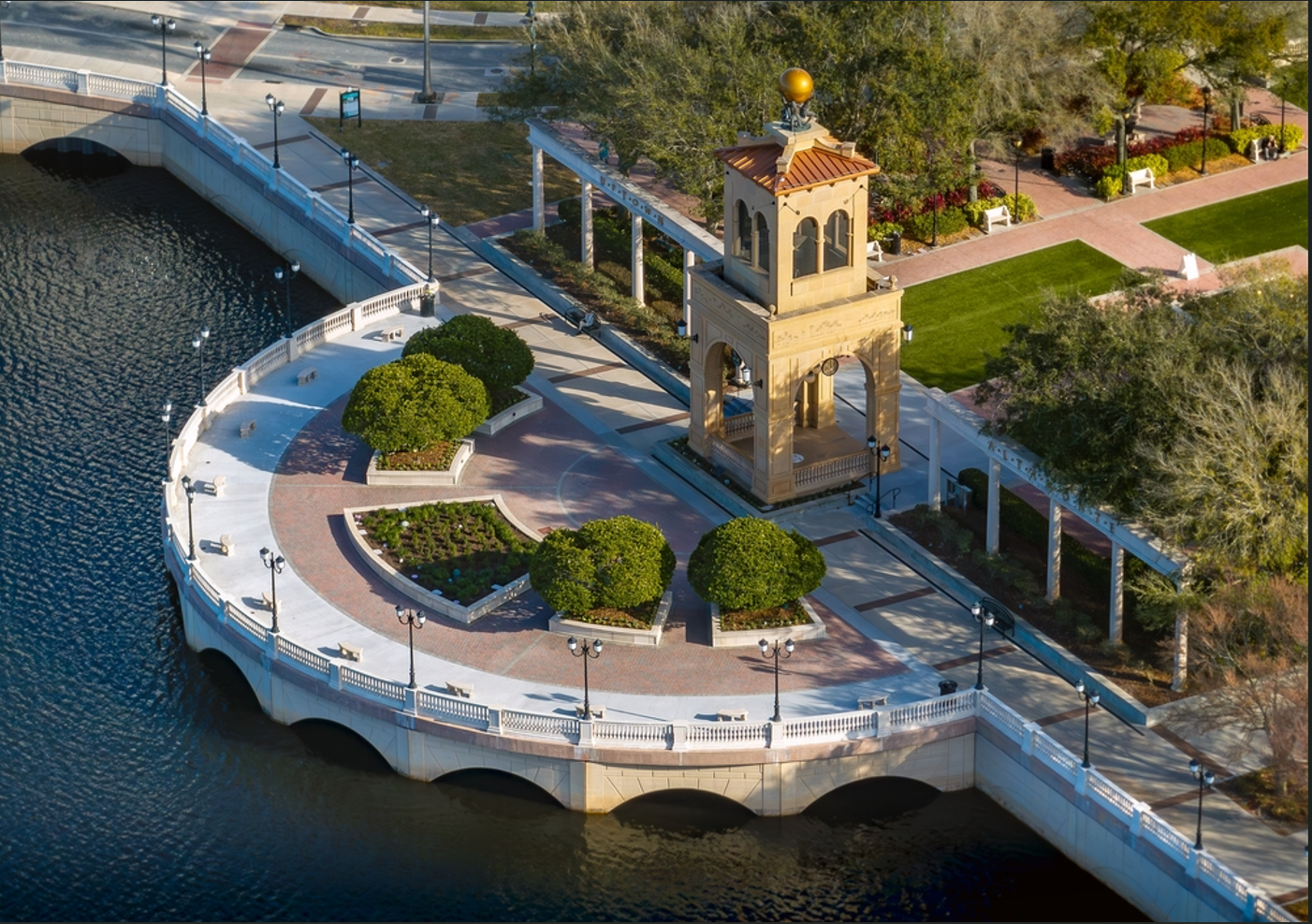
Although that quote above about the Altamonte Springs project may sound like the city jumped into this technology without a real plan in place, that wasn’t the case at all. Throughout our conversation, Melde talked a lot about how everything the city wanted to do was with real purpose, and how important that was to make everything work. As an example, instead of just creating a digital twin of the entire city right away, they started with a smaller area as a pilot project, creating a twin of Cranes Roost Park in the center of the city.
To do this, Melde’s team flew a drone around the park, collecting reality capture data of the area to create the basis of the digital twin. That was then combined with subsurface utility data from the city, all within their GIS, to create a geographically contextualized 3D model for the entire city. Now, different departments are seeing how this works, and they are all seeing the potential value it can have for their potential work. For this project, both Melde and Edmonds explained, the technology wasn’t really a barrier, but rather receiving buy-in from stakeholders and coordination across all of these different departments. They are relying heavily on stakeholder feedback and ensuring that, as this project expands beyond the park, everything is done with purpose and with tangible value in mind.
The technical challenges for the Longboat Key project, on the other hand, proved to be a valuable learning experience for the InterDev team. That was particularly true for Arnold, who told Geo Week News that this was her “first big project,” and that she had just been hired on before that. She was thrown right into the fire, taking charge of the lidar classification project that ultimately transformed this project from 2D polygons to a 3D, simulation-ready digital twin. This was her first time working with lidar data in this way, and while there were some initial challenges, it ultimately ended up being valuable experience.
“This was my first time even looking into classification, and just figuring out the ropes of it,” Arnold said. “But definitely, once you get into it, it’s not as intimidating as you think. I think seeing a point cloud for the first time, you’re kind of like, ‘This is a lot.’ But once you really get into it and get that workflow going, you see the light at the end of the tunnel. And we ended up with a really cool 3D model that works.”
This model is now being used by local officials and is available for public consumption, with sea level rise projects being fed into the model to simulate potential scenarios into the future. Ellis and Arnold explain that for each decade, they have low, mid, and high projections for sea level rise, and users can see how each of these projections could impact future development and local infrastructure.
Whether you want to call these digital twins or 3D models, there’s no doubt that these types of projects are creating real value, and not just for large cities or major organizations. Both of these projects take place in small to mid-sized communities – their combined populations are under 60,000 – but the advancement of the many technologies involved in making this work has made these models accessible for everyone. Perhaps most importantly, at least to the professionals interviewed by Geo Week News, they also make this information more accessible and understandable to the public.
“My biggest thing with this tool is that I don’t want it to be fear-mongering,” Ellis said. “I don’t want it to scare people away; I just want it to be information. I believe having data in the hands of the public is only going to help.”

.jpg.small.400x400.jpg)