

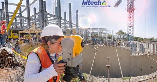
Point-Cloud-to-BIM has become crucial for surveying companies for creating an accurate, clear, and comprehensive digital replica of any construction site. Generating a 3D digital model based on precise data in proper spatial context supports surveyors in visualizing data, integrating workflows, and producing client-centric deliverables.
Point-Cloud-to-BIM enables surveying companies to convert high-resolution laser scans into 3D as-built models. Since the information-rich 3D models are highly detailed and clash-free, they reduce rework resulting in savings of time and costs.
In this article, we set our focus on the top five ways Point-Cloud-to-BIM can support surveying companies to augment profitability.
Why do surveying companies face challenges with legacy methods?
Legacy surveying methods fall short of delivering the required outcomes for renovations, retrofitting, or refurbishments. Surveying companies using traditional surveying tools face a series of challenges in capturing as-built conditions due to:
· Lack of data visualization in the field
· Lower communication and accountability
· Reduced productivity and project delays
· Absence of collaboration
· Closed competitive advantage
5 ways Point Cloud to BIM helps surveying companies maximize efficiency and ROI
1. Enhanced visualization of As-Built conditions improves renovation and facilities management
Survey companies with laser scanning capabilities require Point Cloud to BIM conversion to enhance project visualization. Projects that include renovation, retrofitting, or facilities management require accuracy, completeness, and reliability in their as-built datasets. Clients can achieve 360-degree visualizations with the as-built Revit model that include floor plans, elevations, ceiling plans, cover sheets, and more.
In fact, a Revit model at required LOD with an accuracy range of +/- 10mm can support surveying companies with insights into accurate material consumption, precise timelines, and lower project costs. Data visualization in 3D geometry supports surveyors with accurate measurements, plan creation, and progress tracking. The presence of visualization also helped reduce onsite rework and field risks, thereby saving costs and increasing profits.
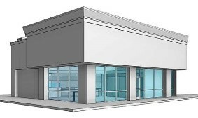
A building survey company turned to Point-Cloud-for-BIM modeling for improved facilities management. An as-built model was required to improve facilities management for a leading retail coffee outlet in the USA. An as-built 3D model with 10mm accuracy was built with floor plans, elevations, ceiling plans, and cover sheets.
With the coordinated as-built 3D model, the client was able to leverage an accuracy of +/-10mm to analyze the state of the outlet in a collaborative setting.
Project Images
 |  |
2. Improve project accountability and communication to cut project costs
Meeting project deadlines, lowering project costs, and upholding renovation quality can be achieved through a Point-Cloud-to-BIM model. High-resolution walkthroughs in real-time help clients navigate the actual site in 3D space. Having a digital replica or digital twin through various project lifecycles tracks project progress, leading to higher accountability.
Perpetual communication through complete access on a single 3D model reduces site visits, cuts down on surveying visits and costs, and fuels improved onsite operations between various trades. An augmented level of communication with complete deliverable visualization can help surveying companies’ grasp a repeat clientele, thereby increasing profits.
3. Save project renovation time with higher productivity and consistency
Surveying large spaces or areas through traditional 2D methods has proved to be inconsistent and unproductive for surveying firms. Producing as-built scans in a matter of minutes reinforced by 3D model creation avoids site revisit costs and improves team safety and productivity.
Generating an accurate and precise 3D BIM as-built model, speeds up the modeling process, further leading to time savings and higher accuracy. Consistency in the Point-Cloud-to-BIM model is achieved with the use of Revit libraries, leading to greater customization, and building component realism. With higher productivity and consistency, surveying companies not only save time but also costs.
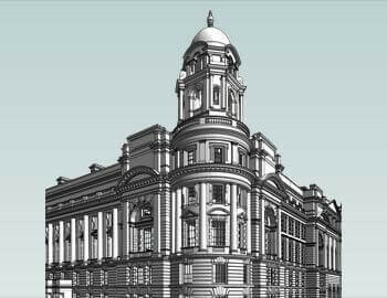
Learn how time savings was achieved with Point-Cloud-to-BIM for a 16th century heritage building.
A laser scanning survey company turned to scan-to-BIM conversion for a 16th century heritage monument building in the UK. Survey images and 3D survey measurements were used to build a coordinated Revit model at LOD 400. The team navigated through various challenges to provide the client with the required deliverables.
Accurate geometries, BIM-driven QA/QC workflows, Virtual Construction Modeling, Revit Families, and techniques were used to achieve a greater project impact. Scan-to-BIM Modeling supported the client with a documented and digitized version of the heritage structure leading to accurate material quantities and higher ROI.
Project Images
 |  |
 |  |
4. Greater work collaboration in a 3D environment improves workflows
BIM has always been strengthened by collaboration. Collaborative techniques and tools bind every facet of the project and people. 3D Point-Cloud-to-BIM models transformed from laser scans capturing every aspect of scanned space encourages efficient renovation. A single 3D model for various trades including Architectural, Structural, MEP, and FP ensures that stakeholders are on the same page.
Collaborative workflows connect every process and person to work in a single collaborative space for faster renovation and restoration. Accurate BOQs and BOMs derived from the Point-Cloud-to-BIM model save on material waste and project costs.
5. Competitive advantage to gain higher efficiencies of scale for renovation and retrofit projects
Surveying companies adopting Point-Cloud-to-BIM as an add-on service can garner high-impact advantages for renovation and retrofit projects. Latching onto advanced scan-to-BIM capabilities can improve project turnaround, lower building costs, and augment profitability.
Surveying firms able to meet strict deadlines with planned quality for various projects, including heritage, commercial, institutions, etc. can gravitate toward a greater client base. Informed decisions, lower risks, and cost reduction, achieved through Point-Cloud-to-BIM solutions, can elevate efficiencies of scale.
Wrapping it up
Surveying companies can utilize the true value of BIM by integrating Point-Cloud-to-BIM workflows to build precise, data-rich, and reliable as-built deliverables in real-time. Capturing high-data volumes through laser scans and converting them to content rich 3D Point-Cloud-to-BIM models reduces onsite ambiguities, mitigates monotonous surveys, and cuts through unnecessary documentation. Positive outcomes result in cost and time savings supported by a comprehensive digital repository for future renovations and facilities management.


