I hesitate to write about a subject for which much has already been written. The perpetual question of the profession's future elicits earnest and thoughtful answers and solutions, although no magic bullet. But perhaps in waiting for a magic bullet, we’re missing opportunities, or failing to recognize trends that are quietly (and not so quietly) shaping that future.
The current state of, and outlook for, the surveying profession is a mix of booms and busts, shifting regulatory landscapes, expanding opportunities in some quarters, and shrinking in others. Frankly, though, when has it not been that way? You only need to attend a local surveying association or society meeting to hear about falling license registration rates or the greying of the profession. Many states note that the number of licensed surveyors is double (or more) than the number of surveyors-in-training (i.e., have passed an exam to earn that designation). This is not a good sign in terms of succession planning.
It should be noted that surveying licensure, in the U.S., and any state laws that cite license requirements for certain activities, is focused mainly on boundary surveying. Boundary surveying requires very specialized education, training, mentoring, and professional judgment. Elements, incidentally, that AI could not conceivably replace—but I digress.... Therefore, discussions around licensing as a gauge of the state and future of the profession ignore the reality that there is a tremendous amount of other surveying going on, that is not necessarily boundary centric. But more on that later.
 “When we talk to young people considering surveying, we have to think about what their careers will look like in 10 or 15 years,” said Henning Sandfort, President of Hexagon's Geosystems Division and CEO of Leica Geosystems. “Technology is advancing so rapidly. Consider AI: Should we recommend that career beginners keep up to speed with every new model? Or should we recommend that they focus on strong foundational skills in one discipline?”
A Wider Lens
The reason I quoted a non-surveyor is to bring home the point that surveyors are not alone in thinking about their future. We are not isolated; there’s the body of work ahead, our clients’ needs, and those who envision, design, and build the tools we will need to meet this future. We will not shape the future of our profession alone.
Sandfort spoke to a group of geospatial press at the recent Hexagon LIVE Global event in June of 2025. The Q&A was wide-ranging, but future casting was a prominent topic. Sandfort is relatively new to this role, following in the footsteps of distinguished Geosystems CEOs, including Jürgen Dold and Thomas Harring, who guided the company during the transition from legacy systems and solutions to a broader paradigm that also includes reality capture and neural processing. No matter what manner of tech wizardry is cooked up, surveying will continue to be the DNA of Leica Geosystems. It is a near cultish environment, but in a good way. For the most part, the entire industry that supports surveying is keeping fundamentals at its core. Some recent examples, though, of a few firms pushing, for example, ultra-cheap GNSS systems, are disturbing. But those are the exception; for the most part, the “Lords of Precision” are looking out for us.
Sandfort comes from a non-surveying background. However, his expertise and senior management roles within Hexagon and Siemens, in global B2B markets, hardware/software innovation and business model transformation, process, automation, and holistic digital environment approaches, anticipate unmistakable industry trends. And it’s good to hear views from outside of our own ranks. His youthfulness belies his depth of experience, coming from a 20-plus-year professional background in industry. The industrial and manufacturing sectors are far ahead of the civil and infrastructure sectors in realizing the benefits of things like digital twins. Sandfort brings this experience to our sector, casting a wide lens on applicable markets and the types of work our profession will (or should) be performing in the future. Think about how commonplace reality capture has become for surveyors, how the infrastructure design and construction we support are steadily embracing digital twins, BIM, and collaborative environments. We need to look wider as well before opportunities go whistling past us… Remember GIS?
“In core surveying work - tunnels, complex structures, precision monitoring - you're not going to replace deep domain expertise with a magic wand," said Sandfort. "The industry fundamentals won’t change overnight. Yes, the industry needs to move faster and close some gaps in adoption and process, but that's achievable. I'm optimistic about our ability to bridge that gap."
How should the surveying profession respond to these changes? Jump in with both feet, or should we sit back out of caution?
"I think we're asking the wrong question," said Sandfort. "Instead of debating whether to jump in or hold back, we should ask: what are the no-regret moves? What do we need to do regardless of what the future holds? Nobody knows exactly where we'll be in 10 years or what the full impact of something like generative AI will be. But even without that clarity, there are improvements this profession can make right now."
Then, what are the things that surveyors need to do to prepare for the uncertain future?
"Surveyors need a clear vision for how they operate - how they run procedures, manage data, and share information," said Sandfort. "What formats? What protocols? What terms? There's foundational work to be done before the sector can fully benefit from advanced technologies like AI. That’s something we need to start today."
The Historically Broad Brush
Surveyors have been, and in some cases continue to be, masters of many things. At times, pioneers, explorers, practical scientists, historians, legal experts, and construction experts. And they would also perform certain engineering tasks. And they often held large project management roles. This is still true, but not as common as in the past. The rapid urban sprawl of the latter half of the 20th century led to a focus on boundary surveying, and at the same time, there was an erosion of some of the other traditional roles as tech democratized (for better or worse) certain elements of the pure measurement aspects.

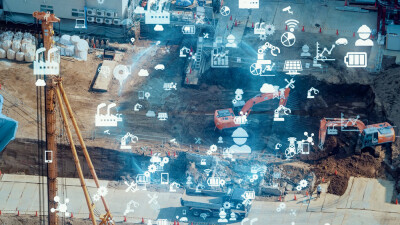
We are embarking on a new wave of infrastructure lifecycles, steeped in automation, tech, and rich geospatial environments. These tools, solutions, and approaches are coming to fruition to bring much-needed productivity gains. The closing of global infrastructure gaps may only be possible with automation and process improvements is an imperative, as there’s no slowing down. This is not as true in North America as in other parts of the world, as there is an element of being victims of our own past affluence; the imperative of becoming more efficient was not always there. Well, it is now, and surveyors should again exert their domain expertise across a much wider range of roles in realizing productivity gains.
We tend to look at our immediate task and not at how it fits in, say, the entire infrastructure lifecycle. This may not be entirely our fault, as it is clients who often compartmentalize assigned tasks. Let’s look at a large-scale infrastructure project, where surveyors are (or could be) utilized more broadly, and how steps taken in early phases could have downstream benefits.
Think of a development project that will entail large-scale grading and drainage, new streets and a highway improvement, utilities, residential and commercial structures, and require buyoffs from many stakeholders. Even in the planning stage, surveyors might commence the boundary work, perform drone surveys, and compile geospatial thematic data. You can already see where the clients might get away with using non-surveyors for some of these tasks. This is where domain expertise needs to be emphasized. In addition, a geodetic foundation needs to be established, which will be used throughout all phases of the project. The surveying profession needs to promote itself as the logical go-to for all the above.
Survey support for the design phase may not (or should not) be limited to doing one survey and handing it over to the engineers. With margins being so tight, design alternatives are considered all the way through this phase, and often into the construction phase. More surveys could be needed. I often hear from engineering teams that traditional surveying can be pricey and may take longer than they’d like; they go looking for alternatives. These are situations, for instance, where the engineer needs, in a hurry, a more detailed as-built survey of certain existing features to mesh with the new design. A surveyor could use, say, a scanning total station, which precisely registers to the project control, and delivers a focused scan via the cloud to the design team directly from the field. Rapid response and rapid deliverables is an expectation of this new era.
Automation and democratization of construction layout and quantities have eroded many legacy roles for surveyors in this phase. But there are ways to stay at the fore. For instance, when conducting the pre-design surveys (e.g., drone flights), you could propose this as a regular service throughout the construction phase. Develop workflows and processes to seamlessly add and update spatial data in the project team’s planned 3D collaborative environment. We need to evolve beyond exporting ASCII and DXF files… Please.
Once built, your role does not have to end. You can set yourself up as the guardian of spatial precision, currency, and completeness. After performing the as-built surveys, the long-term health of the infrastructure requires (or should require) monitoring. Infrastructure project managers lament that when they ask some surveyors about monitoring, they sometimes respond with costly conventional measurement campaigns. They’re looking for more frequent data points, more detail (more datapoints) or both. A comprehensive program that could include combinations of scanning, imaging, InSAR, and various sensors is what’s being sought. If you do not have the domain expertise in all of these, you can collaborate with others or study up.

Is it practical or wise to try to seek domain expertise in all these areas? I know of some folks who are sinking a lot of time into learning how to use AI large language models (LLM), thinking that it could make up for a lack of direct domain expertise. The problem with this is that LLMs only work with what they can ingest, and for esoteric elements of surveying and geodesy, there is just not enough to work with to deliver the magic they wish for. And the AI does not know if it is lacking, wrong, or hallucinating. There’s no large geospatial model (LGM) yet for AI, but this is already being envisioned.
Others see reality capture (RC) as a substitute for domain expertise. There’s a tendency to simply scan everything, capture a gazillion points, with little thought to the downstream bottleneck for processing, classification, feature extraction, and heads-up drafting. RC can work wonders in boosting productivity, and while it has become almost a separate discipline, it still takes domain expertise to plan, execute, and deliver contextually appropriate deliverables from it. The sad irony is that all surveying is by default “reality capture” and was long before the buzz term ever existed. However, it seems that now, just about anyone can go buy a drone and offer up RC services, while clients may not readily recognize the pitfalls. This can be battled by showing that you have domain expertise in many more areas of the project life cycle than that one act of “press the button, wheeee!” RC.
Developing and Implementing the Tools
The tools of this era of rapidly evolving 3D geospatial mini-worlds (digital twins) for projects are mostly already here or are in development. AI (more specifically, neural processing) is being applied responsibly to improve efficiencies for very specific tasks. For example, for point cloud classification, or computer vision (CV) for feature and target recognition. Those who master and integrate these new tools and processes and learn how to “coach bots” can have an edge. Certainly, few if any of these tools could make quick work of the professional judgment elements of boundary surveying; no one is saying that. But for nearly everything else, it can be well worth exploring such developments.
"When it comes to hardware and the physics of measurement, we've largely mastered it," said Sandfort. "We can continue to improve and reach new performance levels, but the next major leap will be in how we take advantage of the data - processing it intelligently, adding context, and driving actionable results."
There’s a lot of discussion (perhaps too much at times) about using the scalability of the cloud to make all this proposed magic happen. The reality may be that for what surveyors do, it may not be as much cloud-centric as it might be a case of recognizing when and how to leverage local, edge, and cloud processing and management. Hexagon’s cloud service is an example of one designed specifically for geospatial data and applications. To some degree, each of the main geospatial solutions providers has developed such focused cloud services, for example, Esri.

"Our vision for HxDR (Hexagon digital reality) is to merge data from multiple sources - imaging, scanners, and UAVs - into a single AI-powered platform," said Sandfort. "Right now, just getting LiDAR and image-based point clouds to work together can be a significant challenge for someone on a construction site. How do you harmonize those different data types efficiently?"
"The challenge is scalability," said Sandfort. "You're dealing with enormous amounts of data, and the question is: how do you provide that scalability without making it too costly? The way spatial and graphics engines like NVIDIA Omniverse are being leveraged is genuinely exciting."
Whether surveyors like it or not, the cloud will play a larger role in their workflows.
“We talk a lot about cloud technology, but the key question is: what’s its purpose in each situation? Where do we need to share data — and with whom?” said Sandfort. "Think about the speed required to ramp up a production site and keep a construction project on track. You need a concurrent data source that different stakeholders can tap into. The cloud is the most effective way to get that job done. I think customer demands - the need to respond quickly and deliver what clients expect - will drive adoption of these technologies across our industry."
We’re already seeing, for some projects, these kinds of advanced digital 3D environments, and we’re being tasked with providing the data to feed these. As Sandfort noted, it is responding to customers that will drive adoption within the profession of the sectors we support. Clients are not as nostalgic as we sometimes tend to be. If you can be productive and competitive with legacy tools and solutions, that shows true skill and expertise, but is it sustainable? We do not have to let go of fundamentals, dedication to delivering the highest precision and accuracy, and professional standards and integrity, if we look to broaden our roles. We have done it before, and we can do it again.