Long before humans agreed on alphabets, currencies, or calendars, they drew maps. From scratched outlines on cave walls to clay tablets etched with river bends to painted animal hides marking hunting grounds, maps predate nearly every other form of organized human communication.
When I joined Geo Week News last fall, I hadn't fully appreciated how maps had shaped my own life, from a hand-drawn guide to the best trick-or-treating streets before I could form a coherent sentence to plotting the perfect restaurants during a college trip to Paris. Maps have always been how I, like so many others, make sense of the world around me.
That realization deepened after interviewing experts, attending conferences, and reflecting on my own experiences: maps are, in the truest sense, a universal language. And they have been throughout history.
A Language Without Words
Maps work because they bypass the need for a shared spoken or written tongue. A Roman soldier and a Han Dynasty general would have understood nothing of each other's speech, but hand either one a drawn representation of terrain, roads, and settlements, and both could probably grasp its meaning.
This is not a coincidence. It reflects something fundamental about how humans understand space. We are visual, spatial creatures. We think in terms of here and there, and maps tap directly into that wiring.
Echoes Through History
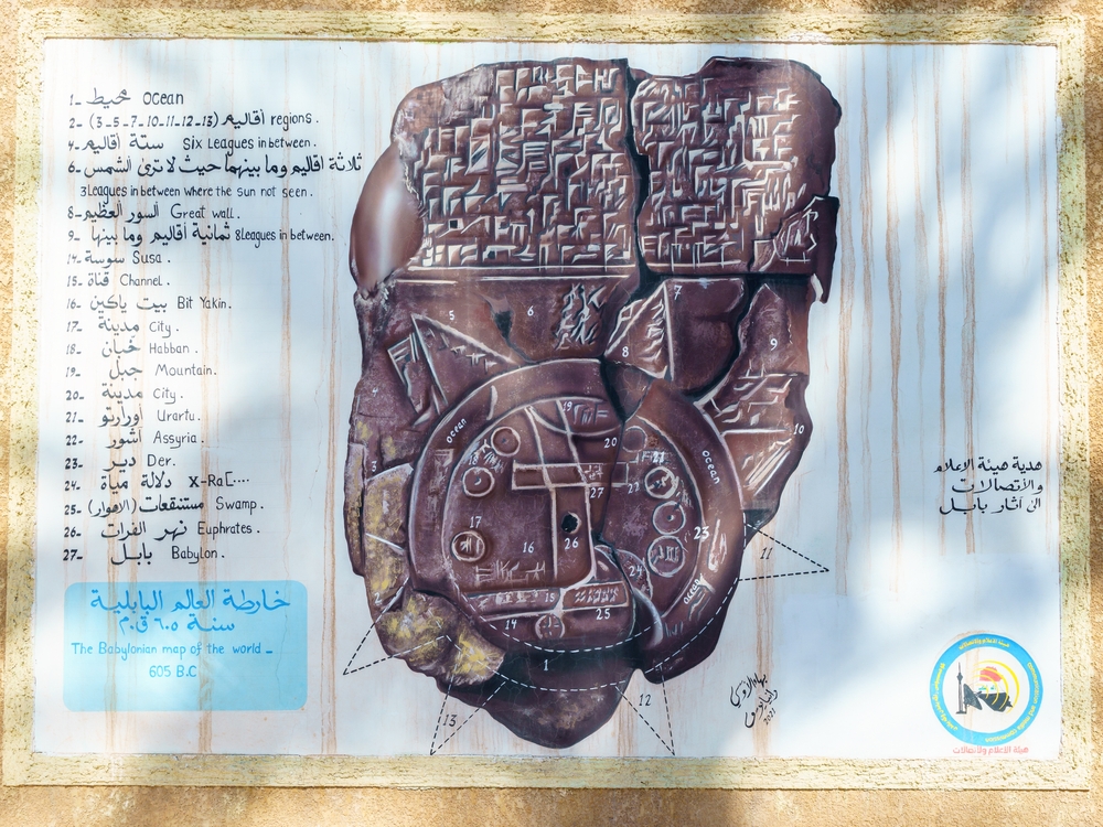
The oldest known map is the Babylonian World Map, carved into a clay tablet around 600 BCE. It shows Babylon at the center of the world, surrounded by ocean, which proves to be a way to say, "Here is where we are, and here is everything else." Despite its inaccuracies by modern standards, any person alive today can look at it and understand what it is attempting to communicate.
The Ptolemaic maps of ancient Greece introduced grids and coordinates in the 2nd century CE, an early attempt to create a standardized system for spatial communication that any literate reader could interpret, regardless of native language.
During the Age of Exploration, maps became the most politically and commercially valuable documents in existence. Portuguese, Spanish, Dutch, and English navigators competed fiercely, not just for territory, but for the maps that described it. A good chart of the Caribbean or the Indian Ocean could determine the fate of empires. Enemies didn't need to speak the same language to understand what a rival's map was showing them.
The Lewis and Clark expedition (1804–1806) produced maps of the American West that became a shared vocabulary between the U.S. government, Indigenous nations, fur traders, and eventual settlers. Parties who shared almost nothing else culturally or linguistically.
In World War II, battlefield commanders from a dozen Allied nations with different native languages all read from the same topographic maps. A grid reference needed no translation. North was north. A contour line meant the same thing in English, French, and Polish.
GIS: The Universal Language Gets a Louder Voice
GIS didn't invent the universal language of maps; they amplified it beyond anything previously imaginable. Where a paper map could show you what was where, GIS lets you ask why, when, how much, and what if. It layers data onto geography: population density over terrain, disease spread over time, deforestation rates across decades. It transforms a static picture into a dynamic, queryable, living document.
Before GIS, creating a high-quality map required professional cartographers, expensive printing, and government or institutional backing. Today, people from all over the world can all work from the same open geographic datasets, visualize the same spatial relationships, and communicate findings to a global audience, all without sharing a spoken word.
What Will Never Change
Strip away the software, the satellites, and the screens, and something essential remains unchanged: the act of looking at a map is the act of orienting yourself in the world and in relation to others. That need, to understand where we are, is as old as human consciousness itself.
Maps have always said, "Here is the world as I understand it; let me show you." GIS has simply given that ancient sentence a louder, clearer, and more precise voice.
In a world that seems more divided by language, politics, and culture than ever, the map remains - as it always has been - something everyone can read and interpret.