
Webinar
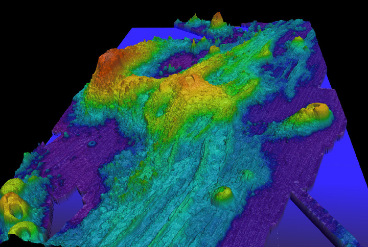
3D Bathymetric Models and Maps
On-Demand Webinar | Free
On-demand Webinar | Free
Bathymetric maps are increasingly important tool for public and private sectors. A panel of experts will discuss how these tools and innovations are making a difference for stakeholders of all sizes.
Speakers

Jim Van Rens, Senior Vice President & Strategic Advisor, RIEGL USA

Anders Ekelund, Vice President, Airborne Bathymetric LiDAR, Geospatial Content Solutions Division, Hexagon

Carol Lockhart, Chief Hydrographer, Woolpert
Moderator

Carla Lauter, Editorial Analyst
This webinar is provided free of charge and underwritten by a sponsor. Following the webinar, you may be contacted by the sponsor with information about their products and services.
