Contributed by Brian Soliday, Chief Revenue Officer, Voxelmaps
About Voxelmaps: Voxelmaps is one of the top geospatial mapping companies worldwide. Founded by Peter Atalla in 2017, Voxelmaps is a spin-off from Navmii, an established navigation & SD Mapping Company with 16+ years of experience in mapping over 180 countries on a global basis. Voxelmaps provides businesses from many industries with a new form of mapping, which provides superior levels of accuracy, information, and insight.
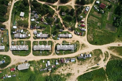
The Rise Of The Digital Twin
Though the market for digital twins is relatively small, USD 6.90 billion in 2021, the market is projected to grow to USD 72.35 billion in 2028 at a CAGR of 39.9% during the forecast period according to Fortune Business Insights.
The concept of a Digital Twin has been around for decades, even way back to the 1970s when NASA’s Apollo 13 mission used prototype Digital Twins to help rescue three astronauts after the spacecraft experienced a terrifying oxygen tank explosion.
Up until fairly recently, Digital Twins were limited to industries such as aerospace and the architecture, engineering & construction (AEC) markets, however, this is no longer the case and there is now a wide variety of Digital Twin use cases in many industries such as utilities, transportation, telecommunications, and natural resources.
Voxelmaps Real-World Applications/Use Cases
Utilities
Use Case: Vegetation Management/Encroachment
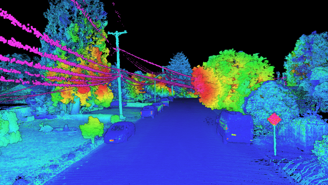
Project: Utility Infrastructure Asset Capture using aerial LiDAR
Using our Voxelmaps SYMBO mobile mapping system (LiDAR, Hi-res imagery) we drove the streets to capture various utility Infrastructure distribution assets. Our mobile mapping device captured this data in detail, allowing the identification AND measurement of all the assets. Then using the AI/ML-based Voxelmaps Insight Platform (VIP), we was able to automate the feature extraction which identified and quantified vegetation encroachment issues.
Transportation
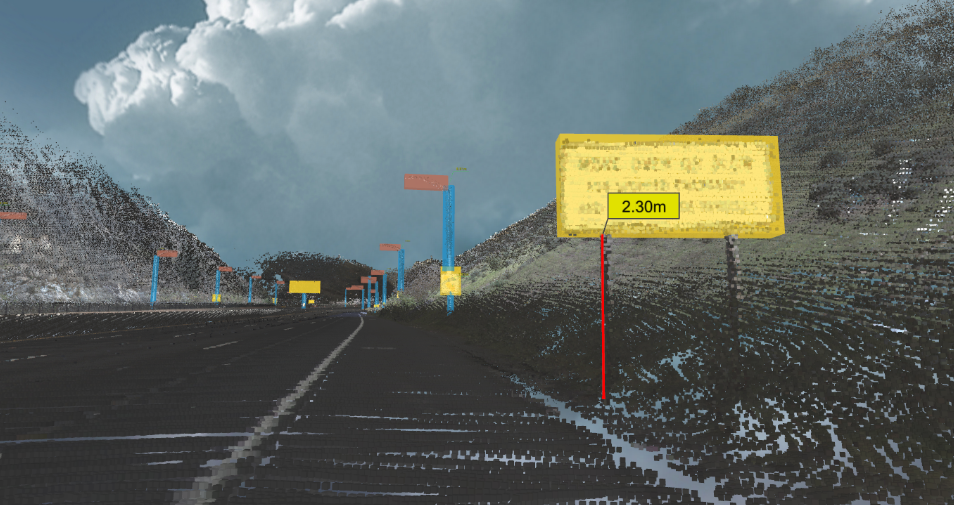
Use Case: Mapping Of Traffic Signs
Project: Traffic sign data collection and mapping for a major navigation company
Within the road network right-of-way, we were contracted to map an area and carry out feature extraction of the signage inventory for a major navigation company. Across that network, we identified and mapped out a whopping 7 million signs for that company. We did the automated sign recognition and then all that data was then converted to XML ready for delivery.
The Voxel Approach
The 4D Volumetric Voxelmaps approach, AKA the Voxel approach, offers a new and fascinating form of digital mapping that provides superior levels of accuracy, information, and insight. As our maps are built from voxels, we have the ability to map absolutely everything that is visible!
Here’s why we believe that the Voxel approach is the future of Digital Twins:
Voxelmaps allows organizations to automatically extract their assets through our AI/Machine Learning (ML) toolset. With voxels, you can see the assets at all angles which makes a huge difference in terms of the recognition of features, not to mention that the accuracy/resolution of voxel data is approximately an astounding 1-4cm.
The Voxel model includes incremental 4D volumetric updates, meaning that the model is always live and updated without having to regenerate the original model. Additionally, we can perform 4D volumetric automated change detection with future collections so that manual verification is minimized.

Understand And Forecast The Roles And Dependencies Of Your Physical Assets With Voxelmaps Technology
If you’d like to learn more about our technology and the Voxelmaps Insight Platform (VIP) that offers affordable and accessible ways to utilize digital data to improve business processes, identify potential problems, and create new opportunities, contact us today.
About the Author: Brian Soliday, Chief Revenue Officer at Voxelmaps has over 30 years of extensive experience working in sales, marketing, and channel development within the GIS and remote sensing industries. His career includes CRO, VP, and director-level positions with leading geospatial organizations such as Autodesk, Trimble, Space Imaging, LizardTech, Intermap, and TerraGo. Brian has presented at over 100 geospatial events on an international basis and has written published articles in; Planning, Point of Beginning, GEOinformatics, The World & I, GEOEurope, Arc News, Space News, and Earth Observation Magazine.