

Sponsored by Insta360
The technology for lidar scanners has been steadily improving over the last decade, in large part thanks to its adoption by the autonomous vehicles sector. Sensors are becoming more powerful and systems are shrinking without sacrificing any power, leading to more useful data than ever that is easier to collect. The most important developments in recent years for the lidar surveying industry, however, may not even have to do with the actual scanning technology itself. Instead, thanks to improvements to software algorithms, the ability to fuse this lidar data with other types of data has unlocked new potential insights and use cases for these professionals. In particular, the improved ability to fuse point cloud data from lidar scanners with high-resolution imagery from 360° cameras has led to significantly more detailed point clouds, ultimately unlocking new insights and creating more powerful deliverables.
Even more recently, visualization tools have been undergoing seismic shifts with the continued development of 3D Gaussian Splatting. Removing the need to rely on point cloud data, this new 3D creation technique takes a series of images and creates a high-quality, cost-effective 3D scene rendering that can be streamed on any device. Just as lidar-based point clouds are benefiting from the development of high-quality 360° cameras, so too is the emerging space around Gaussian Splatting.
Insta360, a leader in the 360° imagery space, was founded in 2015 to create innovative products that help people capture and share their lives. They’ve also since added an enterprise division for professionals across the AEC, real estate, and mobile mapping, among many others. Today, they have customers across 14 industries in over 100 countries and regions.
Insta360 cameras are widely recognized as leading solutions for 360° data capture in professional workflows. A full range of accessories, such as mounts for hard hats, an invisible “selfie stick” that is automatically removed from 360° imagery, and an invisible tripod, make the X5 adaptable for on-site acquisition. These accessories, combined with the camera’s compatibility with lidar systems, enable true data fusion for geospatial and AEC professionals.

Before the release of the X5, Insta360’s Pro series and ONE series cameras were widely used in enterprise workflows for applications such as virtual tours, 3D modeling, and as-built documentation. These cameras enabled professionals in construction, real estate, and GIS to simply capture immersive 360° imagery, facilitating things like site inspections, progress tracking, and large-scale mapping projects. The introduction of the X5 continues this evolution with new hardware enhancements and stronger SDK capabilities.
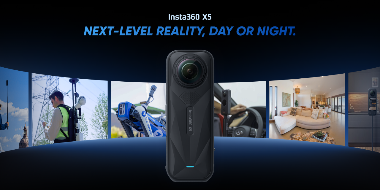
Insta360’s new X5 camera was released earlier this year, and has several marked improvements over the previous generation of offerings. On the hardware side, the X5 features dual 1/1.28 sensors, as well as a fast, triple AI chip system for superior low light. The camera provides image quality up to 8K resolution, and features in-camera Pure Shot for 72MP images with reduced noise and enhanced details, as well as in-camera HDR synthesis for a wider dynamic range with more balanced lighting. The upgraded Timelapse Mode is optimized for capturing long site walkthroughs efficiently with smaller file sizes and improved processing performance.
Additionally, the X5’s battery lasts even longer, up to 185 minutes, marking a 37 percent longer than previous generations, along with new removable lenses that allows users to replace any work lens themselves. And finally, Insta360 has already released SDKs that support the X5, with significant upgrades including desktop SDK GPU support and more robust, flexible interfaces—enhancing development efficiency for our partners and developers. For more details, check out Insta360’s SDK page. You can find full product specs on their official X5 one-pager.
All of these capabilities make this enterprise 360° camera ideal for a number of different industries, particularly those who are looking to fuse the data from this improved model with their lidar sensors. Construction professionals can use this technology to track progress on a project, surveyors and other geospatial professionals can collect high-quality data for mapping and inspection workflows, and facility managers can seamlessly collect as-is data with minimal disruption.
By combining this imagery with high-quality point cloud data from improved sensors, end users can ultimately gain the accuracy and depth that comes from lidar data with the colorization and texture. For any workflow that requires a true understanding of an overall scene, and particularly the ability to detect objects and segment assets within a point cloud, this data fusion is crucial.
Creators have also demonstrated how they are using the X5 for Gaussian Splatting workflows as well. This user on X, for example, showed off the finish product of a walkthrough of the Kensal Green Cemetery in London, a stunning 3D scene creation built with Gaussian Splatting based on images taken with the X5. In this video, Olli Huttunen aimed to create a custom-built 3D scanner with three Insta360 cameras, showing the process of how he was building his scene, including the post-production steps he took.
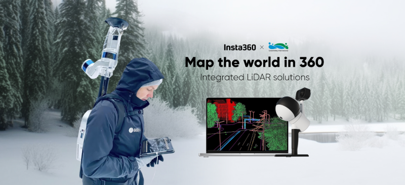
Insta360 is not a stranger to this kind of data fusion, either, as they have been working with some of the leaders in lidar technology to provide an all-in-one solution for users. For example, they have worked with GreenValley International to offer a comprehensive lidar mapping solution incorporating high-quality 360° imagery from Insta360’s cameras with mobile mapping systems from GreenValley International. With the integration, a user can simply walk through a site of interest and collect data to create a high-quality colorized point cloud. As they point out in this blog, this kind of solution can be useful for a number of industry professionals, including forestry, mining, 360° documentation, and reconstruction. Below, you can see an example of how the GreenValley International team mapped a tree population in the Yarlung Tsangpo Nature Reserve, and in the process, discovered and mapped the tallest tree in Asia.
Similarly, FJDynamics has incorporated Insta360’s cameras into their own handheld scanning system, with the added capability of visualizing the point cloud in real-time as scanning takes place. They call out many of the same potential use cases, while also noting its potential for those in public safety, media and entertainment, and robotics.
Taken together, Insta360’s partnerships with lidar solution providers and the evolution of their camera hardware with the X5 show just how far 360° imaging has come, not just as a standalone tool, but as a critical part of the modern geospatial data stack. Professionals today aren’t just looking to collect more data. They’re looking to collect better data more efficiently, and in a way that drives truly actionable insights. The X5 helps deliver on that promise, enabling everything from faster site documentation to more immersive visualizations and clearer decision-making. As workflows continue to evolve, especially in industries like construction, mapping, and facility management, the ability to combine rich visual context with the precision of lidar will no longer be a nice-to-have. It’ll be a standard expectation.


