
High-precision positioning and UAV technology
UAV technology has exceeded expectations and can be used in many applications such as surveying and mapping, especially drone mapping, mining, environmental investigation, power inspections, and so on. For many of these applications, high-precision positioning and navigation are very important. As the technology of PPK and RTK is becoming easier to understand for UAV users, many GNSS-enabled UAVs can even use RTK technology directly for precise positioning and navigation. This article describes how to use the SatLab Freyja GNSS receiver as a stationary station to provide precise correction data for UAVs, thereby improving the accuracy of deliverables and enhancing the experience with better navigation.
Compared to connecting the UAV to a network RTK service (Regional augmentation system, also called CORS), a base station set up in the field will provide a more convenient and portable working environment, providing a more stable and reliable data stream in mobile degraded-network areas. And a shorter baseline can significantly reduce accuracy degradation, providing higher RTK precision.
How on-board RTK technology works
This solution requires a Freyja GNSS receiver, the Satsurv APP, an Android handheld terminal such as a smartphone, and a UAV drone.
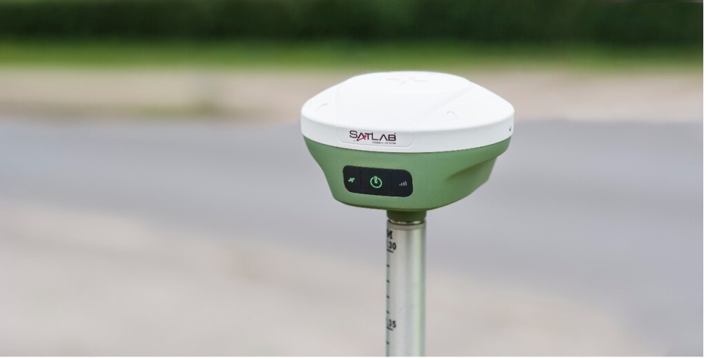
Freyja is the latest generation of GNSS receivers from SatLab, and the ultra-compact pocket design makes it very portable and flexible. Thanks to its excellent power consumption control and large capacity built-in battery, Freyja can reach more than 10 hours of continuous operation as a reference station. In addition, the built-in IMU tilt-survey function greatly improves the efficiency in the field. As an ultra-portable GNSS receiver, Freyja is not only a good helper for land surveying but also an ideal partner for UAV mapping.
Satsurv is the mobile application that SatLab has been working on for years. The newest release features a refreshing UI design as well as becoming more and more powerful, including how to empower UAV applications. The Satsurv APP can be installed directly on the Android device (UAV controller).
Setting-up Workflow for Drone Mapping
The simple workflow will be as follows:
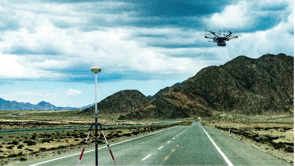
Use a tripod to set up Freyja near your working point, either on a control point with known coordinates. Alternatively, you can launch Satsurv APP to collect a high-precision position as a new control point by connecting to the CORS service.
- Step 1: Use Satsurv to configure Freyja as a base station under data collector internet mode. Therefore, Freyja is now officially a base station and will send correction data to the handheld terminal via Bluetooth.
- Step 2: The key step in this operation is to enable differential data to be forward by Satsurv. This feature allows Satsurv to broadcast the correction data from the Freyja over the LAN of the mobile terminal.
- Step 3: If you are running Satsurv on a peripheral Android terminal, you can turn on its mobile hotspot. Then you can use the controller’s WIFI to connect to this LAN. It is just like connecting to a standard CORS service. You can use the controller to connect to the local IP and port displayed by Satsurv via the NTRIP protocol to get the correction data. Operation is the same as Satsurv is running on your Android OS UAV controller.
- Step 4: Now you can fly your UAV drone with high-precision. The real-time correction data will be sent from Freyja via Bluetooth and forwarded to the LAN by Satsurv.
Finally, let’s recap the simple setting-up procedures: Set up Freyja > Enable the data to be forwarded to the LAN > Link UAV controller to the hotspot > Fetch correction data like using CORS service and fly.

High-precision positioning and navigation is a critical part of using UAV drones regardless of the applications. Different from traditional drone surveying, the emergence of RTK technology such as Freyja GNSS receiver improves the work efficiency by offering real-time, highly-accurate position solutions for drone surveying, and ensuring a safer and more stable flight.
Learn more about Freyja on the SatLab website.
About SatLab Geosolutions AB
SatLab Geosolutions is a Swedish-based global satellite positioning solutions company with offices strategically located around the world. Founded by a group of passionate and pioneering engineers, with a total of more than 40 years of experience in the GNSS industry, the management team is made up of veteran industry experts who value our customers’ needs. Focusing on research and development, the SatLab Geosolutions team works around the clock to create innovative products for surveying professionals across the globe, providing superior complete solutions.


