As the surveying profession grapples with shifting demographics, rising workloads, and persistent labor shortages, firms across the U.S. are reassessing how technology fits into their long-term strategies. Associated Land Surveyors & Planners, PC (ALS), a family-owned firm in Etowah, N.C., is one of the companies leaning into modernization as a pathway to growth.
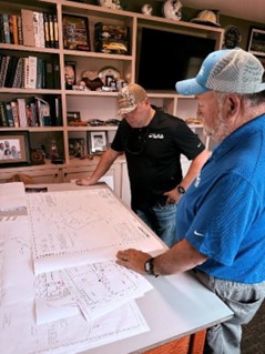
Founded in 1988 by Terry A. Baker, ALS has evolved from a two-person operation into a full-service provider supporting land surveying, planning, mapping, construction staking, and subdivision design across Western North Carolina. Today, the company fields six to eight crews daily and manages as many as 50 active projects per week. “Our current staff is possibly the best overall staff we've ever had,” says Vice President Cameron Baker. “Some of these employees have been with us for more than 20 years, and each serves an integral role in our success.”
But as Baker explains, the environment his team operates in looks very different from the one his father navigated decades ago. “We need more people to continue growing the business, and it’s hard to find quality help right now. The supply is just not there, and it’s that way pretty much across the state.”
With the average age of a surveyor nationally hovering between 55 and 65, the firm sees workforce pressure firsthand. ALS has taken steps to raise the profession’s profile among students by participating in high school and early college career programs, but the company also recognizes that technology plays a pivotal role in sustaining productivity and safety with limited staff.
Moving from a Mixed Fleet to a Standardized Platform
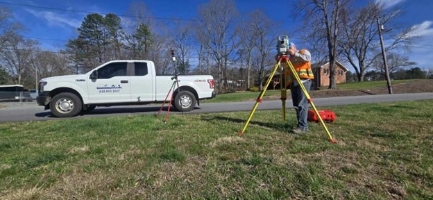
For years, ALS operated with a patchwork of GNSS equipment, total stations, and data collectors from several vendors, a setup that increasingly hindered efficiency. Instruments weren’t always compatible, and crews disliked the tablets in use for data capture.
That began to change after a hands-on evaluation of Leica Geosystems equipment guided by Charles Clausen of Transit & Level Clinic. ALS tested the Leica TS16 robotic total station and GS18 T tilt-enabled GNSS rover, and the equipment aligned with the firm’s priorities around craftsmanship, reliability, and longevity.
The introduction of Leica Captivate 10 software with a more seamless field-to-office workflow solidified their decision. ALS committed to standardizing its entire fleet on Leica hardware and software.
“At the end of the day, we want every piece of equipment to be able to work with every data collector,” Baker says. “It’s important for us to function at max capacity.”
Beyond the technology's performance, there was also a trust factor.
“At ALS, we treat each client the same, whether it’s a small project or a large-scale project. That really goes a long way,” Baker explains. He notes that they expect the same level of service from their technology providers.
“Reliable service is huge for us. That was a big reason for choosing the Leica Geosystems brand.”
Looking Ahead: Robotics, AI, and Automated Workflows
ALS is now preparing to integrate the Leica TS20 AI-powered robotic total station and the AP20 AutoPole system. According to Baker, these tools represent the next phase of the firm's modernization effort.
“We’re really looking forward to using the TS20 and AP20,” he says. “We think it’s going to be a huge improvement.”

The TS20’s intelligent automation is expected to enhance construction staking and layout productivity, particularly in wooded or obstructed terrain. The AP20’s automatic pole height compensation and ability to measure accurately at an angle support crews working in tight or hazardous environments, which is an everyday challenge in North Carolina’s mountainous regions.
Tilt-enabled GNSS from the GS18 T adds further safety and speed by eliminating the need for precise plumb positions when collecting data.
ALS anticipates measurable efficiency gains within 2 to 3 months, once crews are trained and workflows adjusted.
A Strategic Investment in the Next 35 Years
For ALS, the shift isn’t only about adopting new tools; it’s about positioning a family-run firm for the future. The company’s reputation has long been defined by its exceptional quality and personal service, values instilled by founder Terry Baker and carried forward by the next generation. Technology strengthens rather than replaces those principles.

The goal, Baker says, is to increase efficiency, reduce risk, and create a unified technology platform that can scale with the business. But the deeper objective is resilience, ensuring ALS remains competitive and capable of delivering at a high standard as the industry continues to evolve.
Why Firms Like ALS Are Investing Now
ALS’s transformation reflects several pressures influencing the surveying landscape:
- Labor shortages demand tools that multiply the output of existing crews.
- Interoperability reduces downtime and eliminates mismatched equipment issues.
- Safety concerns are driving the adoption of tools like tilt GNSS and automated prism pole systems.
As ALS demonstrates, strategic investment in technology isn’t just about staying current; it’s becoming a foundational requirement for long-term competitiveness in a profession undergoing structural change.
About the Author: Christine Grahl is an investigative storyteller with nearly two decades of experience covering innovation in geomatics and surveying technologies. As content, communications & creative lead for Geomatics at Leica Geosystems, part of Hexagon, she directs the development of in-depth, educational and inspirational content that supports professionals working across surveying, construction, and geospatial workflows. Her work focuses on how advances in measurement, automation, and 3D spatial data are transforming the way teams capture, model and understand the built and natural worlds.