

Millions of miles of road infrastructure in the United States are in need of observation, inspection, repair, or improvements. Managing critical infrastructure assets and inventorying their current condition has traditionally been an extensive and time-consuming process. As road infrastructure ages, the need to keep safety systems up to date and conforming to best practices becomes more critical each year. While there are existing databases of signs, road markers and other safety systems (such as guardrails), without regular observation and inspection, it is impossible to know for certain which systems need to be replaced or are not within Federal Highway Administration (FHWA) standards.
Depending on state, federal or municipal funding levels, the time and availability of personnel to inventory assets on certain stretches of roads may come up short. Miles of road can require days of detailed work to assess, while only relying only on previous records leaves room for mistakes and costly re-work.
 By leveraging a combination of existing data and strategically partnering with service providers to collect more imagery and scans of road assets, Allvision is driven to improve the process with technology. By incorporating the latest in scanning and cloud-based classification and object identification technology with AI, their proven systems can save days or even weeks of labor in preparation for road projects.
While traditional surveying and asset inventory is both time and cost heavy, Allvision’s solution leverages AI to provide reporting on critical infrastructure assets to enable rapid decision making and prioritization. By working with partners in automotive, mapping, engineering, and robotics, Allvision is able to provide ground-breaking solutions designed to build smarter cities and infrastructure.
Highway projects shouldn’t have to start at mile zero
When approached with a road project, Allvision works to query existing databases and find gaps in what information is available, and then partners with service providers to collect any missing information via new scans that can be completed over a short period of time. Rather than an involved RFP process, Allvison’s technology-forward setup can save months of back and forth even before a project begins by providing a foundation of verified and up-to-date information.
“The world changes – what’s here today might not be here a year from now.” -Michael Frecks, Survey/Lidar Manager, TREKK Design Group

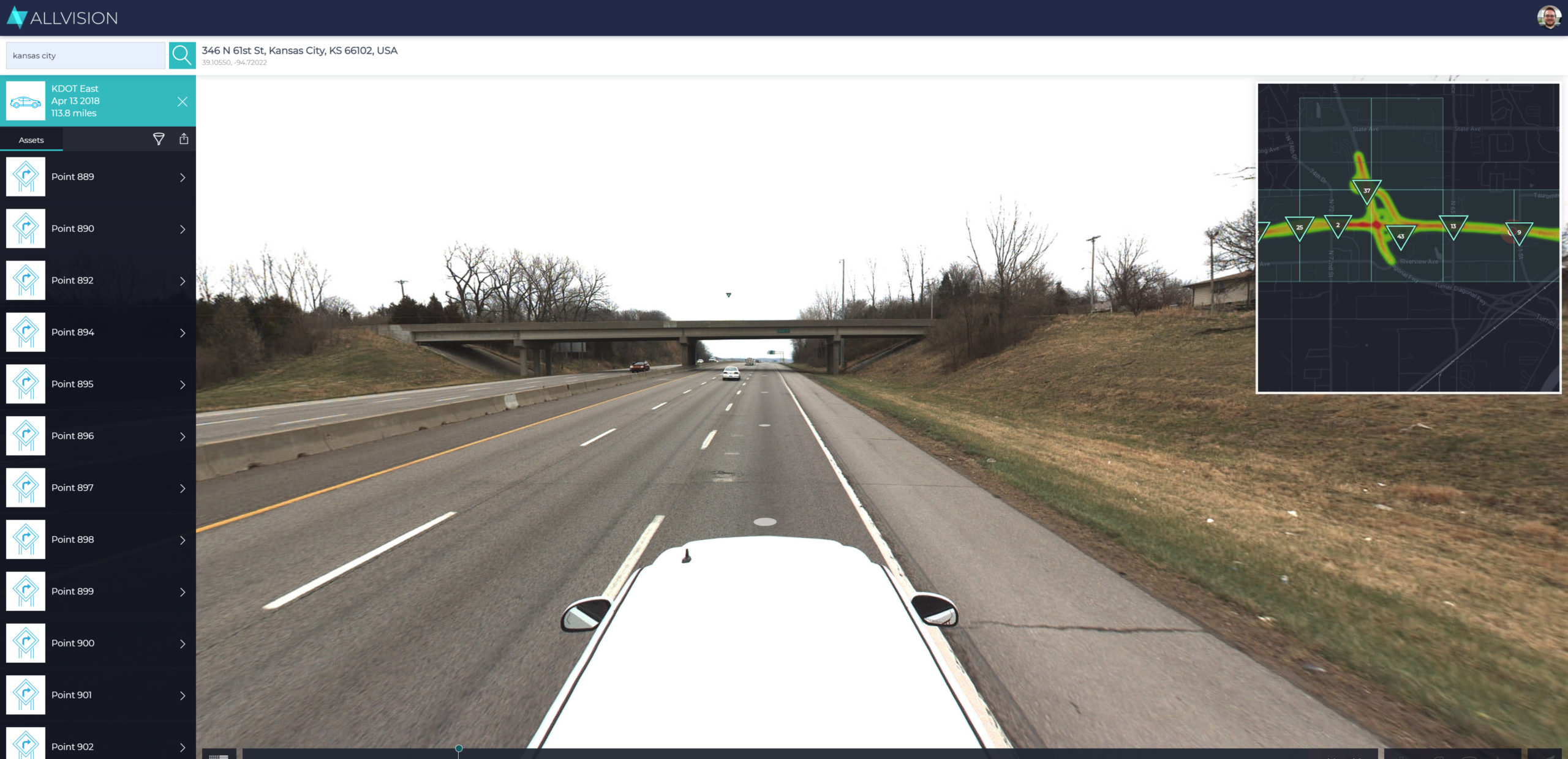
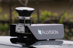
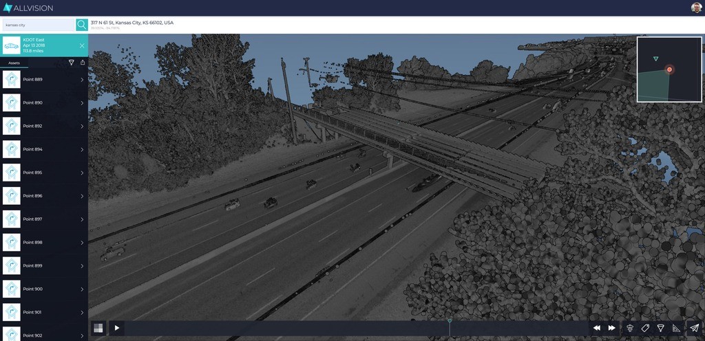
To deploy mobile mapping assets where needed, Allvision works with TREKK Design Group LLC, a civil engineering services and mobile mapping firm that has a variety of acquisition platforms. Depending on the scale of the project, TREKK can deploy airborne, terrestrial, mobile or hand-held scanning assets. Because the Allvision platform can ingest myriad data types (lidar, photos, video, GPS and location data), the collection can be right-sized to any project and combined to get the insights and analytics needed at any scale.
The datasets, once collected, are processed in the cloud, applying proven technology in asset identification, object extraction, and other analytics to get the most out of the data collected once seen as a whole. Once collected and assembled, the information can also be updated over time, in a more regular inspection or re-mapping schedule rather than starting from scratch each time – resulting in significant time and cost savings.
Another benefit to this new workflow is that it starts to break down the silos between experts on the same project. For highway work, there are some roles that specifically deal with certain assets – for example, workers focused on guardrails, others on paint, and yet another group focused on signs and signals. By unifying the data into a central dataset and location, potential clashes can be avoided, and a bigger picture of the entire project can be gleaned from fewer documents.
When a project is delivered, the data includes all of the captured data, any associated documentation, georeferenced images (so that mapped assets can be verified). Flags for variances can also be setup with in the system – e.g., how far a sign is away from its correct position, or how many miles of certain types of road markings are present vs. what was prescribed.
From a safety perspective, a record of assets is required by the FHWA as part of the Highway Safety Improvement Program, or HISP. With accurate maps and inventories of assets, HISP can better understand and investigate the causes of crashes and fatalities. This data-drive strategic approach is only as effective as its data, making efforts to keep asset inventories current and reliable a crucial element for improving highway safety.
In 2021, Allvision plans to launch a product to further help its clients to query what data and imagery is already available, giving them further insight into the scope of potential projects, and helping them hone in on what areas are the most critical.
To learn more about Allvision, visit Allvision.io


