[Editor's Note: This article has been updated with additional information.]
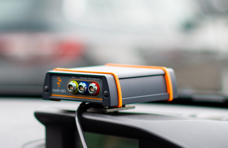
Septentrio, a provider of high-precision GNSS/INS positioning solutions, and XenomatiX, provider of true-solid-state-LiDAR technology for autonomous applications and road management solutions are starting a partnership enabling high-quality lidar solutions. XenomatiX will be using the compact and robust GNSS/INS receiver from Septentrio, AsteRx SBi3 Pro+, to provide millimeter accurate analysis of pavement conditions using global positioning coordinates.
New high precision requirements
Septentrio’s high-quality GNSS/INS will be a part of XenomatiX’ Road lidar called XenoTrack, which has been the solution of choice for road surveyors and road management companies. Since early 2020, this road scanning solution is also used for large-scale digitization and characterization of roads. Customers for such data require centimeter precision for the localization of road defects and millimeter precision for the seizing of the defects. When measuring among road sections, all measurement data must be stitched together to create a complete and correct model, excluding drift and missing data. The combination of a very productive, lane-wide road scanner from XenomatiX and precise and reliable GNSS/IMU from Septentrio allows for creating such accurate road models.
Integrating Septentrio’s GNSS/INS into Xenomatix’ short-range lidar system
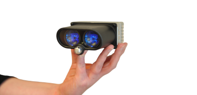
XenoTrack is a short-range lidar system, based on XenomatiX’ multibeam technology that emits 3000 laser beams simultaneously, projected on the road. Every detected laser spot returns a 3D data point. All these points are acquired at the same time to create a geometrical model of the road surface, without the influence of the motion from the vehicle. This is repeated up to 60 times per second, resulting in a dense point cloud from which various road characteristics can be derived, such as IRI, waviness, rutting, and potholes. This lidar system measures the height profile of the road with millimeter precision, making road scanning much more productive and cost-effective as the system can be installed on any car, driving at regular speeds.
Septentrio’s AsteRx SBi3, high-performance RTK GNSS/INS receiver with a dual antenna setup, ensures cm-accurate geotagging of the XenoTrack point cloud frames for relative and global millimeter accuracy over large distances. Large distances, in this case, means hundreds of kilometers: thanks to RTK-corrections, the road models are referenced to world coordinates, eliminating the influence of drift or poor data stitching. The GNSS/IMU is synchronized with the lidar system, which means that every measurement consists of synchronized lidar data, GNSS data and car body movement data. Advanced mapping algorithms use these inputs for very precise SLAM and stitching.
Combining lidar, CAN-data and GNSS/INS data
XenomatiX’ sensor fusion algorithms combine visual SLAM techniques with GNSS, IMU and CAN to obtain a seamless map of the road shape. The acronym CAN stands for Car Area Network, which is an automotive bus to which most electronic systems are connected. The lidar has access to the CAN of the vehicle to read car speed and steering angle. These additional quantities that are used to calculate the position of the road relative to the measurement system. Combining lidar, CAN-data and GNSS/INS data allows to turn the road measurement into a very precise overall digital model expressed in a global coordinate system.
Septentrio and XenomatiX' aim to pair their technologies in the continuing pursuit of safer ADAS solutions. XenoLidar-X, XenomatiX’ LiDAR, is designed for advanced ADAS applications, and Septentrio’s high-precision GNSS receiver can optimize vehicle perception in localization and SLAM applications.
XenomatiX offers a complete mapping system as well as services including data from the XenoTrack sensor, camera and RTK GNSS/INS receiver with dual antenna - all delivered in a form factor that is meant to fit a standard vehicle. For more information on XenoTrack or the AsteRX SBi3 Pro+ receiver, visit their respective product pages.