Geomatics Data Solutions brings talents and experience of owners Lockhart, Arumugam
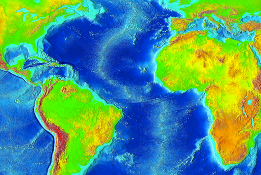
DAYTON, Ohio – In an effort to add underwater mapping capabilities, Woolpert has acquired Geomatics Data Solutions, a company with offices in Surrey, British Columbia, and San Diego, that brings deep knowledge of bathymetric lidar and multi-beam sonar, technologies that allow for 3D mapping of near-shore salt water, riverine and fresh water lake profiles.
“If there’s truly a vast unknown in the mapping world,” said Chris Ogier, national practice leader, state & local government, geospatial services, at Woolpert, “it’s what lies underneath the water.”
Ogier said he’s seeing demand from emergency responders, ports and harbors, shipping agencies, climatologists and other customers who are looking for good data. “They need an accurate assessment of how deep it is and the shifts in the characteristics of the sea floor, whether by natural causes or otherwise,” he said, “have to be monitored.”
Whether it’s helping improve the world’s ability to move freight, or the study of sea level rise and other environmental factors, Ogier said this kind of 3D data “is a huge benefit over what we have now.” Further, the ability to combine lidar and multi-beam data opens up new possibilities for Woolpert, he said.
With the acquisition come GDS co-owners Carol Lockhart and Dushan Arumugam, who have more than 30 years of combined experience developing spatial workflows and processing marine and terrestrial survey data, serving as lead hydrographers on numerous multi-beam and LiDAR projects across five continents since 1999. According to a Woolpert release, Lockhart and Arumugam are two of only a handful of professionals in the world who have worked with Laser Airborne Depth Sounder (LADS), Scanning Hydrographic Operational Airborne Lidar Survey (SHOALS) and HawkEye II bathymetric LiDAR data.
Nor is it just their technical expertise that interests Woolpert: “We’re very excited about the prospects for international work that GDS bring with them,” Ogier said. “They bring a great fit to us for that because they’ve already performed so much of this type of work all over the world.”
Further, the technology has progressed a great deal in the last five years, Ogier said, which makes the data of much greater utility. Primarily, the ability to process the bathymetric LiDAR sensors to account for varying water conditions and depths water is one of the “biggest leaps,” he said, and when you combine that with the vastly increased processing power of today’s hardware and software solutions, “over the last 10 years, both bathymetric LiDAR and multi-beam technologies have come tremendous distances in terms of their business potential.”
With bathymetric lidar, Woolpert has done successful testing to as deep as 30 meters in the clear waters surrounding the Bahamas, but the more cloudy waters around New England might only allow for depths of 4-6 meters. “But, in the case of the New England project, they were particularly interested in depths of less than twenty-five feet, so it was good enough,” Ogier said, “because they didn’t have good near-shore data.” Which technology you use, and what data you collect, really depends on the application and the need, he said.
One example of combining the technologies occurs with hurricane evacuation planning, he said, where he’s worked in the past with the Florida Coastal Mapping project (through the Florida Division of Emergency Management). There, emergency management agencies, and state and local authorities were tasked with modeling a category five hurricane scenario. A desire to combine data sources to attack a project like this is “really the gist of one of the biggest reasons we made this acquisition,” Ogier said. “We’re experts at topography, but in order to do proper modeling for storm surges and inundation, you need integrated fusion of the bathymetric data, topography, tidal data, and varying weather and climate data.
“One of the biggest reasons we’ve invested in this technology is so we can take that to the next level.”


