

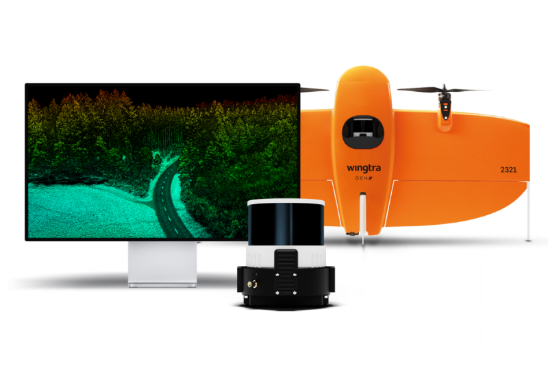
Swiss-based drone technology provider Wingtra announced a new drone lidar solution that aims to provide a new level of ease and efficiency to the market. The solution, named Wingtra LIDAR, combines its existing WingtraOne GEN II drone with a Wingtra-engineered lidar sensor, a Hesai XT32M2X scanner. Wingtra LIDAR cuts out time-intensive extra post-processing strip alignment work and delivers precise terrain information right away from each flight.
System specifications
The lidar system has a payload weight (incl. mount) of 1030 g, and a point density of 110 pt/m2 (at 45 m AGL). The scanner offers a horizontal FoV of 90 degrees, a vertical FoV of 40.3 degrees, a total of three returns using a rotating sensor. The maximum range is 300m, and a pulse rate of 640 k/s (single return). 1280 k/s (double return), and 1920 k/s (triple return). Additional hardware includes an Inertial Labs IMU and NovAtel OEM7500 GNSS. Detailed system specifications are available here.
Wingtra customers already use the WingtraOne GEN II to map and perform photogrammetric worksite analysis. With the new system, users are able to map up to 360 ha (890 ac) at 90 m (295 ft) altitude, and no calibration is needed with a quick one-minute initialization. Streamlined post-processing is available through the Wingtra LIDAR app for faster data turnaround.
The drone used for Wingtra LIDAR is a WingtraOne GEN II, a tailsitter vertical take-off and landing (VTOL) drone that weighs 3.7 kg and a maximum payload height of 800 g. Operations specifications include a flight speed of 16 m/s (35.8 mph) and a maximum flight time of up to 59 minutes. A full list of all drone specifications is available here.
Wingtra mentions that lidar applications generally are meant to complement photogrammetry missions, and excel in mapping beneath vegetation. However, both technologies are different in terms of capabilities and results, but complement each other for different projects. More info on this topic is available here. The Wingtra LIDAR product website mentions that applications for the system include environmental mapping, urban planning and land management, construction and infrastructure, and mining and minerals.
Additional information
Wingtra provides drones for the mapping, survey and mining industry. Since their market entry in early 2017, Wingtra has partnered with more than 70 equipment dealers and has been selling mapping drones globally. For more information on the new lidar drone release, refer to a recent online webinar that discusses the new system in detail.


