
Pix4D, the Switzerland-based provider of UAV data processing solutions, has released version 1.3 of its popular Pix4Dmapper image processing software.
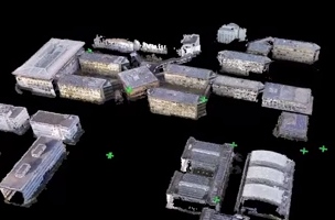
The software, which has seen adoption on the professional and pro-sumer markets, automatically processes terrestrial and aerial imagery, creating 3D models based only on image content. The new version aims to make sharing your models with customers or project stakeholders even easier. It includes the ability to output processed data as a 3D textured mesh file that can be used to create flythrough animations. See below for a quick introductory video.
Speaking with SPAR, a company representative explained the value of these 3D meshes. “The new full-textured 3D mesh function provides stunning visual results that are easy to share and embed on websites. Customers can now show quick overviews of their projects on a variety of platforms.”
The representative pointed out another change that will make the sharing project overviews a simpler process. The meshes can be shared in the 3D PDF format. Why? “Virtually every computer is equipped with Adobe Reader, and though many people may not know it, Reader includes a 3D viewer that can open the 3D mesh. So now anyone can visualize the 3D results without needing to download additional software. It’s one of the easiest ways to share 3D models on a wide scale.”
In the new version, processing has also improved. In a release, Pix4D stated that the software makes use of the Nvida GPU. “For initial processing,” the company says, “GPU support will improve processing speed from 10% to 75%, depending on image content and project size. GPU support is also used to densification and Semi-Global Matching.”
Among other changes, Pix4Dmapper 1.3 brings more user options for automatic point cloud classification, including selection tools for manually deleting points or classifying points into classes. “Pix4D,” the company told me, “now has powerful algorithms to remove buildings, trees and other objects (both automatically and manually” to extract bare earth terrain models.”
Other features include project splitting for larger mapping projects and automatic correction for brightness, luminosity and color balance to create better looking orthomosaics.


