
In Brief:
- Velodyne argues that LiDAR is necessary to speed up improvements in US infrastructure
- During a panel of industry insiders, Wolfgang Juchmann explored the ways that real-time 3D sensors may add value to infrastructure
- Afterward, he explored cutting edge civil infrastructure applications for such real-time 3D sensors
MORGAN HILL, Calif. (Nov. 17, 2015) – As revamping America’s transportation infrastructure claims a top spot on the nation’s agenda, LiDAR pioneer Velodyne has urged that geospatial LiDAR data be part of the solution.
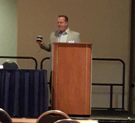
Speaking before the influential Geospatial Transportation and Mapping Association (GMTA) 3rd Annual Meeting and TransData Expo 2015 on Nov. 11, Velodyne executive Wolfgang Juchmann recommended that highway mapping and 3D geospatial LiDAR (Light Detection and Ranging) data be used to expedite improvements in the country’s highways, railways and waterways.
With vehicles deploying ever more sophisticated automating technologies, no single technology is more responsible for that leap than LiDAR. Transportation agencies increasingly use LiDAR for project surveying and/or extracting detailed asset and diagnostic inventories from network-wide data collections. Throughout, Velodyne has been in the forefront, developing LiDAR sensors dedicated to vehicle automation and infrastructure mapping. The company’s sensors are found on the test vehicles of nearly every major automaker and Tier 1 supplier, and used by mapping companies Microsoft/Bing Maps, Nokia/HERE Maps and TomTom, among others.
In a high-profile panel discussion that followed the keynote — addressing matters ranging from regulations and standards to the need to educate the transportation industry on the value of geospatial data — Juchmann joined moderator Robert Dingess, GMTA head; Gavin P. Gautreau, Senior Geotechnical Research Engineer, Louisiana Transportation Research Center; Ray Mandli, President of Mandli Communications; and Darin Muncy, Market Manager, Trimble Navigation, Inc.
Juchmann recapped the first decade of Velodyne’s LiDAR sensors, dating from the 2004-05 DARPA Grand Challenge, to Google’s early adoption, to its status today as de-facto standard for high level autonomous driving. He highlighted a host of current applications, including implementations by Google, Uber, Caterpillar and various front-line players in the traditional automotive industry, and described application areas in which real-time 3D LiDAR sensors may add tangible value: smart intersections, crash avoidance scenarios, using on-board data for insurance assessments, and more.
Juchmann segued from current applications in automotive, mapping and robotics — where Velodyne is the acknowledged industry leader in 3D scanning — to such cutting-edge applications as real-time vertical clearance measurements. One case in point: LSA Autonomy has developed a tool that combines a camera and Velodyne’s HLD-32E 3D LiDAR sensor to detect wires that may obstruct special transports of oversize objects. The system alerts the driver with acoustic and verbal warnings when clearances are insufficient.
Lauding mobile mapping pioneer and fellow panelist Ray Mandli of Mandli Communications in Madison, Wis., Juchmann noted that when Bruce Hall — brother of Velodyne founder/CEO and HDL-64E inventor David Hall — showed Mandli the HDL-64E in 2007, he immediately recognized its potential. Mandli has used Velodyne’s LiDAR sensors ever since, starting with a Hummer-based rig that maps state-owned streets for various state departments of transportation.
Texas and Utah rank as early adopters of LiDAR-driven mobile mapping, having realized the benefits of digital capture ahead of most states, Mandli reported. Other states have since followed suit, and Mandli’s rich data format has become the de facto standard for DOT highway asset management. Many of the roads captured initially have been recaptured using the much more compact HDL-32E, which now also includes calibrated reflectivity features, enabling users to locate street signs, lane markings and license plates easily.
Mandli’s company, which also offers a real-time tool for bridge vertical clearances, was recently involved in pre-mapping possible routes to move a Space Shuttle fuel tank from its original location to a future storage site in Florida. In this project, guaranteeing that the chosen route did not interfere with the fuel tank was vital, and Velodyne’s HDL-32E proved up to the task.
Underscoring LiDAR’s potential to boost the bottom line, Jamie Retterath of Facet Technology, Eden Prairie, Minn., chronicled how his team is using Velodyne’s HDL-32E sensors to determine reflectivity lifetimes of street signs, enabling the Minnesota Department of Transportation to save money as it replaces signs that have degraded over time.


