
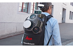
Las Vegas, NV — Yesterday, as part of their HXGN Live festivities, Leica Geosystems announced their first wearable mobile mapping solution. Leica calls the Pegasus:Backpack “a unique wearable reality capturing sensor platform combining cameras and LiDAR profilers with the lightness of a carbon fiber chassis and a highly ergonomic design. […] The Pegasus:Backpack is designed for rapid and regular reality capture.”
What’s in it?
The new product is essentially a smaller, wearable version of the Pegasus:Two mobile mapping system. It has fewer cameras than its older sibling — a total of five where the Pegasus:Two has eight — but otherwise the cameras seem to have nearly identical specs. They provide 360-degree coverage and boast a very large sensor size, which should help to reduce noise and give higher accuracy for any photogrammetric measurement. These cameras offer more than colorization for your point cloud, they offer a second means of capture to ensure coverage.
Pegasus:Backpack also includes two mounted Velodyne pucks (VLP-16 sensors). These scanners acquire 600k points per second at a range of up to 50 meters. There’s no doubt that the smaller size of Velodyne’s scanners has made this sort of wearable, ultra-portable implementation possible.
When loaded with its four included batteries, the whole rig weighs around 13kg (28lbs). It will last for a total of three scanning hours, or double that if you opt for a set of hot-swappable batteries. In its carrying case, it’s sized so that you can check it as baggage. If you want to add extra sensors, it includes the standard Pegasus external trigger and output ports.
When would you use it?
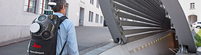
The Backpack is built for scanning projects that can be covered on foot and at walking speed. This includes both indoor and outdoor mapping situations, such as buildings that require BIM modeling, traffic-closed urban areas, heritage sites with limited access, unmapped underground infrastructure, mining, and even the building of GIS systems.
It uses GPS for outdoor positioning, and inertial measurement units and SLAM (simultaneous location and measurement) for indoor positioning where GPS signals cut out. This gives it a location accuracy of 5cm to 50cm after ten minutes’ walking without the use of control points.
For survey-grade work, a terrestrial scanner set-up will supply higher relative accuracy and more precise positioning. But you also have to move it every time you want to set it up, rather than just walking through your project space at a normal speed, capturing data as you go. It’s likely that this product will satisfy many needs for 3D-scanning professionals and provide another tool.
Price details are not yet available. SPAR will continue reporting on this product as more information becomes available.


