
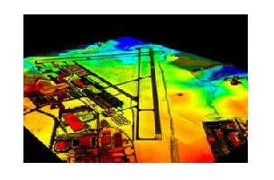
3D elevation data, source: USGS.
Design, geospatial and infrastructure management firm Woolpert has been awarded the first US Geological Survey (USGS) 3D Elevation Program (3DEP) project. The 104-year-old company is headquartered in Dayton, Ohio, and has offices throughout the United States.
The USGS is in the process of awarding projects throughout the country as a response to “the growing needs for high-quality topographic data and for a wide range of other three-dimensional representation of the Nation’s natural and constructed features.” The 3DEP will gather LiDAR data over the contiguous US, Alaska, Hawaii, and US territories over the next 8 years.
According to the USGS, the data gathered for the 3DEP will be used to support high-value applications like flood-risk management, infrastructure and construction management, and geologic resource assessment and hazard mitigation.
The data that Woolpert collects in Mississippi will be used to update soil surveys, slope maps and wetland delineations, as well as by archaeologists for the preservation of historic sites in river deltas.
3DEP has had a moment in the spotlight recently, as 3D elevation data played a large part in the President Obama’s Climate Action Plan. “We’re going to do more, including new data and 3D maps to help state [and]local officials in communities understand which areas and which infrastructure are at risk as a result of climate change.”
Woolpert’s project marks another first for the company. Back in December, Woolpert received one of the first exemptions in the nation from the FAA to fly unmanned aircraft for commercial purposes.


