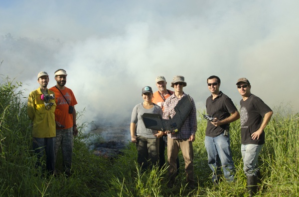
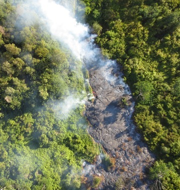
On October 22nd, 2014, in a collaborative partnership with Hawai‘i County Civil Defense and the U.S. Geological Survey Hawaiian Volcano Observatory, the flight team from the UH Hilo Spatial Data Analysis and Visualization (SDAV) Laboratory used a senseFly swinglet CAM, carrying an RGB camera payload, to collect high resolution still images of the lava’s active flow front. These shots were then merged into a full orthomosaic for use by Civil Defense emergency planners.
The UH Hilo flight team includes Ryan Perroy, assistant professor of geography and environmental science; Nicolas Turner, SDAV cyber computer programming analyst; and Arthur Cunningham, consultant for aeronautical science.
“The lava flow has already impacted the lives of many residents in Puna,” said Perroy. “Our UAV support can provide quick and accurate information to emergency responders.”
The team closely monitored the flight performance of the swinglet CAM UAV as it travelled over the lava and noted minor turbulence as it crossed the thermally dynamic environment. A county helicopter provided support with an air observer on board from the UAV team during flight operations.
The Unmanned Aircraft Systems Integration Office of the Federal Aviation Administration worked closely with the Hilo research team on approval of their Certificate of Authorization. The flights are in direct support of disaster relief operations in the area and the FAA and flight team worked together to make sure all safety concerns were met.
As of October 29th, the lava flow is currently headed toward the town of Pāhoa in the district of Puna, threatening to cut off the main highway and other access roads thus isolating an area of about 10,000 residents from the rest of the island. The flow is currently advancing at 10 yards an hour and is 280 yards from Pahoa Village Road.
The researchers plan to fly again and continue supporting relief operations with quick aerial assessments when needed. sensefly representatives are closely monitoring and supporting the team’s mapping relief effort and are at-the-ready with additional equipment should this be needed.