
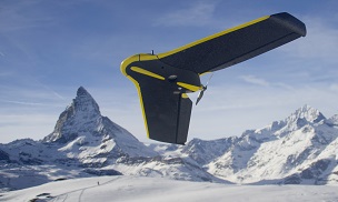
The 3D Mapping Forum at the Esri User Conference featured gads of sessions on topics important to the 3D scanning marketplace, but none felt quite as urgent as the one on unmanned aerial systems. This standing-room-only panel discussion included representatives from companies at the forefront of the UAS industry: Baptiste Tripard from Sensefly, Adam Rice from Skycatch, Bret Kugelmass from Airphrame and Andy Nickerson from Aerovel (who graciously stepped in to pinch hit when another panelist couldn’t make it).
The panel was extremely informative about the current state of UAS. First, learning about each individual company educated those of us still trying to grasp the breadth and variety of services and hardware within the UAS market. (Expect more on this from SPAR in the future). Second, and perhaps more importantly, it demonstrated how much like the Wild West the market still is – the conversation was cordial but filled with strong disagreement about the current abilities of the technology, the technological barriers it has yet to break, and where we might see it go in the future.
Today’s post is the first of two articles summarizing the highlights of the discussion:
The Technology Still Has Limitations
Judging by the material you can find online, it seems like a UAS can do anything you want it to. However, an early portion of the discussion focused on the factors that are still preventing the technology from reaching its full potential.
Some argued that the only important barrier is regulatory, but Airphrame’s Bret Kugelmass disagreed. He noted that there are still important technological limitations we have yet to overcome, like the problem of insufficient battery power. He noted that “once batteries get better – his technology vs. our technology – it will look pretty much the same. Things will just stay up persistently.” Once we solve that problem, he speculated, you could use a UAS for “constant contextual awareness, situational awareness — whether you’re a city operator, a police force, or another industry we haven’t imagined yet. We’re moving to a future where these things will always be everywhere, collecting data and sending it back for different applications.”
Contrast the possibility of constant flight with the current state of affairs, where even the longer lasting UAS solutions can stay up for only a few days at a time and others need regular recharging or refueling.
Afterward, Baptiste Tripard from Sensefly pointed to another technological barrier: the limitation on sensors that you can mount to a UAV. “The evolution of the technology involves adapting the sensors that you can put onto the aircraft,” he said, which means the future will likely bring development in the “range of the sensors that you can put into a little device.”
This rings true. We know that the smaller UAVs – which are the ones you’ll likely be using unless you’re military – have a strict limit to the amount of weight they can carry. This means that LiDAR sensors, which are often too heavy, may be out of the question until they are made significantly lighter. For now we are limited to using smaller and lighter sensors like consumer cameras, which makes photogrammetry a popular means of measurement for UAS users.
Photogrammetry Won’t Replace LiDAR
It’s worth noting that some in the sessions (presenters and attendees alike) were confident that photogrammetry will become cheap and precise enough to replace LiDAR. As I quizzed other experts after the discussion, however, the general sentiment became clear: Photogrammetry is fantastic for select applications like volumetric measurements or simple visualization, but it is still not precise enough to replace LiDAR, which will always be useful for more exacting applications like wire measurement. As a result, I wouldn’t expect photogrammetry to replace LiDAR any time soon.
A UAS Cannot Solve All Your Problems
No matter how much data your UAS can gather, it still can’t tell you what to do with it or help you take action with it.
Aerovel’s Andy Nickerson argued that this point is even more important than the technical limitations of the UAS. “The airframe doesn’t matter, the sensor doesn’t matter,” he said, “what the customer wants is information – actionable information on which they can make a decision. That probably accounts for about 0.5% of the data that gets collected on a mission. So it takes this ecosystem in the room to deliver that tiny bit of information so that a fire agency can go to that particular spot to put out the hotspot, or a tree crew can go trim the tree along the power line so it doesn’t hit the power line and start the fire that burns down two thousand houses in San Diego county, or where the crooks in Nigeria are punching holes in the pipeline and stealing oil. So the challenge is to reduce the volume of data to actionable information.”
Tripard pointed out another current problem with the data gathered by a UAS: Even if that data is actionable, you should be certain that you have the means to act on it. “Right now,” he said, “the technology – if we talk about agriculture, for example – is way ahead of the actual means that some farmers have to operate their farms. Because we collect so many points, and we have such a huge amount of data, right now it’s hard to get that data into the actual workflow.”
Skycatch’s Adam Rice, among others, made a case for the importance of consulting with providers to get actionable information from a UAS. “Let’s take a mine site,” he offered by way of example. “[Skycatch] can build a site map of the mine site and point cloud of the mine site, but what they want to do with it, we don’t know yet – and they don’t know the type of data that this UAV can create. So once we get to the point where we can create the data set, we’ll have a discussion with them with the data set in front of us, understanding how we can take this from a pretty picture to actionable.”
That’s all for now. Tune in next week for more from the session, including a discussion of the legality of the UAS and some talk of a possible public backlash.


