Last week, VEERUM, a digital twin software provider whose products are designed for infrastructure, utilities, and heavy civil construction projects, announced that they will now be supporting the Open Geospatial Consortium (OGC) open standard for 3D Tiles. The company announced that their software will now support textured mesh standard file formats like Context Capture, Agisoft Metashape, and RealityCapture 3D Tiles, as well as all CAD and BIM formats.
VEERUM, which was founded in 2014 and is based in Calgary, Canada, provides software applications to asset owners in order for them to fully understand their assets. VEERUM points to the massive global need for upgraded and new infrastructure to support a growing population which is increasingly moving to urban areas, as well as the well-known fact that most projects go over budget and/or beyond the scheduled timeline. Working with industries like oil and gas, mining, utilities, and heavy civil construction, the company provides solutions around both on-site and remote maintenance, asset management, construction progress visualization, and more.
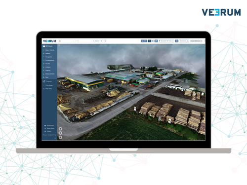
Prior to this addition of mesh-based visuals, VEERUM’s solutions offered visuals with point clouds. Of course, point clouds can still be extremely valuable, but adding these new OGC standard 3D Tiles open up new use cases and improved workflows for some users. Where these 3D Tiles really shine is when users need photorealistic visualizations, as well as for large datasets. A point cloud of, say, a piece of equipment or one building can be extremely valuable, but looking at datasets that get larger than that becomes less convenient. With 3D Tiles, and particularly with a cloud-based solution like VEERUM’s, those large datasets are much more easily streamable, and things like name plates and other assets which require photorealism are much more easily accessible.
The OGC originally announced their 3D Tiles community standard in 2019, four years after the original unveiling of the open specification by Cesium, and earlier this year they approved 3D Tiles version 1.1 for adoption as an official OGC Community Standard. Earlier this year, we spoke with Lisa Bos, a Senior Product Manager with Cesium, who told Geo Week News about the original development of 3D Tiles as a way to provide geospatial context to 3D objects, as well as the road to becoming an OGC Standard.
As larger-scale and higher-resolution 3D models are growing in demand across industries – including those VEERUM serves – the demand for workable files with which to view the data is growing. In addition to VEERUM, news came down earlier this year announcing that 3D Tiles will be used to render new Photorealistic 3D Tiles within the Google Maps Platform. This was also discussed with Bos in the conversation mentioned above.
For VEERUM, they are now giving their users an opportunity to use different data layers for their projects to provide as much information as possible. Alongside 3D Tile files, VEERUM users can overlay extra layers including satellite imagery, lidar scans, and IoT sensor data.
“With 3D Tiles, we have achieved remarkable visual fidelity at continental scale, enabling a photorealistic user experience that mirrors site conditions,” VEERUM CTO Rob Southon said in a press statement. “Our adoption of the OGC open standard for 3D Tiles provides a new visual way of working, empowering teams to make decisions with hyper-realistic models. What is most exciting is that users can take advantage of the entire VEERUM feature set within these photorealistic 3D Tiles, providing a powerful visual solution for digital asset management.”