
At Intergeo 2009, Trimble announced version 4.5 of its Trimble Trident-3D software suite designed to rapidly capture roadway data and automate workflows for information extraction. It’s another product aimed at processing LiDAR data from mobile methods more efficiently and automatically.
New functionality and enhancements include:
- LiDAR point cloud registration tools to achieve better accuracy
- Enhanced polyline tool for improved editing
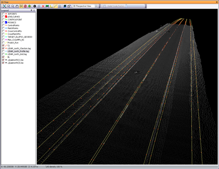
- Automated pavement edge detection to supplement existing pavement marking breakline creatio Export breaklines, cross-sections and triangulated irregular network (TIN) models in LandXML
Version 4.5 enhancements increase the resulting positional accuracy with new modules for automatic survey control point detection (such as of spherical targets) in LiDAR data and point cloud-to-point cloud registration. New and enhanced functions are provided for breakline detection and creation such as edge-of-pavement, centerline, crown and pavement markings. The new LandXML export provides workflow compatibility with many industry standard computer-aided design (CAD) applications.
According to Trimble, the Trident-3D software suite is used with more than 50 mobile mapping vans by transportation service providers and organizations throughout the world. Availability is expected by the end of this month.


