
New AX60 is an ‘entry-level’ airborne laser scanner
Trimble Navigation Ltd. has added two laser scanners for rapid, efficient point cloud capture, and high-resolution images, during corridor- and wide-area-mapping projects to its airborne lidar portfolio: the AX60i and AX80 for fixed-wing or rotary aircraft.
The Sunnyvale, Calif.-based AX60i is an “entry-level” lidar system designed for low-altitude corridor mapping applications, Sunnyvale, Calif.-based Trimble said. The AX60i can be operated up to 5,000 feet above ground level (AGL) at a 400 kHz laser pulse repetition rate (PRR) with a single-channel, downward-looking laser. The device can be upgraded to the company’s high-altitude AX60 system, Trimble’s only other airborne lidar system.
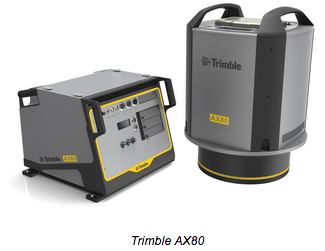
The AX80 is a dual-channel lidar system that can be operated up to 15,500 feet AGL and is designed for challenging survey applications including high-altitude, wide-area mapping to detailed, low-altitude, corridor mapping. The AX80 has an 800 kHz PRR with forward- and backward-looking capability to enhance point density on the ground and boost image resolution. The resulting 2D, oblique view allows scanning of vertical facades of structures.
Trimble said an optional, fully-calibrated 80-megapixel camera with forward motion compensation can be added to the two systems. The camera is integrated into the sensor head package and does not need recalibration each time the system is fitted to an aircraft.
These systems are optimized for precision applications, providing a uniform distribution of laser points across the entire field-of-view to widen the usable swath width. Operators can reduce track overlap or duplication, or fly at higher altitudes to achieve a given resolution.
The two systems come with Trimble flight planning software and Trimble Inpho v5.6 analysis software.


