

Mapmaking company TomTom aims to push the boundaries of location technology. With a new map visualization technology that is available through its APIs and SDKs, the company is doing just that: it gives its mapping visualization a complete makeover, while at the same time incorporating its location data to provide a better user interface and experience.
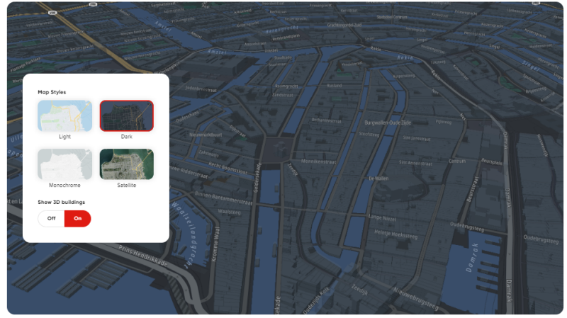
Detailed 2D and 3D visuals and textures
The new visual experience is named TomTom Premium Map Display and is meant to “upgrade” its existing car navigation system maps. In an extensive online blog post, TomTom explains what drives the demand for this new technology and how it enhances the user experience: TomTom Premium Map Display aims to bring map surfaces to life with detailed 2D and 3D visuals and textures, with added overlays of dynamic layers such as traffic, electric vehicle (EV) charging points, lane-level navigation and more.
Rather than just giving their maps a new makeover and incorporating 3D and immersive views, TomTom Premium Map Display is meant to provide a better user experience, for example enabling improved location awareness and wayfinding. With a map that more resembles the real world through details that didn’t exist before (including building footprints and shapes visualized in accurate detail), it becomes easier for people to orient themselves. This will benefit different location-based applications, such as courier and on-demand driving services.
Why does TomTom incorporate new tech to create new map visualization?
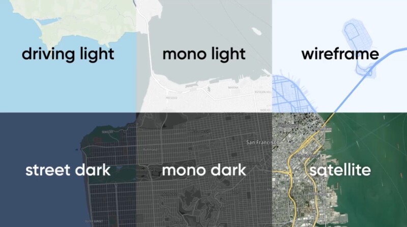
There are multiple reasons for developing and releasing new mapping visualization tech for TomTom. The company mentions that the car industry demands richer in-car graphics and more advanced digital experiences. Immersive 3D visuals are also incorporated in GIS, BIM, and AEC, so it’s no surprise that the automotive industry is moving in this direction too. The collaboration with Unity and other game software developers has been covered in many articles on this website, for example here, here, and here.


