

During the AEC track of the Geospatial World Forum in Zaandam, The Netherlands, Senior Vice president of Geospatial at Trimble, Ron Bisio, spoke about the increasingly important role of the surveying and geospatial professional in BIM. As a case study, he monitored how surveying and geospatial techniques were deployed in the stages of the construction cycle of a second Trimble head office in Colorado. This also enabled him to check where BIM as a profession stands today and see how surveying and geospatial technology are used in BIM projects today.
The evolution of BIM
In general, BIM went from using isolated 2D drawings and 3D maps to 3D collaboration models, that enable multi-time, multi-continent project collaboration. The future will be even more exciting when infrastructure will be brought into BIM, offering multi-discipline and workflow support. In addition to changing technology, Bisio mentioned a statistic from Deloitte that shows how BIM and geospatial are not different disciplines anymore. It mentioned that one of the business benefits of BIM is to improve the ability to show younger staff how projects go together, which shows that BIM is used to a generational transfer of how to construct a building.
Topographic surveys
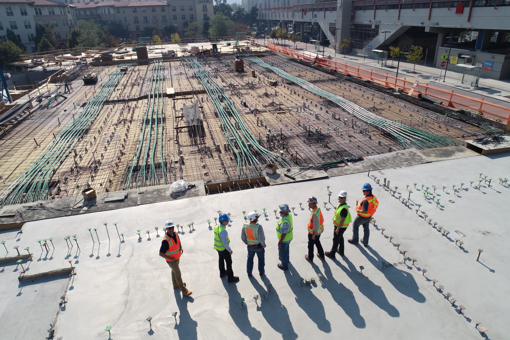
Looking back at the surveying, design, construction and operation phases of Trimble’s headquarter office in Colorado, surveying and geospatial technology were used in at least three of all four phases. First, surveying technology was used to develop topographic surveys, a DTM, floor plans and layouts. In addition to surveying property lines, this also included all of the utilities and the infrastructure around it. What is considered BIM Level 2 was, in reality, a combination of point clouds, scanning technology and 3D models, with Microsoft HoloLens 2 added for collaboration: stakeholders who were going to be in the building used that to visualize the building as it was being constructed with scan data.
The surveying data was then put into Tekla, Trimble’s model-based construction software so that Trimble employees could see the design of their new building. Tekla was also used for all the steel and concrete prefabrication that was done on- and offsite. In addition, cameras on the construction site enabled monitoring of the building construction process.
Laser scanning and visualization
Laser scanners were used to quickly capture the as-built and look for clashes when the building was being raised. Using the existing models, these clashes could be mitigated as quickly as possible. A Trimble Connect cloud-based solution was used to give all stakeholders access to the data as it was scanned, which also allowed people to use multiple design tools and let them leverage the same data in a cloud-based environment.
Finally, VR headsets were used for visualization purposes, enabling users to see what the building design will look like and where the light will come from and how that changes through the day. Trimble is now producing AR hardhats that construction professionals can use and take visualization to the next level. At the Geospatial World Forum event, Trimble demoed a site vision tool for visualizing underground data and placing that inside of a design.


