

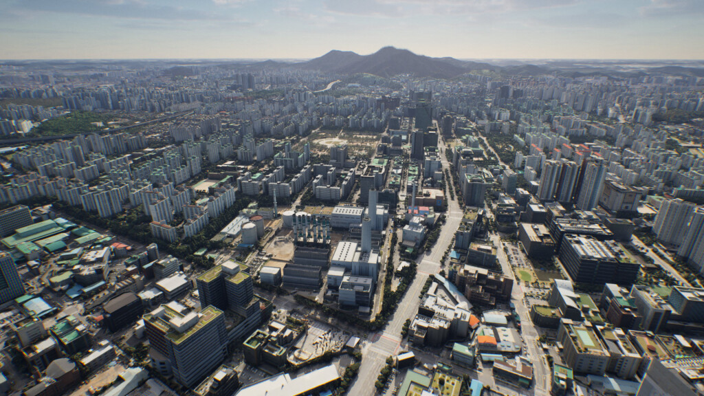
Earlier this month, Techtree Innovation, a Seoul, South Korea-based company who specializes in 3D geospatial visualization products, announced the launch of their new AROUND platform. In their release of the news, the company describes AROUND as a “high-precision, high-resolution 3D geospatial map platform that significantly improves the quality and accuracy of existing 3D maps.” The platform is based on the company’s proprietary technology for 3D map generation and rendering, and offers four distinct solutions for different applications.
The maps provided in the AROUND platform are rendered with satellite maps, GIS data, photogrammetry, and graphic production via Epic Games’ Unreal Engine. Techtree Innovation says the platform provides accuracy and resolution “within 5cm,” and indicates that the visualizations include data such as terrain, buildings, vegetation, roads, and more.
As noted, the platform includes four different solutions for different applications and customer needs.
Around.city is, as the name suggests, designed for urban planning and eventual smart city development. Using Around.city, users can run simulations based on accurate city data, and analyze city performance by different segments, like commercial, residential, cultural, etc.
Around.real is really focused around the transportation industry. The company notes that this solution provides the base 3D visualization mapping data “with all collisions and blocks placed.” They continue to suggest that this solution can be used for simulators of aircrafts or autonomous cars, along with other transportation means.
Around.sim also revolves around simulation capabilities, but this time revolving more around the environment. This visualizes data on physical phenomena like building wind, flooding, and population density.
Around.map is the most established of these offerings and is designed for the real estate and construction industries. This solution allows for the visualization of building plans for marketing purposes, as well as simulation capabilities for things like traffic and sunlight.
What’s particularly striking about this platform and the four different solutions is the recognition of the different industries who can benefit from similar technology. The combination of accurate location data, robust datasets on top of the base maps, and 3D visualization leads to capabilities that can benefit many different spaces. Urbanization is rapidly increasing, and smart city technology is becoming more ubiquitous, but a key piece in making all of this work is a central piece of planning technology. The simulations that become possible with all of the data mentioned above are crucial for implementing the next phases of technology, like smart cities and autonomous vehicles, as well as preparing for future problems, such as those presented by climate change.
Seung-Yeop Choi, the CEO of Techtree Innovation, said in a statement, “We aim to provide an experience of meeting the future where the world can be understood more easily through Around, beyond reality.” He added, “We will strengthen our technological competitiveness, expand our application areas to various industrial fields, and strive to become a global leading company in the field of geospatial information visualization targeting domestic and global markets.”


