Precision ag market forecast to hit $3.7 billion by 2018
Trimble Navigation said Thursday it acquired the assets of C3 Consulting LLC, a privately held, crop science software firm promoting sustainable farming methods with tools to conserve natural resources, reduce chemical inputs and restore native fertility.
Terms of the deal were not disclosed. Madison, Wis.-based C3 combines crop information with detailed soil data to assess the factors impacting a farm’s crop yield and quality and make recommendations to farmers’ advisors – agronomists, ag retail suppliers, and Trimble resellers – on how to resolve crop-growing challenges.
For example, if a field has areas of high soil compaction, the farmer may be over watering or over fertilizing to accommodate for areas of low productivity without realizing that the main issue is lack of root expansion.
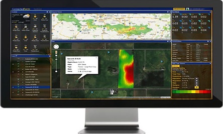
Trimble said farmers can view C3’s detailed soil analysis, which can be applied to all manufacturer equipment types, and recommendations from their advisor on its new Connected Farm online dashboard, which displays farm information such as weather forecasting, rainfall totals, irrigation rates, fertilizer rates, commodity prices, field operation maps, and fleet locations.
The C3 acquisition is part of Trimble’s aggressive expansion into the precision agriculture market over the past year. Sunnyvale, Calif.-based Trimble made a trio of acquisitions in August to strengthen its water management expertise and boost the monitoring and reporting capabilities of its Connected Farm online portal. The global precision farming market is forecast to reach $3.7 billion by 2018, growing annually by more than 13 percent, according to a new report by MarketsandMarkets.
Trimble, with $2 billion in 2012 revenue, uses positioning technologies – GPS, lasers and optics – to focus on applications requiring position or location, including surveying, construction, agriculture, fleet and asset management, public safety and mapping.
Trimble’s agriculture division is a pioneer in precision agriculture, selling GPS and guidance hardware and software, including application control for seed, liquid and granular products, and laser- and GPS-based water management technology.
C3 products, now owned by Trimble, include:
Soil Information System (SIS) software for 3D mapping of soil characteristics, analyzing 120 unique soil and topographic properties, to pinpoint problem areas, develop an effective strategy for improving output, and provide a recommendation such as the exact depth and area to break up hard soil. SIS can precisely map the top four feet of the earth’s surface using above and below ground sensors combined with GPS, Trimble said.
VIDEO: SIS software to optimize use of water, fertilizer and soil amendments by targeting applications
The data is processed with a series of algorithms resulting in more than 60 3D soil models for physical and chemical soil characteristics including root zone depth, soil texture, plant available water, compaction depth and severity, macro and micro nutrient levels, soil nutrient holding capacity, and salt and toxicity concentrations.
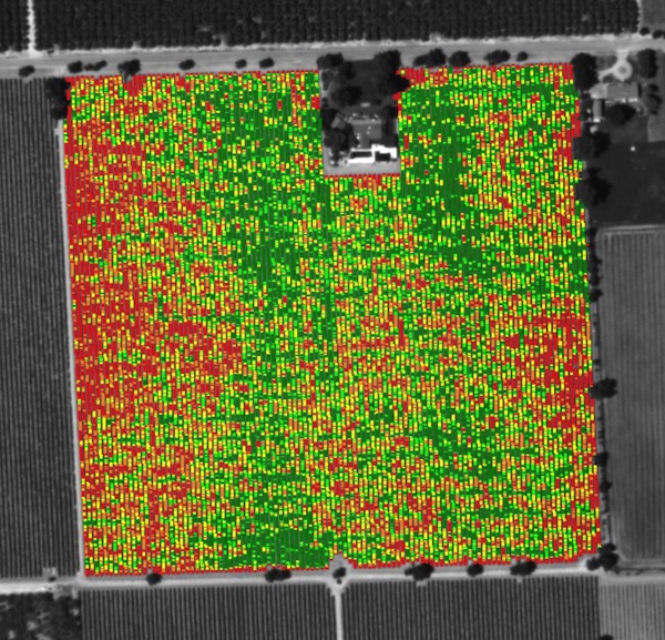
- PurePixel Vegetation Mapping software processes vegetative aerial imaging for crop health analysis, and removes interfering factors such as soil, cover crops and shade which leads to better interpretations and analytics.
- Agricultural Forensics combines SIS and PurePixel for processing soil information and vegetative aerial imaging to understand the relationship between a crop and its environment produces detailed maps of more than 100 site and crop characteristics for analysis.
- Soil Inventory combines multiple precision agriculture technologies to help determine field variability.
- Soil Imaging Penetrometer is a miniature soil imaging system that views and analyzes in-situ soil imagery collected at high resolution.


