
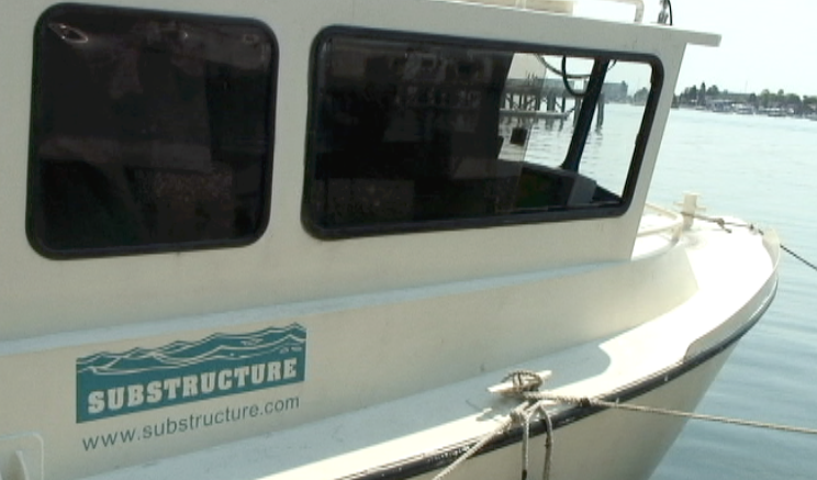
PORTLAND—Here at the EnergyOcean International conference, held this past week, Substructure, a Portsmouth, NH, firm specializing in marine industrial services, demonstrated the capabilities of the Orion, a workboat outfitted with multi-beam acoustic scanning, an MDL Dynascan mobile laser scanner, an Applanix POS MV IMU, and a great deal more technology designed to create accurate 3D maps of the ocean (or lake) floor and surrounding coastline.
This reporter took a trip on the Orion, captained by Substructure president Tom Reis, along with Substructure chief engineer Andrew Kelly, who demonstrated the boat’s capabilities out on Casco Bay.
The Orion, and Substructure, are the result of Reis’ background, which combines civil engineering study at the University of Deleware, business at the University of New Hampshire, diving for sea urchins and then commercial diving on shipwrecks and for engineering firms.
“I got into remote sensing,” he says from the boat’s cockpit, “because of what we found to be the inadequacies of getting information we needed,” as commercial divers. “The equipment being used for that kind of work was incredibly poor and the data being collected was very inaccurate. I felt like there had to be something better, so I did a ton of research to figure out how to best acquire data and design a working vessel.”
The MDL unit is relatively new to the Orion, and is in something of a testing mode. What the company hangs its hat on is the multi-beam acoustic imaging work, done with a Sonic 2024 from R2Sonic, which can get good data as far as 1,000 feet down for broad surveying with the 200 khz frequency, and about 100 meters with the higher resolution 400 khz beam. They can also tune those frequencies to make sure they don’t clash with any other vessels sonar systems.
The Sonic 2024 is off-the-shelf technology, Kelly said, “the unique aspect of our usage is our mounting configuration and integration” with the rest of the vessel’s technology.
There’s a need, said Reis, for high-resolution imaging to support marine construction, demolition, debris removal, dredging, and many other applications where diver evaluation or single-beam sonar may currently be used, but provide inaccurate or untrustworthy data.
“Most structural evaluations that are performed on bridges and dams and things of that nature are all based on divers going down and doing an evaluation,” Reis said, “with a poor set of tools, actually.
“To get a full geo-spatial baseline work to work from is impossible to get from a diver, it’s an inaccurate acquisition process.”
Further, he said, “There’s specific angular uncertainties that are inherent in single beams that can not be calibrated out. With multi-beam you can do off-set passes overlapping the beams that allow you to calibrate the system based on the geo-referencing of the vessel and the motion control system on the vessel.”
That POS MV system had us within two one hundredths of a degree accuracy within six degrees of freedom, while sitting at the dock, and two to three centimeters dynamically accurate within the xyz system.
Now the company is further demonstrating an ability to marry that multi-beam data with data from the MDL unit, allowing for a point cloud that brings above and below surface data together. Especially in tidal areas, where what is above and below the surface varies depending on the time of day, this data can be very useful to engineers.
See video of the demonstration here:
They’re “normally processed as different data sets,” Reis explained, “and real-time corrections are not applied currently [to the laser data]. We’re more focused on the real-time correction of the multi-beam, which needs continual tuning. Scanning you just have to clean out points at the end.”
For absolute control, they either put physical targets on known locations on the shore line and survey those from the water, or they can take the boat onto a trailer and put out targets in the parking lot and get control that way.
Most of the data is collected and visualized through IVS 3D’s Fledermaus software package, he said.
But scanning on a boat presents a number of obstacles, whether it’s the multi-beam sonar or the laser. Substructure has developed systems to understand how pitch, roll, and yaw affect the data collection. How the aluminum hull flexes. They’ve designed the boat with a very low-vibration propulsion system, with a drive train that consists of a Yanmar 370Hp diesel with a Twin Disc transmission. That drives a North American Marine Jet Traktor Jet 381 HH. The advantage being high thrust at low speed, “which is what we need for better control of the boat a slow survey speeds,” said Kelly. This makes for predictable data quality, and all surfaces were sprayed with urethane and every single component is soft mounted – anything that’s energy producing.
And that’s just to account for vibration. To cut down on electromagnetic interference, every electrical connection is crimped, soldered, and adhesive-lined shrink-tubed to make sure there’s no voltage leaking.
The result is a survey speed of six knots if doing the multi-beam scanning, but more like one or two knots to get the laser scanning with similar resolution to the multi-beam.
Finally, it’s trailerable, “so we can take it pretty much anywhere,” said Reis.


