Google Earth Engine crunches 650,000 Landsat 7 images to create high-res world deforestation map
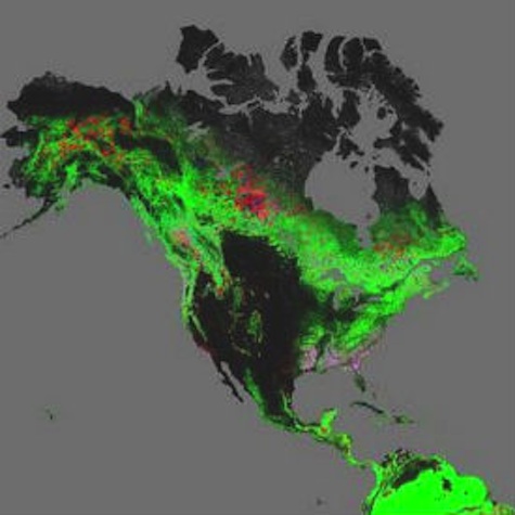
Using 30-meter-resolution satellite images, researchers have created the first map measuring deforestation worldwide and revealing the loss of 2.3 million square kilometers of forest from 2000 to 2012.
“Intensive forestry practiced within subtropical forests resulted in the highest rates of forest change globally,” according to the study, published online Nov. 14 in the journal Science. “Boreal forest loss due largely to fire and forestry was second to that in the tropics.”.jpg "11.19.13wmap")
Led by researchers at the University of Maryland, the study used more than 650,000 Landsat 7 satellite images, from 1999 to 2012, to also show a gain of 800,000 square kilometers of new forest.
The images captured by Landsat 7, launched in 1999 as the seventh satellite of the Landsat program with a primary goal of refreshing the global archive of satellite photos.
Landsat 7
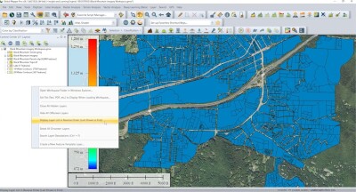
Landsat 7 images were obtained from a free archive at the U.S. Geological Survey’s center for Earth Resources Observation and Science (EROS) and processed by collaborators on the study from Google, who used the planetary-scale, Google Earth Engine platform to crunch the images in a matter of days compared to the 15 years it would have taken a single computer.
Check out the global map of forest change here.
The map reveals that forest loss in the tropics increased by 2,101 square kilometers every year during the period of the study. Subtropical forests were found to have the highest rates of change, largely due to intensive forestry land uses, the study said.
Brazil showed the largest decline in annual forest loss of any country, cutting annual forest loss in half, from a high of approximately 40,000 square kilometers in 2003-2004 to 20,000 square kilometers in 2010-2011.
Indonesia had the largest increase in forest loss, more than doubling its annual loss during the study period to nearly 20,000 square kilometers in 2011-2012.
The disturbance rate of North American subtropical forests, located in the southeast U.S., was found to be four times that of South American rainforests during the 12-year study period, with over 31 percent of U.S. southeastern forest cover was either lost or regrown.
At national scales, Paraguay, Malaysia and Cambodia were found to have the highest rates of forest loss. Paraguay was found to have the highest ratio of forest loss to gain, indicating an intensive deforestation dynamic.
The mapping database will be updated annually to quantify all forest stand-replacement disturbances including logging, fire, disease or storms.