Since August of 2015, Real Earth has offered a free web-service for converting Velodyne LiDAR scans into high-quality maps, as well as software for registering scans into maps in real-time. The one thing missing from an end-to-end scanning solution was hardware of Real Earth’s own.
Real Earth’s Stencil and Contour indoor mappers are set to fill that gap. These products, according to AutonomouStuff applications engineer Terry Lamprecht, “are intended to add value by providing a simple collection method and a total solution. Real Earth sees a need to provide both their registration service and complete systems.”
Stencil: Integrated Scanner with Velodyne LiDAR
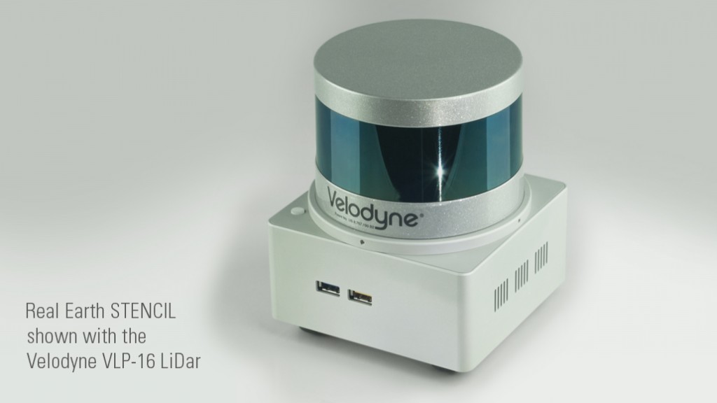 Stencil is a “lightweight and low-cost” unit that includes a spot on top for integration of a Velodyne scanner. Attaching a LiDAR unit turns it into a complete mobile indoor mapping system. The Stencil’s form factor is versatile enough that it can be used for handheld, vehicle, or even UAV scanning.
As Lamprecht elaborated, the Stencil is a “small Linux computer that integrates an IMU and runs the Real Earth SLAM algorithm. The Stencil can currently be combined with either a Velodyne HDL-32E or a VLP-16 (PUCK). This unit creates a registered point cloud by continuously aligning the LiDAR data from the Velodyne unit.”
The benefits are numerous. Stencil can be used for mapping and scanning applications in GPS-denied areas such as indoors or underground. Having a computer and sensor integrated in the same unit allows it to create a map in real-time, allowing users to ensure consistent and full coverage. Since you can choose either the PUCK or HDL-32E sensor, you can scan with either 300,000 or 700,000 points per second.
Most importantly, Lamprecht says, the system is offered at a “much lower price when compared to other comparable systems for mapping.” This makes it a good solution for applications where the Velodyne sensors offer acceptable accuracy, and a versatile addition to the scanning toolbox when it can supplement other, more accurate scanners.

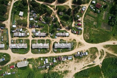
A map generated by the Stencil.
Enabling Robotic Platforms
A secondary benefit of Stencil is that it can be used as a high-resolution localization solution for automated vehicles. Lamprecht says that the unit can provides localization for a moving robotic platform, estimating pose as a rate of about 200Hz.
The device comes in two versions, both of which offer this ability. One version is configured for localization of a robot, and the second (slightly more costly) system is configured for both mapping and localization (or SLAM).
Integrated Solution = Fast Map Generation
Lamprecht explained another great benefit of Real Earth’s end-to-end solution. By offering a small mobile device that can generate a map as you scan, the company is able to provide “very short times” for a mapping final product.
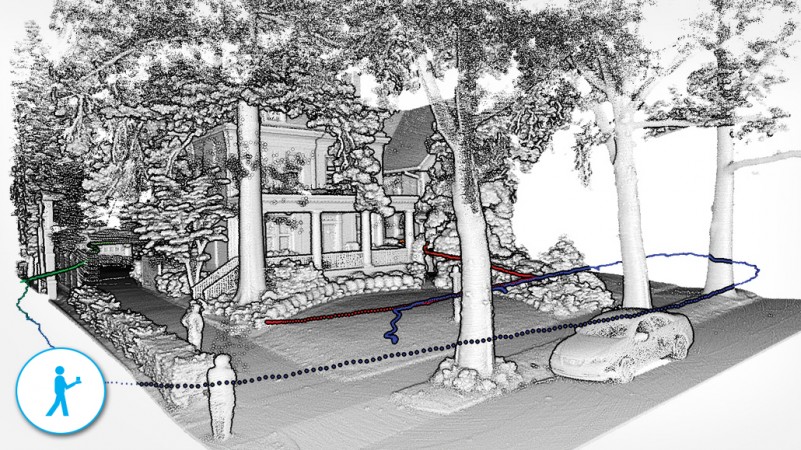
“Traditionally for indoor mapping, tripod mounted scanners must be positioned in several places around the building and tied together using either targets or reference points,” Lamprecht said. “The Stencil is as easy as pressing the start button, walking around and hitting the stop button. The file (.ply) takes up to about 30 seconds to write to disk and can be immediately extracted via USB flash drive. Other processes can take minutes to hours to converge on the map.”
The (Forthcoming) Contour
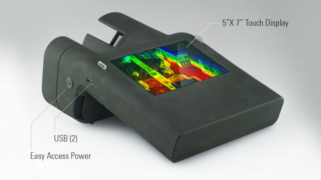 The Contour brings the philosophy of the Stencil one step further. It offers a complete handheld system in a single package, including a 3D laser scanner and an onboard HD color camera for photorealistic coloring and texturing of the scan data. Lastly, it includes its own display, which displays the map in real-time as you scan.
Real-Earth describes the sensor as a solution for performing as-builts of multi-room interiors, multi-floor plans, pipelines, industrial plants, infrastructure, and so on for planning and maintenance purposes. Lamprecht explained to SPAR that the unit is intended for the indoor mapping customer, as the onboard LiDAR unit has a slightly better accuracy, but a limited range when compared with the VLP-16.
And the cost should be the most enticing part: Lamprecht explained that it will likely fall within a few thousand dollars of the Stencil unit configured for mapping, but with the added benefit of a LiDAR sensor already included in the unit.
For more information on RealEarth’s mapping products be sure to see them at SPAR 3D Expo and Conference from April 11-14 in The Woodlands, TX.