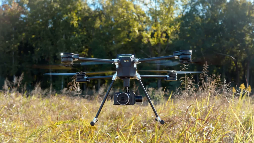
This week, drone manufacturer and autonomous flight technology provider Skydio announced a new, strategic collaboration with Trimble to create, in their words, “an integrated workflow of accurate data capture, data visualization, and data analytics addressing the needs of critical infrastructure industries in their surveying, mapping, and inspections.” As part of the collaboration, which is in the “developmental stage,” Skydio drones will be integrated with GNSS receivers and software from Trimble.
The collaboration was at this year’s Dimensions, Trimble’s annual user conference held earlier this week in Las Vegas, Nevada. They specify that the collaboration will combine the Skydio X10 drone with Trimble’s Construction Cloud, and they call out construction and utility companies along with state transportation agencies as industries and users which will benefit from this collaboration.
Also outlined in the release of this news are what they see as the two biggest benefits of the collaboration. First, they note the automated, API-based integration which allows for simple transfer of drone-captured imagery and metadata from Skydio Cloud to Trimble Industry Cloud. This addresses an issue that can come up in many of these inspection workflows, where it can be a challenge to transfer reality capture data to another system for analysis and insights. By creating an easy bridge between the two systems – in this case Skydio’s flight operation platform and Trimble’s analysis platform, and Trimble Business Center as a whole – the workflow can become streamlined and more efficient.
Additionally, they call out the addition of survey-grade accuracy for the Skydio X10 by enabling compatibility for Trimble GNSS receivers with the RTK GPS attachment on Skydio’s flagship drone. Skydio users will be able to use their Skydio X10 alongside Trimble base stations and GNSS receivers for survey-grade accuracy in mapping missions, and also being able to conduct PPK-based corrections following a flight.
As has been a theme throughout this year, and really over the last couple of years, we’re seeing companies that are already well-established within the construction and inspection industries coming together to help streamline workflows involving new technologies, and in turn potentially spark more adoption of these tools. There are myriad reasons why the construction industry in particular has been relatively slow to adopt newer solutions, but one of the most significant is a lack of interoperability between platforms. When one workflow includes a handful of siloed solutions, it’s often not worth building out ways to bridge all of them in an industry like construction with so many moving pieces.
That said, it’s undoubtedly a net gain for firms to use these kinds of UAV-enabled inspections for projects, and now it’s easy to get the survey-grade accuracy many jobs require, along with easy integrations with key software, all with two companies entrenched in the industry. We’ve written before how Skydio can benefit construction sites with their recently announced Skydio Dock offering, and Trimble has long been at the forefront of both software and location-based technology, having just recently introduced their new R580 GNSS receiver.
“This collaboration brings together two leading companies and their innovative technologies to further revolutionize how we digitize and map our physical world,” said Gagan Kanwar, Skydio’s Head of Technology Partnerships, in a press statement. “By deepening product integration, organizations using Trimble and Skydio will benefit from survey-grade accuracy in mapping missions and go from data-to-insights that much faster.”
“Incorporating Skydio into our ecosystem augments our platform’s capabilities, offering our customers a fully integrated, end-to-end workflow from data acquisition to analytics,” added Aviad Almagor, Vice President of Technology Innovation at Trimble. “Our customers are seeking such automated workflows to handle the vast amount of data and maximize its value through improved production and quality control processes.”