
On scanner #3 and ‘we use it quite a bit’
CHARLESTON, WV — As design firms go, EL Robinson Engineering Co. (ELR) was certainly an early adopter in the use of laser scanning as part of its surveying work (we wrote about the company’s work scanning a collapsed parking garage way back in 2005). The company bought its first laser scanner, a Riegl Z360i, eight years ago, reports Tom Rayburn, the company’s Manager of Geomatics, and is now on its third scanner, a Leica C10.
“We’ve done all sorts of surveying projects with the scanner,” Rayburn says. “We use it for highway design projects – if there’s an interstate bridge replacement we do all the survey work with a scanner so we don’t have to use full lane shift traffic control, nor place our employees in dangerous conditions. We’ve used the scanner for various projects including the following: architectural, monitoring, streetscapes, retrofitting, process piping, contouring, terrain modeling, and volumetric surveys. ELR does not use scanning every day, but we use it as a way to save our clients’ money, eliminate return surveys and provide a more complete survey solution to our projects. We definitely see a return on our investment and our clients see the advantages of scanning.”
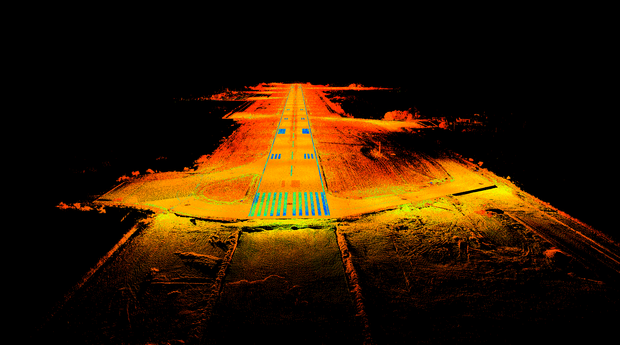
As an example, something new the company has done with the scanner this year was surveying a runway at the Huntington Tri-State Airport here in West Virginia. While the standard deliverable would be elevations on a 10-foot grid, “to save time and with limited runway access we decided to scan it. This gave us the ability to deliver an elevation on five-foot grid and even tighter in critical areas, all with no extra cost in field time,” Rayburn says. “I would say that scanning saved us about half the time. Maybe more considering all runway striping location, plus some signage and lighting location was completed using the scan data.”
There are four surveyors who are trained to use the scanner, which is most of the Survey Crew Chiefs in the Geomatics Department for ELR, which has roughly 140 employees spread out over seven offices in WV, OH and KY.
Also, “We’re doing all the data processing and modeling in house. We complete basic 2D plans to complex 3D modeling for various projects” he says.
As for future investment, Rayburn says “ELR is investigating the future purchase of a mobile scanning system; last year ELR partnered with two other firms to complete a mobile mapping rail project. With the success of that project and other future opportunities we will continue to investigate bringing mobile mapping to ELR, but for now we are sticking with terrestrial.”


