

Scanners using lidar and other scanning technology haven’t just been developed over the last few years, but for a variety of reasons including improved ease of use and greater affordability usage of these tools has certainly increased exponentially in recent years. A lot of the use cases here are for enterprise purposes, with mobile mapping in particular helping transform surveying, particularly in smaller and indoor spaces.
That’s not the only use case for this technology, though, and we’ve seen some public institutions, as well as private organizations with interest in certain areas, use this technology to preserve culturally important sites. Recently, we highlighted a young reality capture company in Ukraine trying to digitally preserve as many culturally important buildings amid the war with Russia. Not every project is quite that dire, but we do see plenty of digital preservation around the world using this technology.
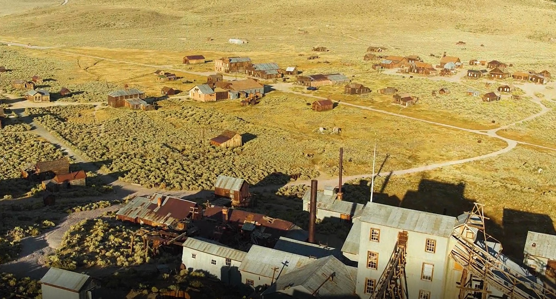
Another recent example is out in California, where a group of scientists from the University of California-Merced are digitally mapping the remains of Bodie, California. Bodie is often described as a town “frozen in time,” a former bustling gold rush town in Northern California along the border with Nevada. Gold was discovered in the town in 1859, and by 1880 there were an estimated 10,000 people in the town. However, once the gold ran out in the area, Bodie became a ghost town and has been empty ever since. The site later became a National Historic Park and a State Park, and everything has been left as is and visitors can see the town as it was when it was abandoned.
However, there is only so much that can be done to preserve the town against natural elements, and it is estimated that at this point only 10 percent of the original town remains intact due to weather conditions, wildfires, and earthquakes. As weather events only increase in frequency, it’s reasonable to expect that more of these structures could be lost to natural events. That’s where the aforementioned group of scientists from UC-Merced come in. The project was delayed multiple times, once due to the COVID-19 pandemic and again because National Geographic’s Drain the Oceans series showed interest and ultimately partnered with the group to do the project.
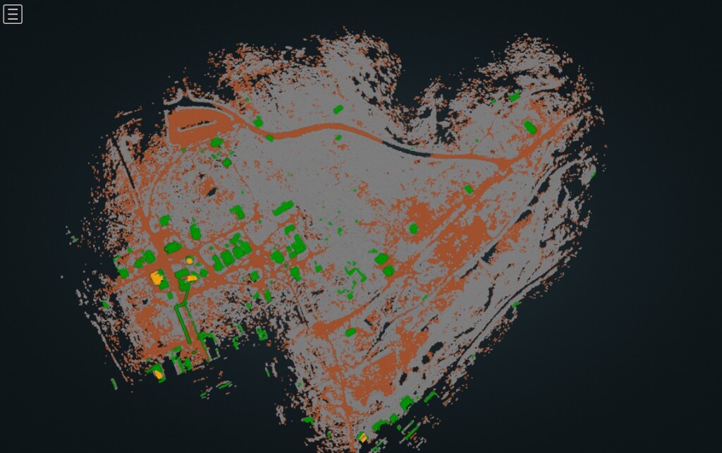
With the broadcast now being involved, the team needed a scanning tool that was easy-to-use and could do the job quickly. Since there were also some COVID-related lockdown policies in place while this project was in progress, they also needed a tool which could support remote collaboration. The team turned to GeoSLAM’s ZEB Horizon scanner to survey over 100 buildings in the ghost town, needing just four days to complete the project. The scanner can be – and was in this project – used both as a handheld tool as well as in concert with drone surveying. In addition, the ZEB Horizon collects 300,000 points per second with its 16 sensors with a range of 100 meters and an accuracy of up to 6mm.
On the use of GeoSLAM’s tool, UC-Merced professor Nicola Lercari said, “What I loved about using the ZEB Horizon at Bodie is that it allowed the team to quickly collect very precise 3D measurements of the site’s landscape and built environment. Using the data, we were able to more precisely identify the location of historic buildings that are long-gone, enabling us to reconstruct them in 3D to show visitors how Bodie was before being abandoned.”
After all of the scanning was complete, the team was able to convert the point cloud data into an accurate 3D model of what was left of the town. Now, if and when natural events continue the deterioration of the structures in place in Bodie, visitors both locally and remotely can still explore what the town looked like at the time of the scanning. Although nothing will ever be able to replace the experience of actually being in the physical presence of the original structures, not only can interested visitors get a real feel for the town in the 3D models, but future developers can also theoretically use these scans to recreate the town as it once stood, which is the case not just for this project but any digital preservation project using scanners like the ZEB Horizon.


