
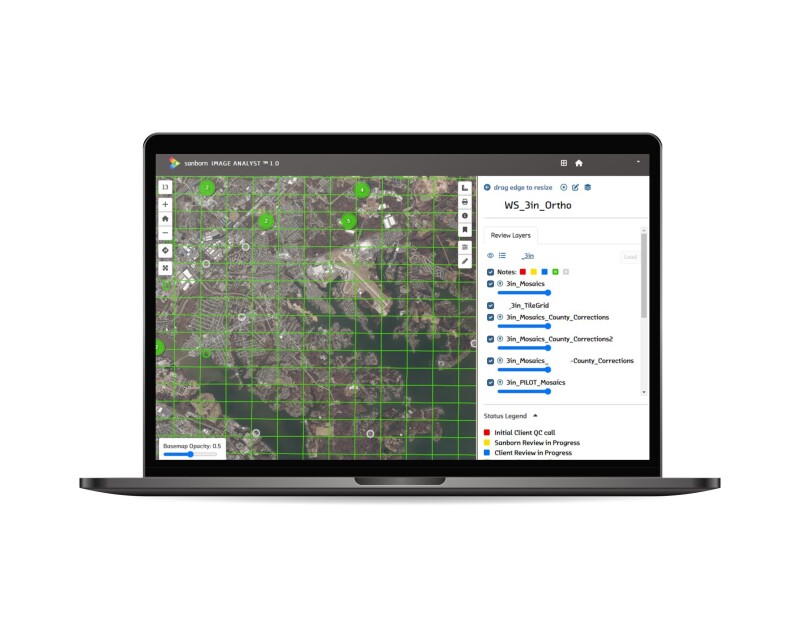
The Sanborn Map Company has unveiled an enhanced version of its Sanborn Image Analyst™, a web-based imagery data review application accessible through the Sanborn GeoServe platform. This upgraded application transforms and streamlines the geospatial data review process, offering a single platform and collaborative approach that shortens the QAQC process while improving data quality.
Key features of the updated Image Analyst include efficient real-time collaboration, allowing multiple users to review data simultaneously, view each other’s comments in real time, and expedite the review process. Enhanced metadata facilitates issue spotting and resolution, with detailed information on QAQC calls enabling the tracking of active participants and quick identification of patterns and common issues. Centralized data on a single platform speeds up the QAQC workflow by reducing redundant calls and eliminating the need for cross-referencing multiple GIS files edited by different parties.
User controls have been implemented to improve security and management, with Sanborn’s Gateway managing access to Image Analyst, providing secure login/password management, and allowing client administrators to assign staff roles and groups. The application supports bringing data into or out of Image Analyst for comparison with local data, allowing client administrators to work with imagery data overlayed by their parcels, roads, and other reference data layers.
The upgraded version also boasts a better data visualization experience with an improved layout, simpler graphics, and more user-friendly interface. Helpdesk integration has been introduced to provide support at every step, with an application-wide helpdesk popup for answering questions and offering tips for optimal usage.
The Sanborn Map Company's commitment to delivering innovative solutions is evident in the upgraded Image Analyst™, promising a more intuitive and collaborative experience for geospatial data review. This enhancement increases efficiency and accuracy across the review process, ultimately improving imagery data for clients.
Source: Sanborn Map Company


