
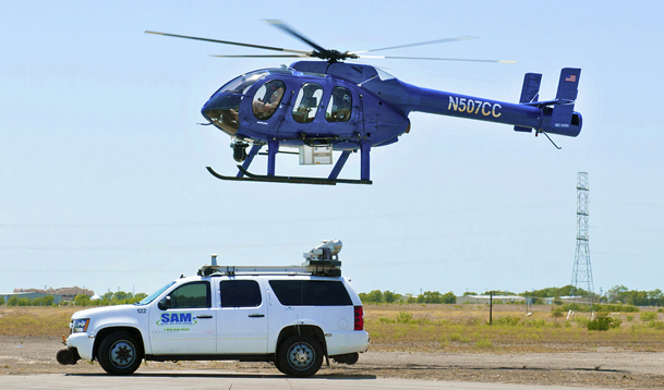
AUSTIN – Surveying and Mapping, Inc. (SAM, Inc.), a provider of geospatial data solutions, announced this week it has purchased an airborne lidar scanning system. The hardware consists of a Trimble Harrier 68i Airborne laser scanner that can be mounted and deployed from either a helicopter or fixed-wing aircraft. The firm has utilized other aerial lidar equipment for several years and has developed considerable expertise with this technology, but the acquisition of its own system will greatly enhance their ability to maximize service offerings for clients, according to the release.
With the addition of airborne lidar to their capabilities, SAM Inc. now has a full suite of lidar tools for terrestrial, mobile and airborne applications and has greatly enhanced their ability to provide complete geospatial solutions, the company stated. According to a statement by Keith McNease, SAM, Inc. VP and principal, “The combination of the three modes of lidar scanning – from a fixed-position, a mobile vehicle, or an aircraft – creates a synergy of lidar services that the firm can bring to bear on a wide variety of projects.”
SAM Inc. considers the Trimble Harrier 68i the most advanced lidar scanning system on the market and has a truly impressive set of specifications, including a very high rate of data capture, extremely dense data capture (or point cloud), a 45-60 degree field-of-view, and an integrated 60 megapixel medium-format digital frame camera. The system is capable of operating at an altitude of up to 5,000 feet and can capture a scan swath width of 83 percent of altitude at 45 degrees. The system offers high accuracy and reliability, minimal calibration requirements, and highest quality data characteristics across the scan. The system also is fully integrated with positioning software and Trimble’s TopPIT software for pre- and post-processing of lidar data.
SAM Inc. believes one of the benefits of the Trimble scanner over similar systems in operation is the complete integration of scanning components. The laser scanner sensor head, geo-referenced optical frame cameras, navigation control components, data processing and display units, and operational software are all part of one off-the-shelf package, virtually eliminating any compatibility issues found in other aggregated solutions. Another advantage is data compatibility with third-party processing software. Unlike some other systems, the Harrier data is in a non-proprietary format and can more easily be integrated with other geospatial systems. This is important for clients that have other legacy data management needs, according to the release.
A key difference between the Harrier system and other lidar systems is its higher data density capability, the release continued. In addition to enhanced sensor characteristics, the scanner coverage pattern consists of regular parallel lines across the scan path, rather than a saw tooth or sine wave pattern, and provides constant point spacing both along and across the track. The fuller coverage results in higher density data collection and produces a more detailed point-cloud.
In some cases greater efficiencies can be gained by deploying this system from fixed-wing aircraft, rather than helicopters. SAM, Inc. will also be able to utilize this equipment in that capacity and would work with other airborne providers to provide that service for required projects. The Harrier scanner was designed from the ground up with the flexibility to be used with either fixed-wing or rotary aircraft. The system also has a remote control feature that enables pilot-only operation for minimal project manpower requirements.
A considerable investment is required to own and operate a system such as this, the company noted, and the acquisition reinforces the commitment SAM, Inc. has for remaining an industry leader with technology services to support its geospatial client needs.


