
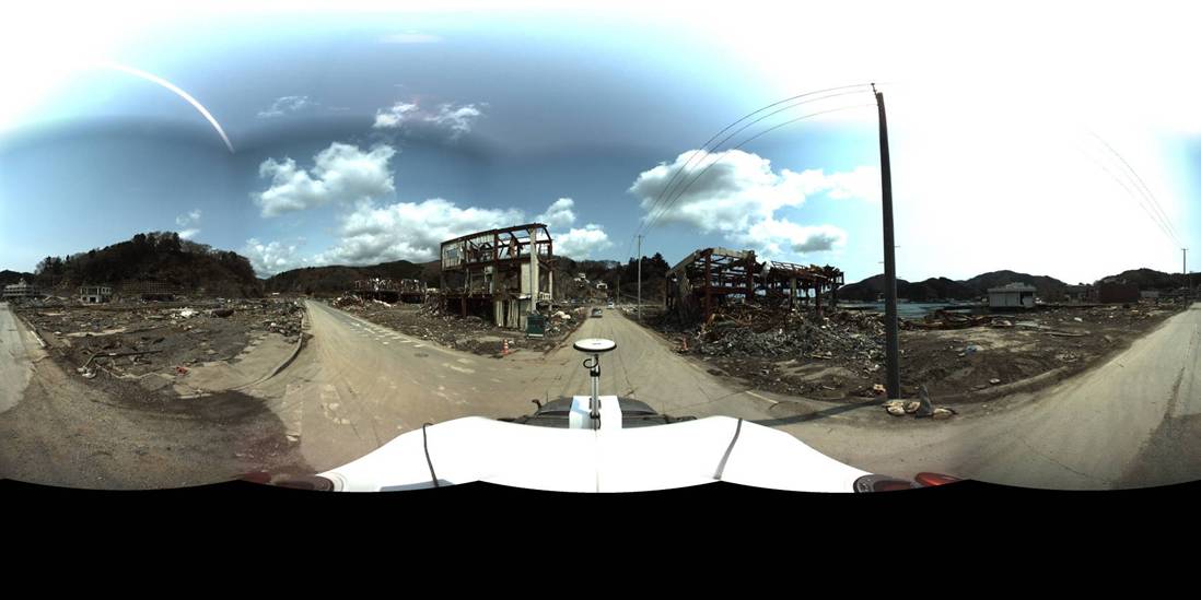
HOUSTON – Scanning methods were anything but normal in Japan after last year’s magnitude-9 earthquake off the coast of Tohoku.
The earthquake caused massive damage to infrastructure and also resulted in a tsunami that hit Japan’s east coast, causing additional damage and thousands of deaths. We recounted the work Asia Air Survey did in Sendai in May of last year.
Robert Kayen of the U.S. Geological Survey and the University of California Los Angeles discussed the important role terrestrial laser scanning (TLS)/lidar data collection plays after such a disaster as part of a presentation here at SPAR International 2012. “When we go out in the field, we really want to promote a culture of safety among all of our reconnaissance investigators,” he said. “We don’t want a reconnaissance activity where someone gets hurt or where someone does not come back. So what TLS does for us, it that allows us to do things we could not do in the past.
“We used to walk on landslides, get very close to damaged structures to make measurements and just a few measurements. Now with TLS we are able to stand back and get a much richer data set but in a much safer place to do that data collection.”
Thus, Kayen said, laser scanning has this “unseen” aspect: “It promotes safety in our post-disaster investigation.”
TLS is great, but with any post-disaster reconnaissance effort, Kayen said you must “marry low tech with high tech.”
“You go out in the field without a lot of gear, you’re going very fast and you want to go safely over ground that might even be moving. So the context here is to try and do as much as you can as quickly as you can without a lot of encumbering equipment.”
Once such low-tech technique is using whiteboards and photos to document scans and reflectors. “We might be going to 20 sites in a matter of a week and if you collect 10 scans at each site it may become a blur in your head to how your organize your data,” said Kayen. “One way to deal with this is in the field is that every scan, every reflector we place on the ground, we use a whiteboard marks the project name, the date, the location, what the name of the reflector is and so on. That way we can go through our photos that are GPS stamped and determine where and when that photo was taken and what specific scan it was associated with.”
Terrestrial laser scanning and lidar analysis enables post-disaster data collection with speed and safety. “It promotes a culture of safety and it provides a permanent archive where we can analyze these data sets over and over again as new engineering methods develop in the civil engineering field,” Kayen concluded. “We collect data quickly, we leave, and then the months of analysis are happening here in the safety of our lab, as opposed to on fairly dangerous ground during the earthquake investigation.”


