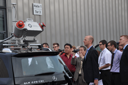
At InterGEO last week, Riegl unveiled its new mobile lidar scanning system, the VMX-250.
The VMX-250 consists of two VQ-250 scanners mounted on a platform accompanied by a GPS-INS and up to eight digital cameras or video equipment units for a 360-degree field of view.
At 600,000 measurements per second, the VMX-250 allows surveyors to capture highly accurate and high-resolution dynamic 3D data at highway speeds, thereby increasing safety on all projects–including the mapping of highways, railroads and waterways as well as extended urban area, construction sites and open pit mines–and contributing to reduced project time of just a few hours.
Echo digitization technology used in the VMX-250 system penetrates foliage, fences and other obstacles. The system’s online waveform technology allows for more than 10 measurements per laser shot. The combination of these technologies results in laser precision of 1 cm or better and accuracy of 3 cm or better.
We’re told the first demonstration systems will be delivered quite soon. System delivery for North America sales will begin in January 2010.


