
NUREMBERG, Germany – Riegl Laser Measurement Systems, manufacturer of laser scanners for terrestrial, mobile, airborne and industrial applications, announced four new scanning systems at the INTERGEO event here this week:
RIEGL VZ-4000: This new compact high-speed, high-resolution 3D VZ-Line Laser Scanner has been designed to offer a wide field of view and an long range of up to 4,000 m, making it suitable for operation in mining and topography applications. The scanner has accuracy to 15 mm, a laser pulse repetition rate of up to 200 kHz, echo digitization and online waveform processing for multiple target capability and an optional waveform data output. Other features include a built-in camera, on-board inclination sensors, integrated L1 GPS receiver with antenna, and built-in SSD data storage media.
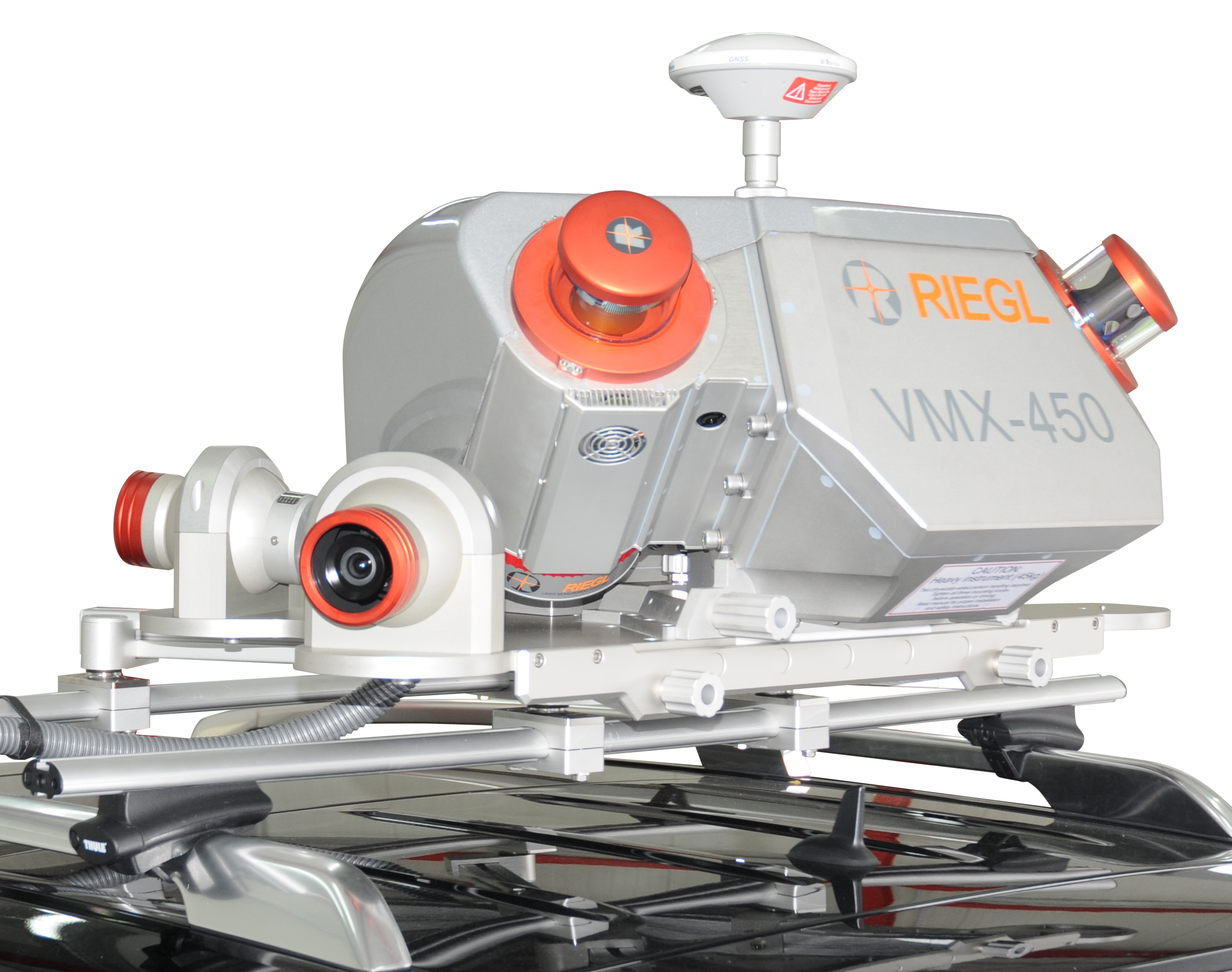
RIEGL VMX-450: This is a fully integrated Mobile Laser Scanning System in a new design, aiming for excellent aerodynamics and protection of cabling. Two RIEGL VQ-450 “Full Circle” Laser Scanners, providing a scanning rate of up to 400 lines/sec and a laser pulse repetition rate of up to 1.1 MHz, are combined with an IMU/GNSS unit and assure very fast acquisition of survey-grade 3D data. Just like its sister type VMX-250, it operates at eye-safe laser class 1 and is capable of multiple targets, guaranteeing a high penetration rate of obstructions. In combination with an optional modular camera system, scan data and precisely time-stamped calibrated images can be acquired simultaneously for seamless storage and processing in the same project structure.
RIEGL VQ-580 Airborne Laser Scanner: Designed for measuring on snow and ice, it delivers data in the areas of snowfield and glacier surveying. It has a laser pulse repetition rate of up to 380 kHz and a range of up to 2,350 m. The combination of echo digitization and waveform processing allows for multiple target capability. A field of view of 60° and a scanning rate of up to 150 lines/sec and hence an evenly distributed high resolution point grid.
RIEGL VQ-820-G Hydrographic Airborne Laser Scanner: Designed for combined land and hydrograhpic airborne surveying, the high-accuracy ranging is based on echo digitization and online waveform processing with multiple target capability. Laser range measurements for high resolution surveying of underwater topography, the bottom of shallow waters and riverbeds, are carried out with a narrow, visible green laser beam at 532 nm. Depending on water turbidity this particular laser wavelength allows measuring into water.
You can learn more from Riegl at booth C13, hall 7.


