
Descartes V8i (SELECTseries 4) based on Bentley’s info modeling environment
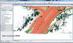
Bentley Systems Inc. said Tuesday the new release of its Descartes V8i (SELECTseries 4), a portfolio of software for processing, managing, streaming, and reusing persistent point clouds, based on its MicroStation information modeling environment, is now available.
Exton, Pa.-based, privately held Bentley, with $550 million in sales last year, said the software is used to process and integrate point clouds and scalable terrain models, as fundamental data types, persistently throughout architectural, engineering, construction and operations (AECO) workflows.
The point-cloud processing capabilities of Descartes V8i allow enable infrastructure pros to enrich, enhance and interpret point clouds for “downstream” workflows – increasing the comprehension, usability, and value of point clouds across the infrastructure lifecycle.
Descartes V8i can further purpose point clouds pre-processed in Bentley Pointools V8i, and as a layered application, it empowers design-time visualization within the company’s civil applications such as InRoads V8i, using OpenRoads technology, and within OpenPlant V8i and AECOsim Building Designer V8i.
With ProjectWise Point-cloud Services, point clouds processed and geo-coordinated with Descartes V8i, rather than being limited to “survey” usefulness, become persistent point clouds managed and streamed for advantageous reuse across collaborative AECO and asset management workflows.
“Point clouds have become both vital and pervasive in infrastructure design and management use cases,” said Robert Mankowski, vice president, product development. “To date, point clouds have been technically consigned to merely a ‘disposable’ survey cost. But now, with our fast and powerful Vortex engine extended beyond MicroStation to ProjectWise Point-cloud Services, point-cloud datasets comprising unlimited billions of points, captured from virtually any scanning source and then processed with Bentley Descartes V8i to enhance and enrich their AECO value, can deliver sustained investment returns through unprecedented information mobility, with unimagined performance, securely and with integrity.”
Recent offerings from Bentley include Pointools V8i and the Pointools View no-charge iWare app for point-cloud viewing. The point-cloud clash detection and point-cloud differencing that are already available in Bentley Pointools V8i will soon be incorporated into SELECTseries releases of MicroStation V8i, Bentley Navigator V8i, and Bentley Descartes V8i, the company said.
The new capabilities in Descartes V8i (SELECTseries 4) include:
- Linear feature extraction: Linear feature geometries, such as rail, tunnel, or road feature types, including center lines and road markings, can now be extracted to improve comprehension and focus on the feature or features to be managed. High productivity is achieved by automation, which speeds what is otherwise a fully manual process.
- Point-cloud class management: Class management enables users to organize point clouds into standard (LAS) and custom classes. Users can create classes, organize points into these classes and control which classes are shown or hidden with any presentation style. This adds intelligence to point clouds and speeds their interpretation.
- Presentation style manager: Users can configure new presentation styles and save them in a style manager. They also can combine multiple shaders in a single view to improve object recognition.
- Clip and clip manager: This new capability allows users to create, save and manage clips to define areas of work. Regions of interest can be defined and managed efficiently, allowing users to focus on the area of the point cloud that is of concern, speeding workflows.
- Sections and section manager: Users can now cut point clouds in cross sections and easily streamline the 3D view configuration process. Sections and section manager extend existing dynamic cross-sectioning capabilities introduced in Bentley Descartes V8i (SELECT series 3) and provide users with an innovative and comprehensive set of tools to analyze point clouds through user-defined cutting planes.
- Geo-coordination for point clouds: With the SELECTseries 4 release of Bentley Descartes V8i, the integration of point clouds from different coordinate systems is now possible. Users can re-project point clouds using their choice of the physical or on-the-fly re-projection mode. The easy geo-coordination of point clouds speeds their integration into information modeling workflows.
- Scalable terrain modeling: The new viewshed tool shows terrain that’s visible from a selected point or along a path to improve the interpretation of terrain models. The selected area can be exported to MicroStation at 1:1 scale.
“We have been early adopters of Bentley Descartes V8i (SELECTseries 4) and this new release provided us exactly what we were looking for. Scalable terrain models now allow us to create and manage terrain models with hundreds of millions of points, and the section modeling capability of Bentley Descartes V8i (SELECTseries 4) addresses tunnel modeling perfectly,” said John Nolan, CAD manager, Network Rail in London. “With the flexible display options for point clouds we can visualize the terrain or only the vegetation as necessary. With its fast, scalable terrain model manipulation and very powerful modeling tools, Bentley Descartes allows us to integrate point clouds and engineering data into hybrid models.”


